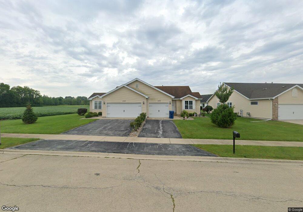
1110 Apache Path Unit 12 Kankakee, IL 60901
Estimated Value: $290,000 - $376,000
Studio
4
Baths
--
Sq Ft
12,981
Sq Ft Lot
About This Home
This home is located at 1110 Apache Path Unit 12, Kankakee, IL 60901 and is currently estimated at $331,994. 1110 Apache Path Unit 12 is a home located in Kankakee County with nearby schools including Herscher High School, Kankakee Trinity Academy, and L W C Academy.
Ownership History
Date
Name
Owned For
Owner Type
Purchase Details
Closed on
Dec 8, 2021
Sold by
James E Girard Trust
Bought by
Trust Number 3013
Current Estimated Value
Home Financials for this Owner
Home Financials are based on the most recent Mortgage that was taken out on this home.
Original Mortgage
$492,000
Outstanding Balance
$420,587
Interest Rate
2.98%
Mortgage Type
New Conventional
Estimated Equity
-$88,593
Purchase Details
Closed on
Oct 17, 2011
Sold by
Municipal Trust & Svgs Bk
Bought by
Girard James E
Create a Home Valuation Report for This Property
The Home Valuation Report is an in-depth analysis detailing your home's value as well as a comparison with similar homes in the area
Home Values in the Area
Average Home Value in this Area
Purchase History
| Date | Buyer | Sale Price | Title Company |
|---|---|---|---|
| Trust Number 3013 | $299,000 | Standard Title | |
| Girard James E | $55,000 | Attorney Only |
Source: Public Records
Mortgage History
| Date | Status | Borrower | Loan Amount |
|---|---|---|---|
| Open | Trust Number 3013 | $492,000 |
Source: Public Records
Tax History
| Year | Tax Paid | Tax Assessment Tax Assessment Total Assessment is a certain percentage of the fair market value that is determined by local assessors to be the total taxable value of land and additions on the property. | Land | Improvement |
|---|---|---|---|---|
| 2024 | $11,944 | $109,032 | $13,370 | $95,662 |
| 2023 | $11,676 | $100,029 | $12,266 | $87,763 |
| 2022 | $12,038 | $99,094 | $11,331 | $87,763 |
| 2021 | $9,478 | $74,838 | $10,817 | $64,021 |
| 2020 | $9,404 | $73,371 | $10,605 | $62,766 |
| 2019 | $9,368 | $72,109 | $10,423 | $61,686 |
| 2018 | $9,497 | $71,043 | $10,269 | $60,774 |
| 2017 | $10,984 | $69,993 | $10,117 | $59,876 |
| 2016 | $15,411 | $79,437 | $9,846 | $69,591 |
| 2015 | $14,204 | $76,075 | $9,606 | $66,469 |
| 2014 | $14,355 | $77,628 | $9,802 | $67,826 |
| 2013 | -- | $78,810 | $9,951 | $68,859 |
Source: Public Records
Map
Nearby Homes
- 1404 Indian Trail
- 1101 Apache Path
- 1412 Indian Trail
- 1414 Indian Trail
- 1416 Indian Trail
- 1418 Indian Trail
- 1833 Indian Trail
- 1917 Indian Trail
- 1420 Indian Trail
- 1402 Indian Trail
- 1208 Arapaho Way
- N 2750 W W Tower Rd
- 1496 W Lotus Ln
- 1785 Indian Trail
- 1268 Deer Path
- 2008 Indian Trail
- 1905 Indian Trail
- 738 River Place Dr
- 754 River Place Dr
- 447 Dennis Ave
- 1112 Apache Path
- 1110 Apache Path
- 1106 Apache Path
- 1106-1108 Apache Path
- 1322 Indian Trail
- 1320 Indian Trail Unit 22
- 1320 Indian Trail
- 1320-1322 Indian Trail
- 1400 Navajo Ct
- 1324 Indian Trail
- 1316 Indian Trail
- 1401 Navajo Ct
- 1105 Apache Path
- 1105 Apache Path
- 1314 Indian Trail
- 1314 Indian Trail
- 1314 Indian Trail
- 1314 Indian Trail
- 1402 Navajo Ct
- 1103 Apache Path
Your Personal Tour Guide
Ask me questions while you tour the home.