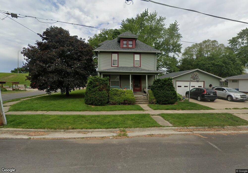
1110 Kiersted St Morris, IL 60450
Estimated Value: $258,000 - $353,000
5
Beds
3
Baths
3,000
Sq Ft
$101/Sq Ft
Est. Value
About This Home
This home is located at 1110 Kiersted St, Morris, IL 60450 and is currently estimated at $302,651, approximately $100 per square foot. 1110 Kiersted St is a home located in Grundy County with nearby schools including White Oak Elementary School, Shabbona Middle School, and Morris Community High School.
Ownership History
Date
Name
Owned For
Owner Type
Purchase Details
Closed on
Feb 17, 2021
Sold by
Martin Annette and Wojcik Annette
Bought by
Martin Annette
Current Estimated Value
Home Financials for this Owner
Home Financials are based on the most recent Mortgage that was taken out on this home.
Original Mortgage
$177,000
Interest Rate
2.8%
Mortgage Type
New Conventional
Create a Home Valuation Report for This Property
The Home Valuation Report is an in-depth analysis detailing your home's value as well as a comparison with similar homes in the area
Purchase History
| Date | Buyer | Sale Price | Title Company |
|---|---|---|---|
| Martin Annette | -- | None Available |
Source: Public Records
Mortgage History
| Date | Status | Borrower | Loan Amount |
|---|---|---|---|
| Closed | Martin Annette | $177,000 |
Source: Public Records
Tax History
| Year | Tax Paid | Tax Assessment Tax Assessment Total Assessment is a certain percentage of the fair market value that is determined by local assessors to be the total taxable value of land and additions on the property. | Land | Improvement |
|---|---|---|---|---|
| 2024 | $6,715 | $85,802 | $15,355 | $70,447 |
| 2023 | $6,324 | $80,808 | $14,461 | $66,347 |
| 2022 | $5,364 | $74,532 | $13,338 | $61,194 |
| 2021 | $5,118 | $70,486 | $12,614 | $57,872 |
| 2020 | $5,048 | $68,686 | $12,292 | $56,394 |
| 2019 | $4,733 | $65,105 | $11,651 | $53,454 |
| 2018 | $4,650 | $63,842 | $11,425 | $52,417 |
| 2017 | $4,308 | $59,937 | $10,824 | $49,113 |
| 2016 | $4,263 | $59,467 | $10,739 | $48,728 |
| 2015 | $3,974 | $57,086 | $10,309 | $46,777 |
| 2014 | $3,862 | $55,596 | $10,040 | $45,556 |
| 2013 | $3,944 | $57,810 | $10,440 | $47,370 |
Source: Public Records
Map
Nearby Homes
- 1224 Grant St
- 1220 Liberty St
- 1595 W Us Rte 6
- 1.88 Acres Rd
- LOT 5 Henry St
- 1112 & 1112 1/2 Butler St
- 1368 Heritage Dr
- 420 E Benton St
- 409 Mckinley St
- 1 By Railroad Track
- 1238 Wauponsee St
- 524 E Chapin St
- 329 Robinson Dr
- 756 Douglas St
- 1233 Oak Grove Ct
- 245 Robinson Dr
- 1218 Gladys Ave
- 812 1/2 E Benton St
- 816 2nd Ave
- 1301 Union St
- 1112 Kiersted St
- 1114 Kiersted St
- 1111 Kiersted St
- 1107 Kiersted St
- 1103 Kiersted St
- 1113 Kiersted St
- 317 Lincoln St
- 1117 Kiersted St
- 1037 Kiersted St
- 1034 Kiersted St
- 414 Railroad St
- 1028 Kiersted St
- 1123 Kiersted St
- 1104 Butler St
- 406 Railroad St
- 1026 Kiersted St
- 1118 Butler St
- 1108 Butler St
- 1112 Butler St
- 316 Railroad St
Your Personal Tour Guide
Ask me questions while you tour the home.