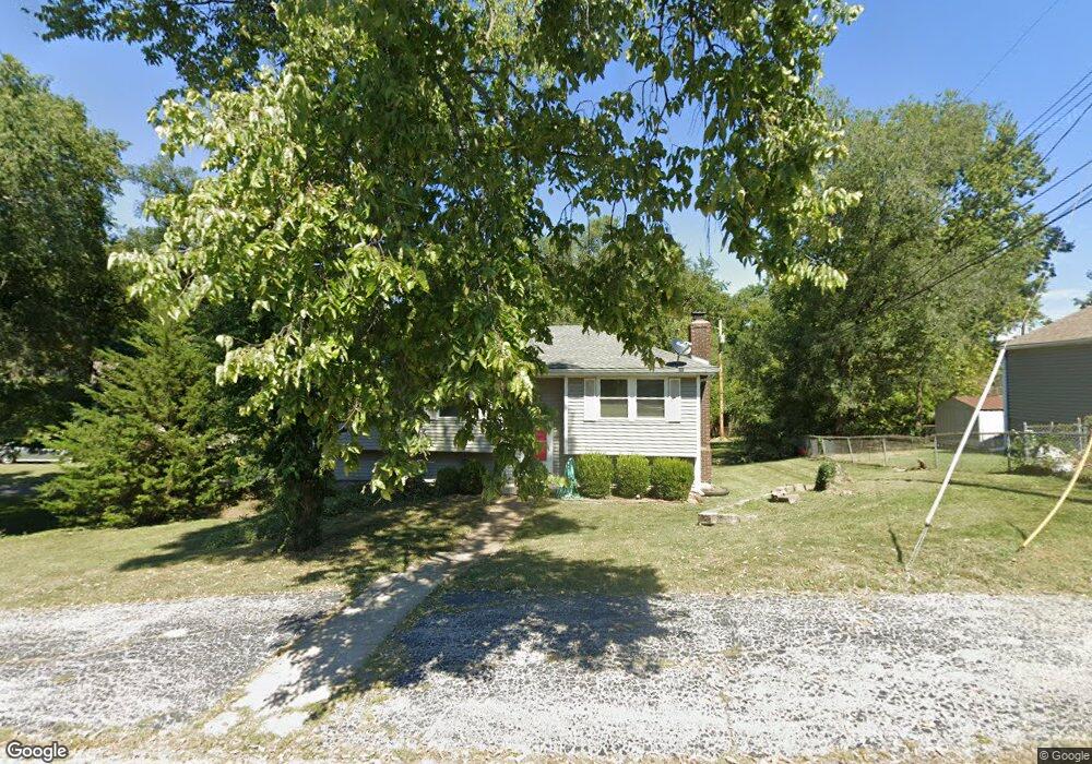
11100 E 82nd St Raytown, MO 64138
Estimated Value: $201,000 - $212,000
3
Beds
1
Bath
960
Sq Ft
$216/Sq Ft
Est. Value
About This Home
This home is located at 11100 E 82nd St, Raytown, MO 64138 and is currently estimated at $207,226, approximately $215 per square foot. 11100 E 82nd St is a home located in Jackson County with nearby schools including Southwood Elementary, South Middle School, and Carver Christian Academy.
Ownership History
Date
Name
Owned For
Owner Type
Purchase Details
Closed on
May 28, 2025
Sold by
Lathrop Lance Lander and Lathrop Lance Luther
Bought by
Lance L Lathrop Trust and Lathrop Family Trust
Current Estimated Value
Purchase Details
Closed on
Aug 2, 2024
Sold by
Warren And Gay Lathrop Co-Grantor Trust and Lathrop Gay P
Bought by
Lathrop Lance Luther
Purchase Details
Closed on
Jul 7, 2016
Sold by
Lathrop Warren L and Lathrop Gay Patricia
Bought by
Lathrop Warren L and Lathrop Gay P
Purchase Details
Closed on
Apr 13, 1998
Sold by
Thorne and Wf
Bought by
Lathrop Warren L and Lathrop Gay P
Home Financials for this Owner
Home Financials are based on the most recent Mortgage that was taken out on this home.
Original Mortgage
$64,350
Interest Rate
7.17%
Mortgage Type
Purchase Money Mortgage
Create a Home Valuation Report for This Property
The Home Valuation Report is an in-depth analysis detailing your home's value as well as a comparison with similar homes in the area
Home Values in the Area
Average Home Value in this Area
Purchase History
| Date | Buyer | Sale Price | Title Company |
|---|---|---|---|
| Lance L Lathrop Trust | -- | None Listed On Document | |
| Lathrop Lance Luther | -- | None Listed On Document | |
| Lathrop Warren L | -- | None Available | |
| Lathrop Warren L | -- | Chicago Title Insurance Co |
Source: Public Records
Mortgage History
| Date | Status | Borrower | Loan Amount |
|---|---|---|---|
| Previous Owner | Lathrop Warren L | $64,350 |
Source: Public Records
Tax History
| Year | Tax Paid | Tax Assessment Tax Assessment Total Assessment is a certain percentage of the fair market value that is determined by local assessors to be the total taxable value of land and additions on the property. | Land | Improvement |
|---|---|---|---|---|
| 2025 | $2,303 | $24,373 | $5,546 | $18,827 |
| 2024 | $2,303 | $25,527 | $5,026 | $20,501 |
| 2023 | $2,287 | $25,527 | $3,601 | $21,926 |
| 2022 | $1,734 | $18,430 | $3,544 | $14,886 |
| 2021 | $1,740 | $18,430 | $3,544 | $14,886 |
| 2020 | $1,748 | $18,346 | $3,544 | $14,802 |
| 2019 | $1,739 | $18,346 | $3,544 | $14,802 |
| 2018 | $1,624 | $17,744 | $4,498 | $13,246 |
| 2017 | $1,624 | $17,744 | $4,498 | $13,246 |
| 2016 | $1,574 | $17,300 | $4,110 | $13,190 |
| 2014 | $1,545 | $16,796 | $3,990 | $12,806 |
Source: Public Records
Map
Nearby Homes
- 11104 E 83rd Terrace
- 7923 Harris Ave
- 8300 Northern St
- 8220 Willow Way
- 8401 Sterling Ave
- 8401 Northern St
- 8324 Pershing Rd
- 10308 E 81st St
- 8408 Woodson Ct
- 8505 Pershing Rd
- 11605 E 78th St
- 8001 Westridge Rd Unit 102
- 7828 Westridge Rd
- 7824 Westridge Rd
- 11709 E 77th Terrace
- 8531 Vassar Ave
- 7606 Woodson Rd
- 9807 E 79th Terrace
- 0 Ash Ave
- 6406 E 87 St
- 8134 Sterling Ave
- 8138 Sterling Ave
- 8201 Harvard Ave
- 8131 Harris Ave
- 8127 Harris Ave
- 8201 Harris Ave
- 8200 Sterling Ave
- 8205 Harvard Ave
- 8130 Sterling Ave
- 8205 Harris Ave
- 8202 Harvard Ave
- 8123 Harris Ave
- 8204 Sterling Ave
- 8126 Sterling Ave
- 10920 E 82nd St
- 10917 E 82nd St
- 8122 Sterling Ave
- 8209 Harvard Ave
- 8204 Harvard Ave
- 8119 Harris Ave
Your Personal Tour Guide
Ask me questions while you tour the home.