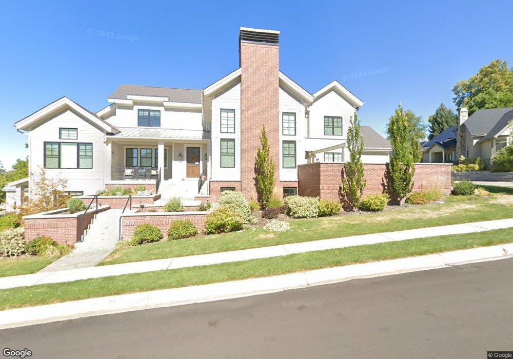
1111 Aspen Ave Provo, UT 84604
Wasatch NeighborhoodEstimated Value: $1,053,000 - $2,036,466
6
Beds
5
Baths
5,774
Sq Ft
$275/Sq Ft
Est. Value
About This Home
This home is located at 1111 Aspen Ave, Provo, UT 84604 and is currently estimated at $1,586,822, approximately $274 per square foot. 1111 Aspen Ave is a home located in Utah County with nearby schools including Wasatch Elementary School, Centennial Middle School, and Timpview High School.
Ownership History
Date
Name
Owned For
Owner Type
Purchase Details
Closed on
Jun 3, 2020
Sold by
Ballif Mark
Bought by
Ballif Mark H and Ballif Julia W
Current Estimated Value
Home Financials for this Owner
Home Financials are based on the most recent Mortgage that was taken out on this home.
Original Mortgage
$255,000
Outstanding Balance
$226,459
Interest Rate
3.3%
Mortgage Type
New Conventional
Estimated Equity
$1,360,363
Purchase Details
Closed on
May 11, 2015
Sold by
Walstad Paul J and Walstad Nancy J
Bought by
Ballif Mark
Create a Home Valuation Report for This Property
The Home Valuation Report is an in-depth analysis detailing your home's value as well as a comparison with similar homes in the area
Home Values in the Area
Average Home Value in this Area
Purchase History
| Date | Buyer | Sale Price | Title Company |
|---|---|---|---|
| Ballif Mark H | -- | None Available | |
| Ballif Mark | -- | Backman Title Services Ltd |
Source: Public Records
Mortgage History
| Date | Status | Borrower | Loan Amount |
|---|---|---|---|
| Open | Ballif Mark H | $255,000 |
Source: Public Records
Tax History
| Year | Tax Paid | Tax Assessment Tax Assessment Total Assessment is a certain percentage of the fair market value that is determined by local assessors to be the total taxable value of land and additions on the property. | Land | Improvement |
|---|---|---|---|---|
| 2025 | $9,319 | $1,099,285 | -- | -- |
| 2024 | $9,319 | $917,345 | $0 | $0 |
| 2023 | $8,383 | $813,450 | $0 | $0 |
| 2022 | $7,647 | $748,220 | $0 | $0 |
| 2021 | $6,267 | $1,069,500 | $214,600 | $854,900 |
| 2020 | $6,312 | $1,009,800 | $171,700 | $838,100 |
| 2019 | $5,323 | $885,600 | $171,700 | $713,900 |
| 2018 | $4,902 | $827,100 | $163,500 | $663,600 |
| 2017 | $3,315 | $307,395 | $0 | $0 |
| 2016 | $2,731 | $236,005 | $0 | $0 |
| 2015 | $2,702 | $236,005 | $0 | $0 |
| 2014 | $2,505 | $228,085 | $0 | $0 |
Source: Public Records
Map
Nearby Homes
- 990 Cedar Ave
- 1205 N Old Willow Ln
- 1411 N Locust Ln
- 907 E 820 N Unit 11
- 1040 N Oakmont Ln
- 737 E 750 N Unit 1
- 1215 N Terrace Dr
- 905 N Terrace Dr
- 735 E 620 N
- 635 N Ridge Dr Unit 25
- 785 E 560 N Unit 405
- 513 E 700 N
- 1801 N 650 E
- 1866 N 1450 E
- 362 N 800 E
- 1383 E 320 N
- 541 E 500 N Unit 12
- 1051 E 300 N
- 2025 Oak Ln
- 386 N 500 E
Your Personal Tour Guide
Ask me questions while you tour the home.