Estimated Value: $270,169 - $277,000
Studio
1
Bath
2,892
Sq Ft
$95/Sq Ft
Est. Value
About This Home
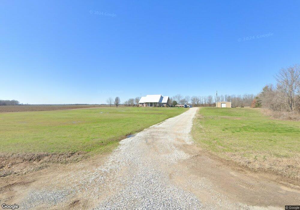
This home is located at 1111 Guice Rd, Epps, LA 71237 and is currently estimated at $273,585, approximately $94 per square foot. 1111 Guice Rd is a home with nearby schools including Oak Grove Elementary School and Oak Grove High School.
Ownership History
Date
Name
Owned For
Owner Type
Purchase Details
Closed on
Apr 13, 2005
Bought by
Miller Brian Lane
Current Estimated Value
Create a Home Valuation Report for This Property
The Home Valuation Report is an in-depth analysis detailing your home's value as well as a comparison with similar homes in the area
Purchase History
| Date | Buyer | Sale Price | Title Company |
|---|---|---|---|
| Miller Brian Lane | -- | -- |
Source: Public Records
Tax History
| Year | Tax Paid | Tax Assessment Tax Assessment Total Assessment is a certain percentage of the fair market value that is determined by local assessors to be the total taxable value of land and additions on the property. | Land | Improvement |
|---|---|---|---|---|
| 2025 | $1,470 | $21,416 | $416 | $21,000 |
| 2024 | $1,570 | $21,416 | $416 | $21,000 |
| 2023 | $1,530 | $20,989 | $389 | $20,600 |
| 2022 | $1,530 | $20,989 | $389 | $20,600 |
| 2021 | $1,530 | $20,989 | $389 | $20,600 |
| 2020 | $1,531 | $20,989 | $389 | $20,600 |
| 2019 | $1,527 | $20,760 | $760 | $20,000 |
| 2018 | $1,479 | $20,760 | $760 | $20,000 |
| 2017 | $1,454 | $20,760 | $760 | $20,000 |
| 2016 | $1,454 | $20,760 | $760 | $20,000 |
| 2015 | $930 | $20,760 | $760 | $20,000 |
| 2014 | $1,448 | $20,760 | $760 | $20,000 |
| 2010 | $1,415 | $20,760 | $760 | $20,000 |
Source: Public Records
Map
Nearby Homes
- 0 Mitchner Rd Unit 3+-acres
- 0 Mitchner Rd Unit 44+-acres 214841
- 0000 Mitchner Rd
- 377 Mcpherson Rd Unit 14.40+-acs/Tracts 1/
- 377 Mcpherson Rd Unit 113.60+-acs/Tracts 2
- 252 Mcpherson Rd
- 00 Mitchner Rd
- 194 Jones St
- 993 Louisiana 17
- 0 Louisiana 134
- 0000 Mitchner Caston Rd
- 00 Louisiana 134 Unit Lot 2
- 4402 Louisiana 134 Unit Lot 4
- 0 Wade Rd
- 5 Sheppard Rd
- 000 Par Road 2272a
- 0000 Par Road 2272a Unit 200422400
- 289 Par Road 2272a
- 735 Hurt Rd
- 13 Self Rd
Your Personal Tour Guide
Ask me questions while you tour the home.