1112 Powers St Oshkosh, WI 54901
Menominee North NeighborhoodEstimated Value: $221,000 - $266,304
About This Home
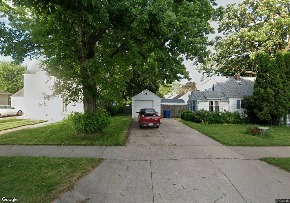
This home is located at 1112 Powers St, Oshkosh, WI 54901 and is currently estimated at $245,326, approximately $121 per square foot. 1112 Powers St is a home located in Winnebago County with nearby schools including Webster Stanley Elementary School, North High School, and St Frances Cabrini Elementary School.
Ownership History
We collect this data history from publicly available records. To have your information removed, we recommend requesting removal directly through your county’s website.
Purchase Details
Home Financials for this Owner
Home Financials are based on the most recent Mortgage that was taken out on this home.Home Values in the Area
Average Home Value in this Area
Purchase History
We collect this data history from publicly available records. To have your information removed, we recommend requesting removal directly through your county’s website.
| Date | Buyer | Sale Price | Title Company |
|---|---|---|---|
| $218,000 | None Listed On Document |
Mortgage History
We collect this data history from publicly available records. To have your information removed, we recommend requesting removal directly through your county’s website.
| Date | Status | Borrower | Loan Amount |
|---|---|---|---|
| Open | $193,000 |
Tax History
We collect this data history from publicly available records. To have your information removed, we recommend requesting removal directly through your county’s website.
| Year | Tax Paid | Tax Assessment Tax Assessment Total Assessment is a certain percentage of the fair market value that is determined by local assessors to be the total taxable value of land and additions on the property. | Land | Improvement |
|---|---|---|---|---|
| 2025 | $4,077 | $229,700 | $27,700 | $202,000 |
| 2024 | $4,077 | $229,700 | $27,700 | $202,000 |
| 2023 | $3,834 | $140,600 | $19,100 | $121,500 |
| 2022 | $3,830 | $140,600 | $19,100 | $121,500 |
| 2021 | $3,587 | $140,600 | $19,100 | $121,500 |
| 2020 | $3,469 | $140,600 | $19,100 | $121,500 |
| 2019 | $3,362 | $140,600 | $19,100 | $121,500 |
| 2018 | $3,300 | $140,600 | $19,100 | $121,500 |
| 2017 | $3,381 | $140,600 | $19,100 | $121,500 |
| 2016 | $3,449 | $140,900 | $19,100 | $121,800 |
| 2015 | $3,391 | $140,900 | $19,100 | $121,800 |
| 2014 | $3,412 | $140,900 | $19,100 | $121,800 |
| 2013 | $3,424 | $140,900 | $19,100 | $121,800 |
Map
- 1003 Evans St
- 421 Rock Place
- 1223 Grove St
- 1322 Broad St
- 1021 Eastman St
- 1331 Broad St
- 402 E Lincoln Ave
- 739 Monroe St
- 755 Grove St
- 841 Mt Vernon St
- 411 Marston Place
- 623 E Irving Ave
- 229 Fulton Ave
- 669 Boyd St
- 29 W Tennessee Ave
- 1111 Merrill St
- 1711 Grove St
- 23 W Nevada Ave
- 316 Oxford Ave
- 852 Frederick St
- 705 Baldwin Ave
- 708 Baldwin Ave
- 702 Baldwin Ave
- 715 Baldwin Ave
- 615 Baldwin Ave
- 1027 Bong Ct
- 721 Baldwin Ave
- 618 Baldwin Ave
- 714 Baldwin Ave
- 718 Baldwin Ave
- 536 Pyle Ave
- 1025 Bong Ct
- 609 Baldwin Ave
- 1026 Bong Ct
- 610 Baldwin Ave
- 727 Baldwin Ave
- 530 Pyle Ave
- 724 Baldwin Ave
- 1021 Bong Ct
- 1115 Powers St
Ask me questions while you tour the home.