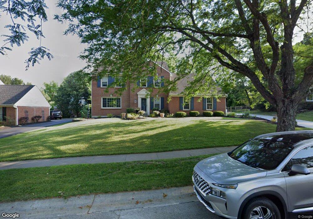
11125 Allenhurst Blvd E Cincinnati, OH 45241
Estimated Value: $412,810 - $584,000
4
Beds
4
Baths
1,972
Sq Ft
$242/Sq Ft
Est. Value
About This Home
This home is located at 11125 Allenhurst Blvd E, Cincinnati, OH 45241 and is currently estimated at $476,453, approximately $241 per square foot. 11125 Allenhurst Blvd E is a home located in Hamilton County with nearby schools including Sharonville Elementary School, Princeton Community Middle School, and Princeton High School.
Ownership History
Date
Name
Owned For
Owner Type
Purchase Details
Closed on
Jul 28, 2006
Sold by
Tolbert Steven M and Tolbert Susan L
Bought by
Messer Laura R and Sage Janet Michelle
Current Estimated Value
Home Financials for this Owner
Home Financials are based on the most recent Mortgage that was taken out on this home.
Original Mortgage
$135,000
Interest Rate
6.83%
Mortgage Type
Unknown
Create a Home Valuation Report for This Property
The Home Valuation Report is an in-depth analysis detailing your home's value as well as a comparison with similar homes in the area
Home Values in the Area
Average Home Value in this Area
Purchase History
We collect this data history from publicly available records. To have your information removed, we recommend requesting removal directly through your county’s website.
| Date | Buyer | Sale Price | Title Company |
|---|---|---|---|
| Messer Laura R | $230,000 | None Available |
Source: Public Records
Mortgage History
We collect this data history from publicly available records. To have your information removed, we recommend requesting removal directly through your county’s website.
| Date | Status | Borrower | Loan Amount |
|---|---|---|---|
| Closed | Messer Laura R | $135,000 |
Source: Public Records
Tax History
| Year | Tax Paid | Tax Assessment Tax Assessment Total Assessment is a certain percentage of the fair market value that is determined by local assessors to be the total taxable value of land and additions on the property. | Land | Improvement |
|---|---|---|---|---|
| 2025 | $5,024 | $105,630 | $19,075 | $86,555 |
| 2024 | $4,287 | $105,630 | $19,075 | $86,555 |
| 2023 | $4,291 | $105,630 | $19,075 | $86,555 |
| 2022 | $4,125 | $81,596 | $18,886 | $62,710 |
| 2021 | $4,010 | $81,596 | $18,886 | $62,710 |
| 2020 | $4,057 | $81,596 | $18,886 | $62,710 |
| 2019 | $4,046 | $74,858 | $17,325 | $57,533 |
| 2018 | $3,795 | $74,858 | $17,325 | $57,533 |
| 2017 | $3,554 | $74,858 | $17,325 | $57,533 |
| 2016 | $3,870 | $80,861 | $16,853 | $64,008 |
| 2015 | $3,908 | $80,861 | $16,853 | $64,008 |
| 2014 | $3,921 | $80,861 | $16,853 | $64,008 |
| 2013 | $3,579 | $75,572 | $15,750 | $59,822 |
Source: Public Records
Map
Nearby Homes
- 11110 Zaring Ct
- 4210 Allenhurst Close Ct
- 11108 Huntwicke Place
- 3977 Cornell Rd
- 10994 Timberwood Ln
- 11157 Jardin Place
- 10903 Sharondale Rd
- 10660 Bridlepath Ln
- 10915 Fernhill Dr
- 11662 Sharonwoods Ct
- 3524 Cornell Rd
- 12 Woodsview Ln
- 11122 Main St
- 4254 Fox Hollow Dr
- 5310 E Kemper Rd
- 3319 Mcgrew St
- 3590 Glendale Milford Rd
- 10301 Giverny Blvd
- 12024 Copperfield Dr
- 4204 Magnolia Aly
- 11131 Allenhurst Blvd E
- 11111 Zaring Ct
- 11098 Zaring Ct
- 11092 Zaring Ct
- 11104 Zaring Ct
- 11105 Zaring Ct
- 11119 Allenhurst Blvd E
- 11086 Zaring Ct
- 11116 Allenhurst Blvd W
- 4102 Benkert Dr
- 11099 Zaring Ct
- 11136 Allenhurst Blvd E
- 11113 Allenhurst Blvd E
- 4096 Benkert Dr
- 11130 Allenhurst Blvd E
- 11110 Allenhurst Blvd W
- 4108 Benkert Dr
- 11107 Allenhurst Blvd E
- 11093 Zaring Ct
- 11124 Allenhurst Blvd E
Your Personal Tour Guide
Ask me questions while you tour the home.