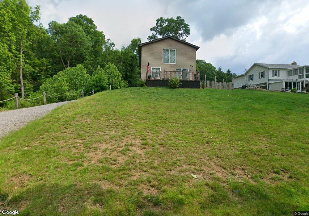
1113 River Rd Freeport, PA 16229
Estimated Value: $278,000 - $324,000
1
Bed
1
Bath
1,440
Sq Ft
$206/Sq Ft
Est. Value
About This Home
This home is located at 1113 River Rd, Freeport, PA 16229 and is currently estimated at $296,459, approximately $205 per square foot. 1113 River Rd is a home with nearby schools including South Buffalo Elementary School and Freeport Area Senior High School.
Ownership History
Date
Name
Owned For
Owner Type
Purchase Details
Closed on
Nov 9, 2022
Sold by
Barnhart Dennis L and Barnhart Deborah V
Bought by
Lobue Michael Joseph and Lobue Julia Ann
Current Estimated Value
Home Financials for this Owner
Home Financials are based on the most recent Mortgage that was taken out on this home.
Original Mortgage
$211,514
Outstanding Balance
$204,919
Interest Rate
6.92%
Mortgage Type
Seller Take Back
Estimated Equity
$91,540
Purchase Details
Closed on
Oct 16, 2020
Sold by
Daum Joseph S
Bought by
Barnhart Dennis and Barnhart Deborah V
Create a Home Valuation Report for This Property
The Home Valuation Report is an in-depth analysis detailing your home's value as well as a comparison with similar homes in the area
Home Values in the Area
Average Home Value in this Area
Purchase History
| Date | Buyer | Sale Price | Title Company |
|---|---|---|---|
| Lobue Michael Joseph | $261,514 | -- | |
| Barnhart Dennis | $239,130 | None Available |
Source: Public Records
Mortgage History
| Date | Status | Borrower | Loan Amount |
|---|---|---|---|
| Open | Lobue Michael Joseph | $211,514 |
Source: Public Records
Tax History
| Year | Tax Paid | Tax Assessment Tax Assessment Total Assessment is a certain percentage of the fair market value that is determined by local assessors to be the total taxable value of land and additions on the property. | Land | Improvement |
|---|---|---|---|---|
| 2025 | $4,531 | $49,500 | $27,920 | $21,580 |
| 2024 | $4,540 | $49,500 | $27,920 | $21,580 |
| 2023 | $3,613 | $49,500 | $27,920 | $21,580 |
| 2022 | $3,613 | $49,500 | $27,920 | $21,580 |
| 2021 | $3,113 | $41,760 | $24,490 | $17,270 |
| 2020 | $3,113 | $41,760 | $24,490 | $17,270 |
| 2019 | $3,047 | $41,760 | $24,490 | $17,270 |
| 2018 | $3,047 | $34,980 | $10,310 | $24,670 |
| 2017 | $3,005 | $41,760 | $24,490 | $17,270 |
| 2016 | $2,921 | $41,760 | $24,490 | $17,270 |
| 2015 | $758 | $7,220 | $7,220 | $0 |
| 2014 | $758 | $7,220 | $7,220 | $0 |
Source: Public Records
Map
Nearby Homes
- 114 Johnetta Rd
- 148 Stonegate Dr
- 171 Hillview Manor Rd
- 102 Bristlecone Ct
- Lot 4 Sober Rd
- Lot 1 Sober Rd
- Lot 3 Sober Rd
- Lot 2 Sober Rd
- 793 Evergreen Rd
- 129 Ridgecrest Dr
- 0000 Sr-2060
- 424 2nd Ave
- 417 2nd Ave
- 110 RR Kiski Camp Dr
- 122 Cemetery Rd
- 109 1st Ave
- 450 Church Rd
- 437-438 2nd Street Wegley Ave
- 0 Sportsman Rd Unit 1719147
- 503 Main St
Your Personal Tour Guide
Ask me questions while you tour the home.