Estimated Value: $457,543 - $602,000
3
Beds
3
Baths
2,037
Sq Ft
$258/Sq Ft
Est. Value
About This Home
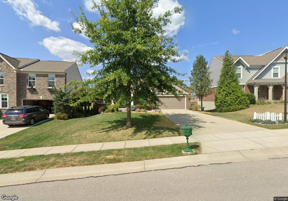
This home is located at 1117 Maxwell Dr, Union, KY 41091 and is currently estimated at $525,136, approximately $257 per square foot. 1117 Maxwell Dr is a home located in Boone County with nearby schools including New Haven Elementary School, Gray Middle School, and Larry A. Ryle High School.
Ownership History
Date
Name
Owned For
Owner Type
Purchase Details
Closed on
Oct 1, 2015
Sold by
Fisher Single Family Homes Iii Ltd
Bought by
Cropper James W and Cropper Marcia Mq
Current Estimated Value
Home Financials for this Owner
Home Financials are based on the most recent Mortgage that was taken out on this home.
Original Mortgage
$247,784
Outstanding Balance
$193,881
Interest Rate
3.88%
Mortgage Type
New Conventional
Estimated Equity
$331,255
Purchase Details
Closed on
Jun 10, 2015
Sold by
Triple Crown Developers Llc
Bought by
Fischer Single Family Homes Iii Ltd
Create a Home Valuation Report for This Property
The Home Valuation Report is an in-depth analysis detailing your home's value as well as a comparison with similar homes in the area
Home Values in the Area
Average Home Value in this Area
Purchase History
| Date | Buyer | Sale Price | Title Company |
|---|---|---|---|
| Cropper James W | $309,730 | Homestead Title Agency Ltd | |
| Fischer Single Family Homes Iii Ltd | $46,000 | None Available |
Source: Public Records
Mortgage History
| Date | Status | Borrower | Loan Amount |
|---|---|---|---|
| Open | Cropper James W | $247,784 |
Source: Public Records
Tax History
| Year | Tax Paid | Tax Assessment Tax Assessment Total Assessment is a certain percentage of the fair market value that is determined by local assessors to be the total taxable value of land and additions on the property. | Land | Improvement |
|---|---|---|---|---|
| 2025 | $4,231 | $421,000 | $80,000 | $341,000 |
| 2024 | $3,674 | $374,000 | $55,000 | $319,000 |
| 2023 | $3,729 | $374,000 | $55,000 | $319,000 |
| 2022 | $3,744 | $374,000 | $55,000 | $319,000 |
| 2021 | $3,104 | $309,700 | $46,000 | $263,700 |
| 2020 | $3,096 | $309,700 | $46,000 | $263,700 |
| 2019 | $3,587 | $309,700 | $46,000 | $263,700 |
| 2018 | $3,609 | $309,700 | $46,000 | $263,700 |
| 2017 | $3,534 | $309,700 | $46,000 | $263,700 |
Source: Public Records
Map
Nearby Homes
- 1965 Hirsch Ct
- 14036 Bridlegate Dr
- 14086 Bridlegate Dr
- 1170 Hicks Pike
- 11960 Cloverbrook Dr
- 1549 Smarty Jones Ct
- 1545 Smarty Jones Ct
- 11204 Mckays Ct
- 11076 War Admiral Dr
- 10409 Giacomo Ct
- 1217 Citation Dr
- 1185 Monarchos Ridge
- 1181 Monarchos Ridge
- 1087 Bold Forbes Ct
- 10808 Kimberly Dr
- 1168 Mccarron Ln
- 10996 War Admiral Dr
- 1152 Monarchos Ridge
- 1013 Reigh Count Dr
- 631 Coaltown Ct
- 1121 Maxwell Dr
- 1121 Maxwell Dr Unit 73
- 1113 Maxwell Dr
- 1961 Hirsch Ct
- 1116 Maxwell Dr
- 1105 Maxwell Dr
- 1110 Maxwell Dr
- 15020 Stable Wood
- 1957 Hirsch Ct
- 15016 Stable Wood Dr
- 1850 Woodward Ct
- 1851 Woodward Ct
- 14017 Bridlegate Dr Unit 78
- 14017 Bridlegate Dr
- 15033 Stable Wood Dr Unit 20
- 15033 Stable Wood Dr
- 15012 Stable Wood Dr
- 14013 Bridlegate Dr
- 14023 Bridlegate Dr
- 15012 Stable Wood Dr
Your Personal Tour Guide
Ask me questions while you tour the home.