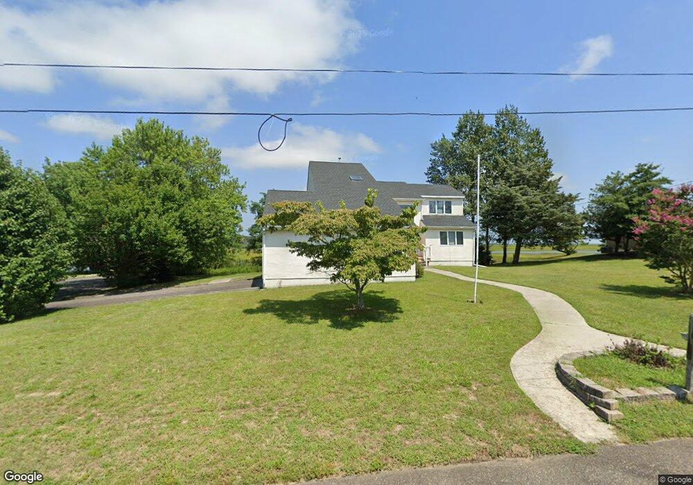
112 Cedar Hill Dr Absecon, NJ 08201
Estimated Value: $561,000 - $667,000
4
Beds
3
Baths
2,371
Sq Ft
$256/Sq Ft
Est. Value
About This Home
This home is located at 112 Cedar Hill Dr, Absecon, NJ 08201 and is currently estimated at $607,307, approximately $256 per square foot. 112 Cedar Hill Dr is a home located in Atlantic County with nearby schools including H. Ashton Marsh Elementary School, Emma C. Attales Middle School, and Holy Spirit High School.
Ownership History
Date
Name
Owned For
Owner Type
Purchase Details
Closed on
Dec 10, 2009
Sold by
Olson Steven and Olson Dorothy
Bought by
Smyler Denise and Dillon Kevin A
Current Estimated Value
Home Financials for this Owner
Home Financials are based on the most recent Mortgage that was taken out on this home.
Original Mortgage
$260,000
Interest Rate
4.3%
Mortgage Type
New Conventional
Purchase Details
Closed on
Dec 13, 1993
Sold by
Moons Excavating Corp
Bought by
Olson Steven and Olson Dorothy
Home Financials for this Owner
Home Financials are based on the most recent Mortgage that was taken out on this home.
Original Mortgage
$44,000
Interest Rate
6.78%
Create a Home Valuation Report for This Property
The Home Valuation Report is an in-depth analysis detailing your home's value as well as a comparison with similar homes in the area
Home Values in the Area
Average Home Value in this Area
Purchase History
We collect this data history from publicly available records. To have your information removed, we recommend requesting removal directly through your county’s website.
| Date | Buyer | Sale Price | Title Company |
|---|---|---|---|
| Smyler Denise | $370,000 | Multiple | |
| Olson Steven | $64,000 | -- |
Source: Public Records
Mortgage History
We collect this data history from publicly available records. To have your information removed, we recommend requesting removal directly through your county’s website.
| Date | Status | Borrower | Loan Amount |
|---|---|---|---|
| Closed | Smyler Denise | $260,000 | |
| Previous Owner | Olson Steven | $44,000 |
Source: Public Records
Tax History
| Year | Tax Paid | Tax Assessment Tax Assessment Total Assessment is a certain percentage of the fair market value that is determined by local assessors to be the total taxable value of land and additions on the property. | Land | Improvement |
|---|---|---|---|---|
| 2025 | $10,406 | $311,000 | $133,100 | $177,900 |
| 2024 | $10,406 | $311,000 | $133,100 | $177,900 |
| 2023 | $10,282 | $311,000 | $133,100 | $177,900 |
| 2022 | $10,282 | $311,000 | $133,100 | $177,900 |
| 2021 | $10,251 | $311,000 | $133,100 | $177,900 |
| 2020 | $10,269 | $311,000 | $133,100 | $177,900 |
| 2019 | $10,195 | $311,000 | $133,100 | $177,900 |
| 2018 | $10,238 | $311,000 | $133,100 | $177,900 |
| 2017 | $10,163 | $311,000 | $133,100 | $177,900 |
| 2016 | $9,877 | $311,000 | $133,100 | $177,900 |
| 2015 | $9,750 | $311,000 | $133,100 | $177,900 |
| 2014 | $9,616 | $311,000 | $133,100 | $177,900 |
Source: Public Records
Map
Nearby Homes
- 406 Burning Tree Blvd
- 172 E Faunce Landing Rd
- 203 Cynwyd Dr
- 202 Burning Tree Blvd
- 410 4th St
- 8 Cessna Ln
- 506 Lazy Ln
- 3 Stone Cir
- 157 E Wyoming Ave
- 107 W Church St
- 101 W Church St
- 140 Pennsylvania Ave
- 317 Pine St
- 19 W Illinois Ave
- 244 E Wyoming Ave
- 175 New Jersey Ave
- 4 E Curran Dr
- 8 E Curran Dr
- 10 E Curran Dr
- 15 W Bolton Ave
- 202 Cedar Hill Dr
- 203 Cedar Hill Dr
- 407 Cynwyd Dr
- 110 Cedar Hill Dr
- 410 Reed Rd
- 405 Cynwyd Dr
- 408 Cynwyd Dr
- 407 Reed Rd
- 501 Burning Tree Blvd
- 406 Cynwyd Dr
- 406 Reed Rd
- 403 Cynwyd Dr
- 111 Cedar Hill Dr
- 407 Burning Tree Blvd
- 404 Cynwyd Dr
- 0 Birch Cir
- 402 Reed Rd
- 401 Cynwyd Dr
- 503 Burning Tree Blvd
- 500 Burning Tree Blvd
Your Personal Tour Guide
Ask me questions while you tour the home.