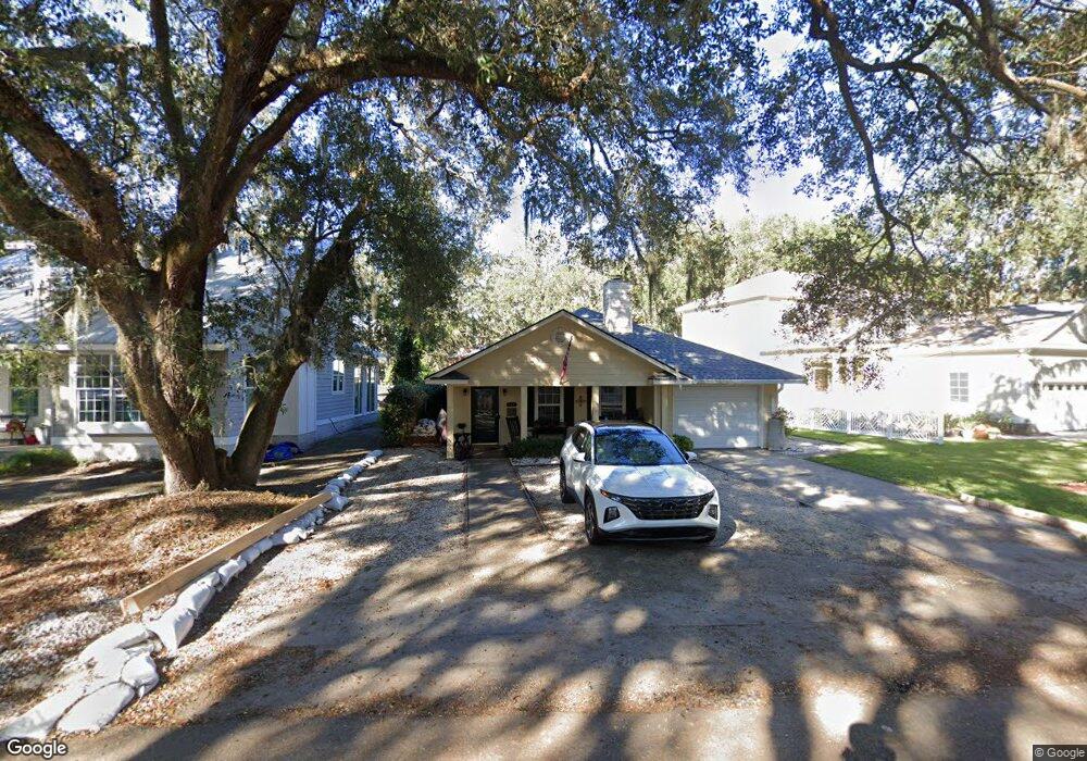
112 Circle Dr Saint Simons Island, GA 31522
Estimated Value: $621,926 - $825,000
3
Beds
2
Baths
1,512
Sq Ft
$480/Sq Ft
Est. Value
About This Home
This home is located at 112 Circle Dr, Saint Simons Island, GA 31522 and is currently estimated at $725,732, approximately $479 per square foot. 112 Circle Dr is a home located in Glynn County with nearby schools including St. Simons Elementary School, Glynn Middle School, and Glynn Academy.
Ownership History
Date
Name
Owned For
Owner Type
Purchase Details
Closed on
Feb 15, 2006
Sold by
Bailey James V
Bought by
Taff James R and Taff Patricia A
Current Estimated Value
Home Financials for this Owner
Home Financials are based on the most recent Mortgage that was taken out on this home.
Original Mortgage
$252,000
Outstanding Balance
$140,518
Interest Rate
6.04%
Mortgage Type
New Conventional
Estimated Equity
$585,214
Create a Home Valuation Report for This Property
The Home Valuation Report is an in-depth analysis detailing your home's value as well as a comparison with similar homes in the area
Home Values in the Area
Average Home Value in this Area
Purchase History
We collect this data history from publicly available records. To have your information removed, we recommend requesting removal directly through your county’s website.
| Date | Buyer | Sale Price | Title Company |
|---|---|---|---|
| Taff James R | $315,000 | -- |
Source: Public Records
Mortgage History
We collect this data history from publicly available records. To have your information removed, we recommend requesting removal directly through your county’s website.
| Date | Status | Borrower | Loan Amount |
|---|---|---|---|
| Open | Taff James R | $252,000 |
Source: Public Records
Tax History
| Year | Tax Paid | Tax Assessment Tax Assessment Total Assessment is a certain percentage of the fair market value that is determined by local assessors to be the total taxable value of land and additions on the property. | Land | Improvement |
|---|---|---|---|---|
| 2025 | $4,941 | $197,000 | $88,920 | $108,080 |
| 2024 | $5,018 | $200,080 | $88,920 | $111,160 |
| 2023 | $999 | $200,080 | $88,920 | $111,160 |
| 2022 | $1,132 | $168,720 | $88,920 | $79,800 |
| 2021 | $1,162 | $167,200 | $88,920 | $78,280 |
| 2020 | $1,079 | $113,840 | $35,560 | $78,280 |
| 2019 | $1,079 | $113,840 | $35,560 | $78,280 |
| 2018 | $1,079 | $113,840 | $35,560 | $78,280 |
| 2017 | $977 | $103,600 | $35,560 | $68,040 |
| 2016 | $716 | $93,360 | $35,560 | $57,800 |
| 2015 | $647 | $80,040 | $35,560 | $44,480 |
| 2014 | $647 | $84,520 | $40,040 | $44,480 |
Source: Public Records
Map
Nearby Homes
- 216 Circle Dr
- 232 Georgia St
- 23 Fred Dr
- 240 Georgia St
- 203 Grand Oaks Cir
- 1704 Frederica Rd Unit 428
- 1704 Frederica Rd Unit 132
- 306 Broadway St
- 240 Peachtree St
- 103 Cater St
- 309 Peachtree St
- 1700 Demere Rd
- 302 W Island Square Dr
- 302 E Island Square Dr
- 122 Red Bird Ln
- 702 E Island Square Dr
- 155 Laurel View Dr
- 114 S Island Square Dr
- 29 Moss Pointe Ln
- 2 Moss Pointe Ln
- 108 Saint Simons Ave
- 1921 2nd Ave
- 111 Saint Simons Ave
- 108 Circle Dr
- 116 Circle Dr
- 106 Saint Simons Ave
- 102 Circle Dr
- 125 Park Cir
- 120 Circle Dr
- Lot #7 120 Circle Drive ( Blk H)
- 1920 2nd Ave
- 120 Circle Dr
- 1918 2nd Ave
- 0 Saint Simons Ave
- 122 Circle Dr
- 115 Circle Dr
- 239 Park Cir
- 1914 2nd Ave
- 113 Circle Dr
- 117 Circle Dr
Your Personal Tour Guide
Ask me questions while you tour the home.