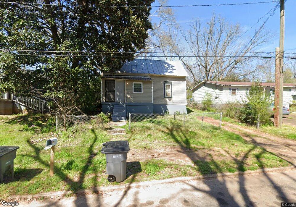
112 Cox St Lagrange, GA 30240
Estimated Value: $76,000 - $105,000
2
Beds
1
Bath
1,103
Sq Ft
$82/Sq Ft
Est. Value
About This Home
This home is located at 112 Cox St, Lagrange, GA 30240 and is currently estimated at $89,969, approximately $81 per square foot. 112 Cox St is a home located in Troup County with nearby schools including Franklin Forest Elementary School, Hollis Hand Elementary School, and Ethel W. Kight Elementary School.
Ownership History
Date
Name
Owned For
Owner Type
Purchase Details
Closed on
Aug 31, 1993
Sold by
Annie Maude B Tucker
Bought by
Bowen Clarence
Current Estimated Value
Purchase Details
Closed on
Aug 27, 1993
Sold by
Larry Darnell Bray
Bought by
Annie Maude B Tucker
Purchase Details
Closed on
Jan 1, 1972
Sold by
Jim Bray
Bought by
Larry Darnell Bray
Purchase Details
Closed on
Jan 1, 1955
Sold by
Scott Lake
Bought by
Jim Bray
Purchase Details
Closed on
Mar 1, 1900
Bought by
Scott Lake
Purchase Details
Closed on
Feb 1, 1900
Create a Home Valuation Report for This Property
The Home Valuation Report is an in-depth analysis detailing your home's value as well as a comparison with similar homes in the area
Purchase History
We collect this data history from publicly available records. To have your information removed, we recommend requesting removal directly through your county’s website.
| Date | Buyer | Sale Price | Title Company |
|---|---|---|---|
| Bowen Clarence | $6,000 | -- | |
| Annie Maude B Tucker | -- | -- | |
| Larry Darnell Bray | -- | -- | |
| Jim Bray | -- | -- | |
| Scott Lake | -- | -- | |
| -- | -- | -- |
Source: Public Records
Tax History
| Year | Tax Paid | Tax Assessment Tax Assessment Total Assessment is a certain percentage of the fair market value that is determined by local assessors to be the total taxable value of land and additions on the property. | Land | Improvement |
|---|---|---|---|---|
| 2025 | $595 | $21,800 | $760 | $21,040 |
| 2024 | $542 | $19,880 | $760 | $19,120 |
| 2023 | $281 | $10,320 | $760 | $9,560 |
| 2022 | $274 | $9,800 | $760 | $9,040 |
| 2021 | $234 | $7,760 | $760 | $7,000 |
| 2020 | $234 | $7,760 | $760 | $7,000 |
| 2019 | $215 | $7,120 | $1,000 | $6,120 |
| 2018 | $215 | $7,120 | $1,000 | $6,120 |
| 2017 | $215 | $7,120 | $1,000 | $6,120 |
| 2016 | $214 | $7,083 | $1,000 | $6,083 |
| 2015 | $207 | $6,863 | $780 | $6,083 |
| 2014 | $198 | $6,543 | $780 | $5,763 |
| 2013 | -- | $8,274 | $792 | $7,482 |
Source: Public Records
Map
Nearby Homes
- 219 Banks St
- 900 North St
- 725 N Greenwood St
- 120 North St
- 243 Beechwood Cir
- 222 Beechwood Cir
- 110 Russell St
- 202 Park Hill Dr
- 105 Dogwood Dr
- 0 Ridley Ave Unit 10550104
- 609 Ridley Ave
- 707 Ridley Ave
- 611 Ridley Ave
- 615 Ridley Ave
- 709 Ridley Ave
- 324 Park Hill Dr
- 806 New Franklin Rd
- 172 Merrybrook Dr
- 106 Ewing St
- 301 E Bacon St
Your Personal Tour Guide
Ask me questions while you tour the home.