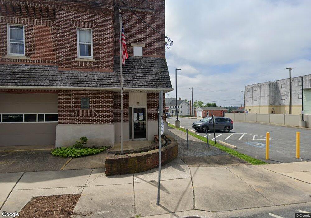
112 E Main St Dallastown, PA 17313
Estimated Value: $150,000
3
Beds
2
Baths
1,365
Sq Ft
$110/Sq Ft
Est. Value
About This Home
This home is located at 112 E Main St, Dallastown, PA 17313 and is currently priced at $150,000, approximately $109 per square foot. 112 E Main St is a home located in York County with nearby schools including Dallastown Elementary School, Dallastown Area Middle School, and Dallastown Area High School.
Ownership History
Date
Name
Owned For
Owner Type
Purchase Details
Closed on
May 22, 2023
Sold by
Board Of Trustees Of The Susquehanna Con
Bought by
Bethlehem Life Church
Current Estimated Value
Purchase Details
Closed on
Oct 31, 2017
Sold by
Hersey Melford Q and Hersey Gloria N
Bought by
Bethlehem United Methodist Church
Purchase Details
Closed on
Jun 2, 2017
Sold by
Koller Keith R
Bought by
Bethlehen United Methodist Church
Purchase Details
Closed on
Dec 3, 1997
Sold by
Sec Of Housing & Urban Devel
Bought by
Koller Keith R and Koller Carla L
Purchase Details
Closed on
Aug 8, 1997
Bought by
Sec Of Housing & Urban Devel
Create a Home Valuation Report for This Property
The Home Valuation Report is an in-depth analysis detailing your home's value as well as a comparison with similar homes in the area
Home Values in the Area
Average Home Value in this Area
Purchase History
| Date | Buyer | Sale Price | Title Company |
|---|---|---|---|
| Bethlehem Life Church | $158,308 | None Listed On Document | |
| Bethlehem United Methodist Church | $175,000 | None Available | |
| Bethlehen United Methodist Church | $155,000 | None Available | |
| Koller Keith R | $82,900 | -- | |
| Sec Of Housing & Urban Devel | $41,500 | -- |
Source: Public Records
Tax History
| Year | Tax Paid | Tax Assessment Tax Assessment Total Assessment is a certain percentage of the fair market value that is determined by local assessors to be the total taxable value of land and additions on the property. | Land | Improvement |
|---|---|---|---|---|
| 2025 | -- | $0 | $0 | $0 |
| 2024 | $1,792 | $51,590 | $44,400 | $7,190 |
| 2023 | $1,792 | $0 | $0 | $0 |
| 2022 | $715 | $0 | $0 | $0 |
| 2021 | $1,636 | $0 | $0 | $0 |
| 2020 | $715 | $22,550 | $22,550 | $0 |
| 2019 | $614 | $19,410 | $19,410 | $0 |
| 2018 | $2,422 | $76,620 | $19,410 | $57,210 |
| 2017 | $2,328 | $76,620 | $19,410 | $57,210 |
| 2016 | $0 | $76,620 | $19,410 | $57,210 |
| 2015 | -- | $76,620 | $19,410 | $57,210 |
| 2014 | -- | $76,620 | $19,410 | $57,210 |
Source: Public Records
Map
Nearby Homes
- 356 E Main St
- 314 S Pleasant Ave
- 165 April Ln
- 328 W Maple St
- 353 W Chestnut St Unit 16
- 417 Frederick Dr
- 727 Blossom Hill Ln
- 695 Oak Rd
- 39 W George St
- 750 Rydell Dr
- 227 Palomino Way Unit 164
- 479 Frederick Dr
- 606 Butterfly Cir
- 99 Furlong Way Unit 99
- 113 Brant Dr
- 150 Yoe Dr
- 129 Heather Glen Dr Unit 78
- 127 Heather Glen Dr Unit 80
- 156 Country Ridge Dr
- 414 S Park St
- 110 E Main St
- 124 E Main St
- 108 E Main St
- 126 E Main St
- 134 E Main St
- 0 Lot 11 Clay Ave Unit 20812643
- 136 E Main St
- 80 E Main St
- 78 E Main St
- 76 E Main St
- 105 E Main St
- 72 E Main St
- 14 S Charles St
- 131 E Main St
- 49 E Howard St
- 18 S Charles St
- 20 S Charles St
- 68 E Main St
- 47 E Howard St
- 137 E Main St
Your Personal Tour Guide
Ask me questions while you tour the home.