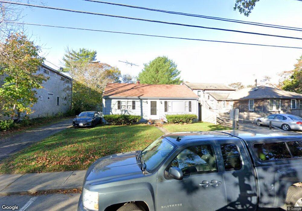
112 Franklin St Vineyard Haven, MA 02568
Vineyard Haven NeighborhoodEstimated Value: $901,000 - $1,153,000
2
Beds
1
Bath
1,073
Sq Ft
$963/Sq Ft
Est. Value
About This Home
This home is located at 112 Franklin St, Vineyard Haven, MA 02568 and is currently estimated at $1,033,000, approximately $962 per square foot. 112 Franklin St is a home located in Dukes County with nearby schools including Tisbury Elementary School, Martha's Vineyard Regional High School, and Martha's Vineyard Charter School.
Ownership History
Date
Name
Owned For
Owner Type
Purchase Details
Closed on
Aug 21, 2023
Sold by
Silvia Peter W and Kazanjian-Silvia Karen
Bought by
William Hope Irt and Silvia
Current Estimated Value
Purchase Details
Closed on
Oct 1, 1999
Sold by
Doherty Lois B and Peterson Priscilla T
Bought by
Schepici Anthony and Schepici Denise
Home Financials for this Owner
Home Financials are based on the most recent Mortgage that was taken out on this home.
Original Mortgage
$358,000
Interest Rate
7.85%
Mortgage Type
Purchase Money Mortgage
Create a Home Valuation Report for This Property
The Home Valuation Report is an in-depth analysis detailing your home's value as well as a comparison with similar homes in the area
Home Values in the Area
Average Home Value in this Area
Purchase History
| Date | Buyer | Sale Price | Title Company |
|---|---|---|---|
| William Hope Irt | -- | None Available | |
| Schepici Anthony | $93,000 | -- |
Source: Public Records
Mortgage History
| Date | Status | Borrower | Loan Amount |
|---|---|---|---|
| Previous Owner | Schepici Anthony | $358,000 |
Source: Public Records
Tax History
| Year | Tax Paid | Tax Assessment Tax Assessment Total Assessment is a certain percentage of the fair market value that is determined by local assessors to be the total taxable value of land and additions on the property. | Land | Improvement |
|---|---|---|---|---|
| 2025 | $6,269 | $828,100 | $536,700 | $291,400 |
| 2024 | $5,885 | $737,500 | $447,300 | $290,200 |
| 2023 | $4,749 | $648,800 | $370,400 | $278,400 |
| 2022 | $4,820 | $554,000 | $275,600 | $278,400 |
| 2021 | $4,682 | $510,600 | $275,600 | $235,000 |
| 2020 | $4,667 | $500,200 | $296,800 | $203,400 |
| 2019 | $4,519 | $492,800 | $296,800 | $196,000 |
| 2018 | $4,013 | $424,700 | $256,500 | $168,200 |
| 2017 | $3,563 | $391,100 | $239,400 | $151,700 |
| 2016 | $3,330 | $363,500 | $224,400 | $139,100 |
| 2015 | $3,012 | $337,700 | $204,900 | $132,800 |
Source: Public Records
Map
Nearby Homes
- 21 Woodlawn Ave
- 26 Union St Unit 7
- 70 Spring St
- 116 Franklin Terrace
- 151 Tashmoo Ave
- 140 Midland Ave
- 4 Lagoon Pond Rd
- 119 N William St
- 33 Lagoon Pond Rd
- 241 Daggett Ave
- 268 Tashmoo Ave
- 61 Causeway Rd
- 16 Frog Hollow
- 35 Mount Aldworth Rd
- 5A2.12 State Rd
- 11 Macs Ln
- 00 Bernard Cir Unit 10
- 73 & 0 Old Country Ln
- 124 Skiff Ave Unit C-12
- 124 Skiff Ave Unit D-10
- 110 Franklin St
- 118 Franklin St
- 4 Midland Ave
- 128 Franklin St
- 107 Franklin St
- 98 Franklin St
- 104 Franklin St
- 115 Franklin St
- 136 Franklin St
- 17 Proprietors Way
- 122 Franklin St
- 6 Midland Ave
- 171 Franklin St
- 88 Franklin St
- 33 Proprietors Way
- 9 Midland Ave
- 85 Franklin St
- 0 Proprietors Way
- 00 Proprietors Way
- 12 Midland Ave
Your Personal Tour Guide
Ask me questions while you tour the home.