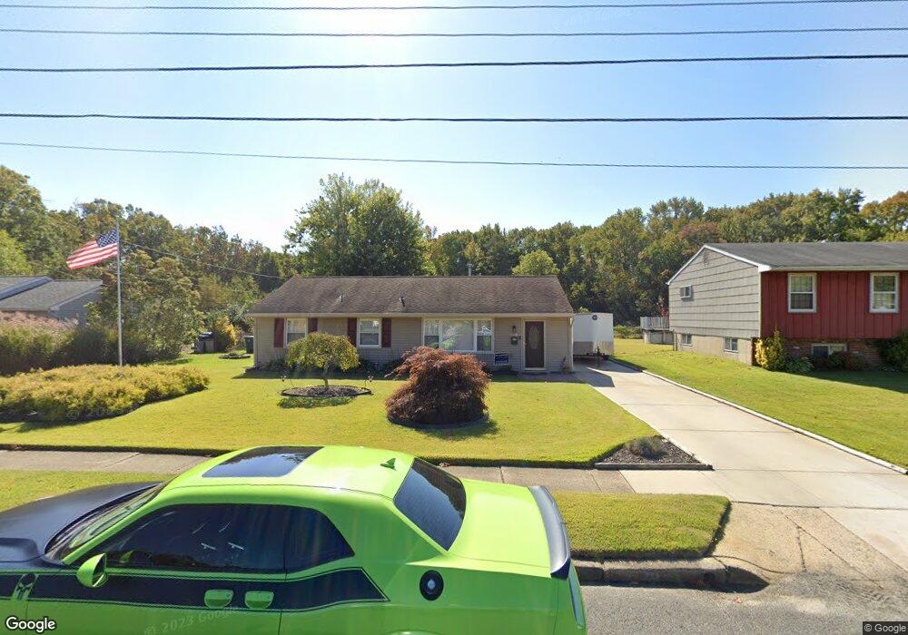
112 Laurel Ln Williamstown, NJ 08094
Monroe NeighborhoodEstimated Value: $287,105 - $319,000
Studio
--
Bath
1,008
Sq Ft
$302/Sq Ft
Est. Value
About This Home
This home is located at 112 Laurel Ln, Williamstown, NJ 08094 and is currently estimated at $304,276, approximately $301 per square foot. 112 Laurel Ln is a home located in Gloucester County with nearby schools including Williamstown High School, St. Mary School, and Finest of the Wheat Christian.
Ownership History
Date
Name
Owned For
Owner Type
Purchase Details
Closed on
Mar 16, 2001
Sold by
Paparo Joseph M and Paparo Kristine L Saber
Bought by
Sumner Michael R and Sumner Shari G
Current Estimated Value
Home Financials for this Owner
Home Financials are based on the most recent Mortgage that was taken out on this home.
Original Mortgage
$92,270
Outstanding Balance
$33,674
Interest Rate
7.05%
Mortgage Type
FHA
Estimated Equity
$270,602
Purchase Details
Closed on
Feb 25, 1994
Sold by
Hahn John Harold
Bought by
Papato Joseph M and Saber Kristine C
Home Financials for this Owner
Home Financials are based on the most recent Mortgage that was taken out on this home.
Original Mortgage
$86,000
Interest Rate
6.9%
Mortgage Type
FHA
Create a Home Valuation Report for This Property
The Home Valuation Report is an in-depth analysis detailing your home's value as well as a comparison with similar homes in the area
Home Values in the Area
Average Home Value in this Area
Purchase History
We collect this data history from publicly available records. To have your information removed, we recommend requesting removal directly through your county’s website.
| Date | Buyer | Sale Price | Title Company |
|---|---|---|---|
| Sumner Michael R | $93,000 | -- | |
| Papato Joseph M | $86,500 | -- |
Source: Public Records
Mortgage History
We collect this data history from publicly available records. To have your information removed, we recommend requesting removal directly through your county’s website.
| Date | Status | Borrower | Loan Amount |
|---|---|---|---|
| Open | Sumner Michael R | $92,270 | |
| Previous Owner | Papato Joseph M | $86,000 |
Source: Public Records
Tax History
| Year | Tax Paid | Tax Assessment Tax Assessment Total Assessment is a certain percentage of the fair market value that is determined by local assessors to be the total taxable value of land and additions on the property. | Land | Improvement |
|---|---|---|---|---|
| 2025 | $4,991 | $136,300 | $46,500 | $89,800 |
| 2024 | $4,955 | $136,300 | $46,500 | $89,800 |
| 2023 | $4,955 | $136,300 | $46,500 | $89,800 |
| 2022 | $4,931 | $136,300 | $46,500 | $89,800 |
| 2021 | $4,963 | $136,300 | $46,500 | $89,800 |
| 2020 | $4,957 | $136,300 | $46,500 | $89,800 |
| 2019 | $4,927 | $136,300 | $46,500 | $89,800 |
| 2018 | $4,847 | $136,300 | $46,500 | $89,800 |
| 2017 | $4,739 | $133,800 | $59,500 | $74,300 |
| 2016 | $4,679 | $133,800 | $59,500 | $74,300 |
| 2015 | $4,545 | $133,800 | $59,500 | $74,300 |
| 2014 | $4,413 | $133,800 | $59,500 | $74,300 |
Source: Public Records
Map
Nearby Homes
- 1666 Holly Pkwy
- 129 Karen Dr
- 112 Karen Dr
- 248 Karen Dr
- 317 Balsam Rd
- 1740 Forest Dr
- 1735 Black Oak Rd
- 256 Staggerbush Rd
- 0 Black Horse Pike Unit NJGL2064170
- 1626 White Cedar Ln
- 1665 Carriage Dr
- 1346 Corkery Ln
- 207 Dickens Ct
- 1702 Exposition Dr Unit 1702
- 1106 Exposition Dr Unit 1106
- 336 Copperfield Dr
- 1313 Stonehenge Dr
- 306 Pickwick Dr
- 415 Stockton Loop
- 501 Stockton Dr
- 108 Laurel Ln
- 116 Laurel Ln
- 120 Laurel Ln
- 1665 Holly Pkwy
- 124 Laurel Ln
- 115 Laurel Ln
- 1660 Holly Pkwy
- 101 Laurel Ln
- 1664 Silver Birch Rd
- 1659 Holly Pkwy
- 128 Laurel Ln
- 1656 Holly Pkwy
- 1658 Silver Birch Rd
- 133 Karen Dr
- 1655 Holly Pkwy
- 201 Karen Dr
- 127 Laurel Ln
- 1652 Holly Pkwy
- 1654 Silver Birch Rd
- 136 Karen Dr
Your Personal Tour Guide
Ask me questions while you tour the home.