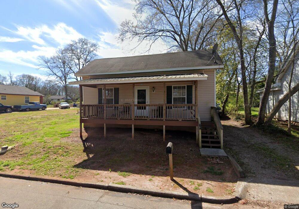
112 Locust St Lagrange, GA 30241
Estimated Value: $46,000 - $70,000
2
Beds
1
Bath
720
Sq Ft
$81/Sq Ft
Est. Value
About This Home
This home is located at 112 Locust St, Lagrange, GA 30241 and is currently estimated at $58,077, approximately $80 per square foot. 112 Locust St is a home located in Troup County with nearby schools including Hollis Hand Elementary School, Franklin Forest Elementary School, and Ethel W. Kight Elementary School.
Ownership History
Date
Name
Owned For
Owner Type
Purchase Details
Closed on
Jan 31, 2025
Sold by
Bobinvestus Llc
Bought by
112 Locust St Llc
Current Estimated Value
Purchase Details
Closed on
Nov 22, 2024
Sold by
Gp Capital Llc
Bought by
Bobinvestus Llc
Purchase Details
Closed on
Apr 23, 2004
Sold by
Jo Ann Murphy
Bought by
Lester Alton and Linda Lester
Purchase Details
Closed on
Jun 9, 1980
Sold by
Lagrange Banking Company
Bought by
Jo Ann Murphy
Purchase Details
Closed on
Jan 12, 1979
Sold by
The Agency Inc
Bought by
Lagrange Banking Company
Purchase Details
Closed on
Dec 1, 1919
Sold by
Moore John W
Bought by
The Agency Inc
Create a Home Valuation Report for This Property
The Home Valuation Report is an in-depth analysis detailing your home's value as well as a comparison with similar homes in the area
Purchase History
| Date | Buyer | Sale Price | Title Company |
|---|---|---|---|
| 112 Locust St Llc | -- | -- | |
| Bobinvestus Llc | $60,000 | -- | |
| Gp Capital Llc | $45,000 | -- | |
| Lester Alton | $2,000 | -- | |
| Jo Ann Murphy | $1,000 | -- | |
| Lagrange Banking Company | $3,000 | -- | |
| The Agency Inc | -- | -- |
Source: Public Records
Tax History
| Year | Tax Paid | Tax Assessment Tax Assessment Total Assessment is a certain percentage of the fair market value that is determined by local assessors to be the total taxable value of land and additions on the property. | Land | Improvement |
|---|---|---|---|---|
| 2025 | $626 | $22,960 | $1,440 | $21,520 |
| 2024 | $555 | $20,360 | $1,440 | $18,920 |
| 2023 | $508 | $18,640 | $1,440 | $17,200 |
| 2022 | $492 | $17,640 | $1,440 | $16,200 |
| 2021 | $236 | $7,840 | $720 | $7,120 |
| 2020 | $236 | $7,840 | $720 | $7,120 |
| 2019 | $222 | $7,368 | $768 | $6,600 |
| 2018 | $222 | $7,368 | $768 | $6,600 |
| 2017 | $222 | $7,368 | $768 | $6,600 |
| 2016 | $220 | $7,301 | $768 | $6,533 |
| 2015 | $221 | $7,301 | $768 | $6,533 |
| 2014 | $211 | $6,957 | $768 | $6,189 |
| 2013 | -- | $8,712 | $768 | $7,944 |
Source: Public Records
Map
Nearby Homes
Your Personal Tour Guide
Ask me questions while you tour the home.