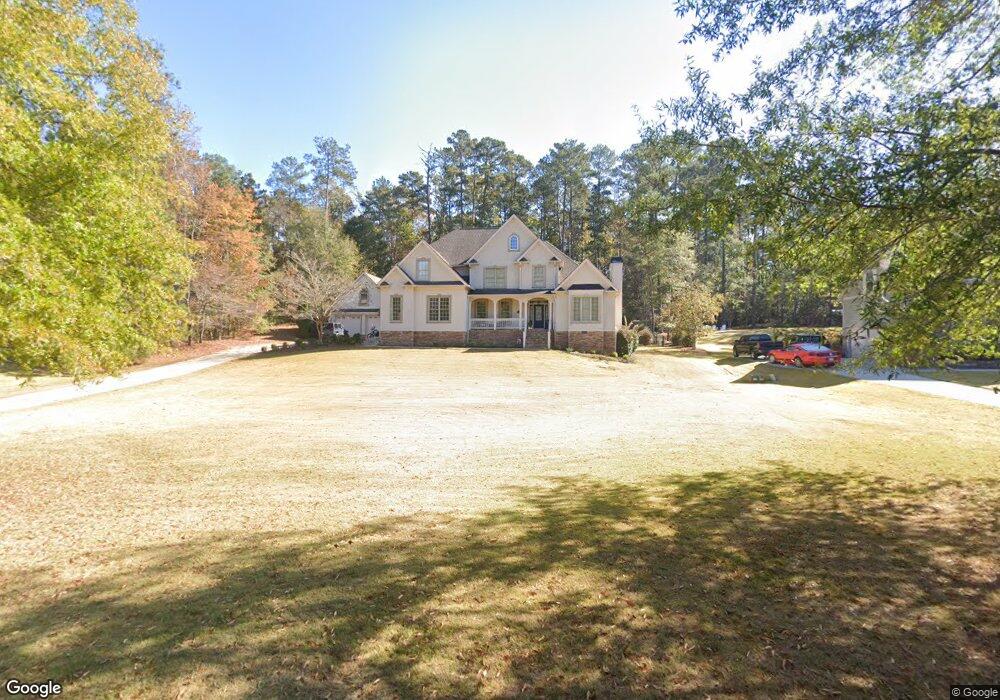
112 Millridge Dr Unit 14 Lagrange, GA 30240
Estimated Value: $577,000 - $628,000
About This Home
This home is located at 112 Millridge Dr Unit 14, Lagrange, GA 30240 and is currently estimated at $602,191, approximately $159 per square foot. 112 Millridge Dr Unit 14 is a home located in Troup County with nearby schools including Hollis Hand Elementary School, Ethel W. Kight Elementary School, and Franklin Forest Elementary School.
Ownership History
We collect this data history from publicly available records. To have your information removed, we recommend requesting removal directly through your county’s website.
Purchase Details
Home Financials for this Owner
Home Financials are based on the most recent Mortgage that was taken out on this home.Purchase Details
Home Financials for this Owner
Home Financials are based on the most recent Mortgage that was taken out on this home.Purchase Details
Home Financials for this Owner
Home Financials are based on the most recent Mortgage that was taken out on this home.Purchase Details
Home Financials for this Owner
Home Financials are based on the most recent Mortgage that was taken out on this home.Purchase Details
Purchase History
We collect this data history from publicly available records. To have your information removed, we recommend requesting removal directly through your county’s website.
| Date | Buyer | Sale Price | Title Company |
|---|---|---|---|
| $580,000 | -- | ||
| $499,000 | -- | ||
| $499,000 | -- | ||
| $385,000 | -- | ||
| $385,000 | -- | ||
| $62,500 | -- | ||
| -- | -- |
Mortgage History
We collect this data history from publicly available records. To have your information removed, we recommend requesting removal directly through your county’s website.
| Date | Status | Borrower | Loan Amount |
|---|---|---|---|
| Open | $464,000 | ||
| Previous Owner | $474,050 | ||
| Previous Owner | $308,000 | ||
| Previous Owner | $321,750 |
Tax History
We collect this data history from publicly available records. To have your information removed, we recommend requesting removal directly through your county’s website.
| Year | Tax Paid | Tax Assessment Tax Assessment Total Assessment is a certain percentage of the fair market value that is determined by local assessors to be the total taxable value of land and additions on the property. | Land | Improvement |
|---|---|---|---|---|
| 2025 | $2,971 | $230,760 | $20,000 | $210,760 |
| 2024 | $5,986 | $219,480 | $20,000 | $199,480 |
| 2023 | $5,571 | $204,280 | $20,000 | $184,280 |
| 2022 | $5,369 | $192,360 | $20,000 | $172,360 |
| 2021 | $4,919 | $163,080 | $20,000 | $143,080 |
| 2020 | $4,919 | $163,080 | $20,000 | $143,080 |
| 2019 | $4,780 | $158,480 | $20,000 | $138,480 |
| 2018 | $4,780 | $158,480 | $20,000 | $138,480 |
| 2017 | $4,780 | $158,480 | $20,000 | $138,480 |
| 2016 | $4,805 | $159,310 | $20,000 | $139,310 |
| 2015 | $4,813 | $159,310 | $20,000 | $139,310 |
| 2014 | $4,610 | $152,345 | $20,000 | $132,345 |
| 2013 | -- | $158,176 | $18,000 | $140,176 |
Map
- 638 Cameron Mill Rd
- 101 Deal Dr
- 217 Baywood Cir
- 1000 Foxcroft Dr
- 960 Cameron Mill Rd
- 2005 Foxcroft Dr
- 116 Lakeland Dr
- 910 Piney Woods Dr
- 214 Highland Trail
- 0 Hills and Dales Farm Rd
- 117 Brookwood Dr
- 227 W Lakeview Dr
- 1784 Mooty Bridge Rd
- 110 Pond View Point
- 101 Ridgeview Dr
- 501 Pineview Terrace
- 108 Saint Anthony Dr
- 300 Cheyenne Dr
- 413 Ashford Cir
- 501 Ashford Cir
- 112 Millridge Dr
- 110 Millridge Dr
- 0 Millridge Dr Unit 13 7141636
- 0 Millridge Dr Unit 15 7141634
- 0 Millridge Dr Unit 11 7141632
- 0 Millridge Dr Unit 12 7141621
- 116 Millridge Dr
- 108 Millridge Dr
- 111 Millridge Dr
- 109 Millridge Dr
- 113 Millridge Dr
- 118 Millridge Dr
- 106 Millridge Dr
- 107 Millridge Dr
- 115 Millridge Dr Unit 8
- 105 Millridge Dr
- 102 Loblolly Rd
- 104 Millridge Dr
- 120 Millridge Dr
- 103 Millridge Dr
Ask me questions while you tour the home.