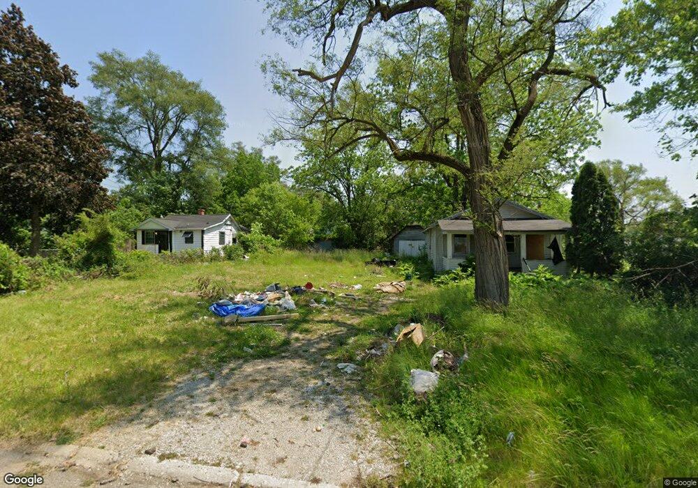
1120 Fulsom St Flint, MI 48504
Ballenger Highway NeighborhoodEstimated Value: $152,500
2
Beds
1
Bath
589
Sq Ft
$259/Sq Ft
Est. Value
About This Home
This home is located at 1120 Fulsom St, Flint, MI 48504 and is currently priced at $152,500, approximately $258 per square foot. 1120 Fulsom St is a home located in Genesee County with nearby schools including Durant-Tuuri-Mott Elementary School, Greater Heights Academy, and St. Paul Lutheran School.
Ownership History
Date
Name
Owned For
Owner Type
Purchase Details
Closed on
Dec 20, 2013
Sold by
Genesee County Treasurer
Bought by
Genesee County Land Bank
Current Estimated Value
Purchase Details
Closed on
Dec 29, 2010
Sold by
Smith Kevin Edward and Smith Amanda
Bought by
Imarketing Services Llc
Purchase Details
Closed on
Nov 24, 2010
Sold by
Cherry Deborah L
Bought by
Smiht Kevin Edward
Purchase Details
Closed on
Mar 1, 2007
Sold by
Post Beverly Irene
Bought by
Mills James A
Purchase Details
Closed on
Jun 5, 2004
Sold by
The Beverly Irene Post Trust
Bought by
Mills James A
Home Financials for this Owner
Home Financials are based on the most recent Mortgage that was taken out on this home.
Original Mortgage
$15,000
Interest Rate
5%
Mortgage Type
Seller Take Back
Create a Home Valuation Report for This Property
The Home Valuation Report is an in-depth analysis detailing your home's value as well as a comparison with similar homes in the area
Home Values in the Area
Average Home Value in this Area
Purchase History
| Date | Buyer | Sale Price | Title Company |
|---|---|---|---|
| Genesee County Land Bank | -- | None Available | |
| Imarketing Services Llc | $1,000 | None Available | |
| Smiht Kevin Edward | $500 | None Available | |
| Mills James A | $300 | First American Title Ins Co | |
| Mills James A | $17,000 | First American Title Ins Co |
Source: Public Records
Mortgage History
| Date | Status | Borrower | Loan Amount |
|---|---|---|---|
| Previous Owner | Mills James A | $15,000 |
Source: Public Records
Tax History
| Year | Tax Paid | Tax Assessment Tax Assessment Total Assessment is a certain percentage of the fair market value that is determined by local assessors to be the total taxable value of land and additions on the property. | Land | Improvement |
|---|---|---|---|---|
| 2025 | -- | $0 | $0 | $0 |
| 2024 | -- | $0 | $0 | $0 |
| 2023 | -- | $0 | $0 | $0 |
| 2022 | $0 | $0 | $0 | $0 |
| 2021 | $0 | $0 | $0 | $0 |
| 2020 | $0 | $0 | $0 | $0 |
| 2019 | $0 | $0 | $0 | $0 |
| 2018 | $0 | $0 | $0 | $0 |
| 2017 | $0 | $0 | $0 | $0 |
| 2016 | $0 | $0 | $0 | $0 |
| 2015 | -- | $0 | $0 | $0 |
| 2014 | -- | $0 | $0 | $0 |
| 2012 | -- | $4,900 | $0 | $0 |
Source: Public Records
Map
Nearby Homes
- 1133 Donaldson St
- 0 Donaldson St
- 3071 Devonshire St
- 3120 Stratford St
- 2944 Wolcott St
- 2902 Prospect St
- 3228 Wolcott St
- 2918 Mackin Rd
- 3101 Barth St
- 3021 Clement St
- 1221 Eldorado Dr
- 1220 Forest Hill Ave
- 2602 Sloan St
- 2547 Altoona St
- 2509 Barth St
- 2513 Tiffin St
- 2622 Concord St
- 2612 Concord St
- 2112 Winona St
- 2038 Copeman Blvd
- 1116 Fulsom St
- 1124 Fulsom St
- 1114 Fulsom St
- 3019 Sloan St
- 1132 Fulsom St
- 1115 Donaldson Blvd
- 1119 Donaldson Blvd
- 3015 Sloan St
- 1111 Donaldson Blvd
- 1123 Donaldson Blvd
- 1127 Donaldson Blvd
- 1123 Fulsom St
- 1127 Fulsom St
- 1133 Donaldson Blvd
- 1131 Fulsom St
- 3037 Flushing Rd
- 3026 Flushing Rd
- 3047 Flushing Rd
- 3034 Sloan St
- 1124 Sutton Ave
Your Personal Tour Guide
Ask me questions while you tour the home.