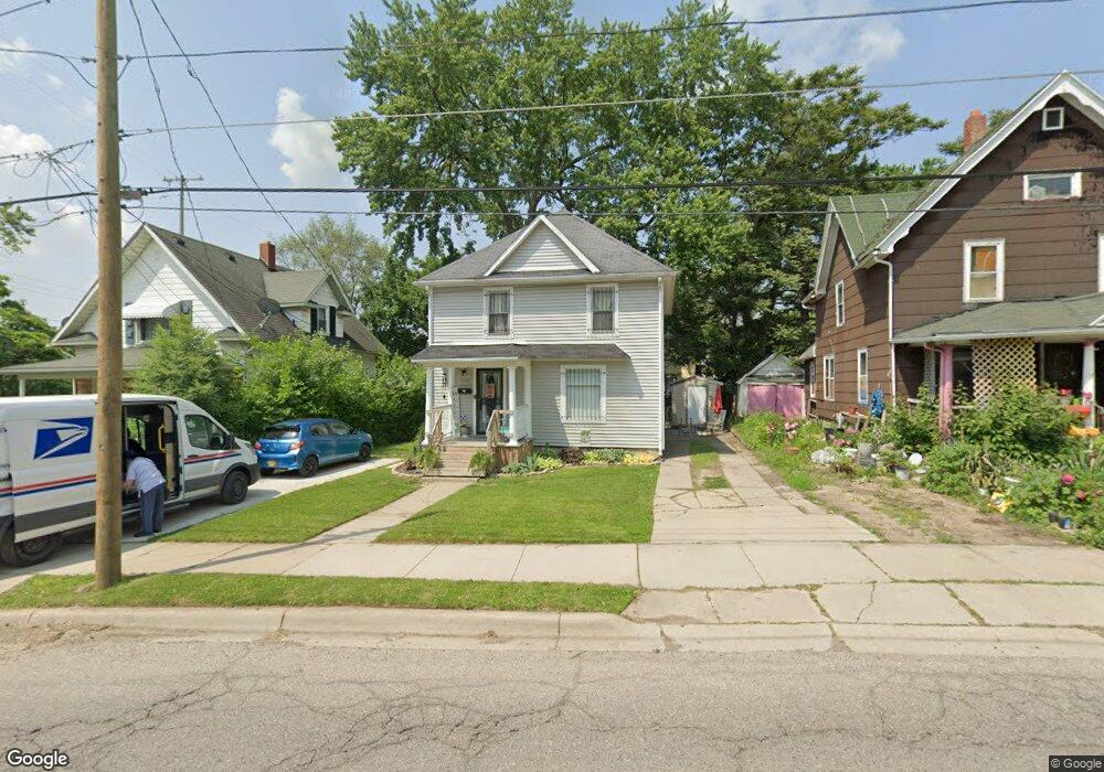
1122 Pershing St Flint, MI 48503
Southwest Flint NeighborhoodEstimated Value: $48,000 - $98,000
4
Beds
1
Bath
1,588
Sq Ft
$46/Sq Ft
Est. Value
About This Home
This home is located at 1122 Pershing St, Flint, MI 48503 and is currently estimated at $72,595, approximately $45 per square foot. 1122 Pershing St is a home located in Genesee County with nearby schools including Eisenhower School, Flint Southwestern Classical Academy, and St John Vianney Catholic School.
Ownership History
Date
Name
Owned For
Owner Type
Purchase Details
Closed on
May 29, 2025
Sold by
James Linda Lee
Bought by
Staley Corrie Beth
Current Estimated Value
Purchase Details
Closed on
Aug 20, 2020
Sold by
James Linda L
Bought by
James Stanley D and James Linda Lee
Purchase Details
Closed on
Jun 9, 2014
Sold by
Allinger Robert and Maxine L Allinger Trust
Bought by
James Linda
Purchase Details
Closed on
Oct 12, 2009
Sold by
Allinger Maxine L
Bought by
Allinger Maxine L and The Maxine L Allinger Trust
Create a Home Valuation Report for This Property
The Home Valuation Report is an in-depth analysis detailing your home's value as well as a comparison with similar homes in the area
Home Values in the Area
Average Home Value in this Area
Purchase History
| Date | Buyer | Sale Price | Title Company |
|---|---|---|---|
| Staley Corrie Beth | -- | None Listed On Document | |
| James Stanley D | -- | None Available | |
| James Linda | -- | None Available | |
| James Linda | -- | None Available | |
| Allinger Maxine L | -- | None Available | |
| Allinger Robert | -- | None Available |
Source: Public Records
Tax History
| Year | Tax Paid | Tax Assessment Tax Assessment Total Assessment is a certain percentage of the fair market value that is determined by local assessors to be the total taxable value of land and additions on the property. | Land | Improvement |
|---|---|---|---|---|
| 2025 | $907 | $25,200 | $0 | $0 |
| 2024 | $824 | $25,200 | $0 | $0 |
| 2023 | $811 | $18,500 | $0 | $0 |
| 2022 | $0 | $16,000 | $0 | $0 |
| 2021 | $841 | $14,300 | $0 | $0 |
| 2020 | $762 | $14,000 | $0 | $0 |
| 2019 | $744 | $12,700 | $0 | $0 |
| 2018 | $738 | $10,000 | $0 | $0 |
| 2017 | $775 | $0 | $0 | $0 |
| 2016 | $770 | $0 | $0 | $0 |
| 2015 | -- | $0 | $0 | $0 |
| 2014 | -- | $0 | $0 | $0 |
| 2012 | -- | $14,500 | $0 | $0 |
Source: Public Records
Map
Nearby Homes
- 2124 Swayze St
- 1820 Chelsea Cir
- 2310 Gibson St
- 2410 Corunna Rd
- 2433 Brown St
- 2437 Zimmerman St
- 2509 Corunna Rd
- 607 Thayer St
- 2464 Gibson St
- 1506 Gainey Ave
- 2618 Brown St
- 2621 Swayze St
- 1518 Monteray St
- 1530 Monteray St
- 2729 Chicago Blvd
- 932 Bradley Ave
- 913 Davis St
- 751 Dupont St
- 612 Bradley Ave
- 825 Frank St
- 1118 Pershing St
- 1126 Pershing St
- 1119 Boston Ave
- 1125 Boston Ave
- 1108 Pershing St
- 1101 Boston Ave
- 1115 Pershing St
- 1126 Boston Ave
- 1202 Pershing St
- 1109 Pershing St
- 1909 Becker St
- 1201 Boston Ave
- 1105 Pershing St
- 1118 Boston Ave
- 1122 Boston Ave
- 1917 Becker St
- 1124 Boston Ave
- 1124 Boston Ave
- 1205 Boston Ave
- 1210 Pershing St
Your Personal Tour Guide
Ask me questions while you tour the home.