Estimated Value: $120,000 - $170,888
3
Beds
2
Baths
2,140
Sq Ft
$69/Sq Ft
Est. Value
About This Home
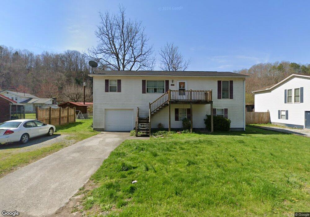
This home is located at 11247 Riverside Cir, Pound, VA 24279 and is currently estimated at $148,222, approximately $69 per square foot. 11247 Riverside Cir is a home located in Wise County.
Ownership History
Date
Name
Owned For
Owner Type
Purchase Details
Closed on
Jun 30, 2010
Sold by
Church Jack B and Church Dinah R
Bought by
Dales Crystal
Current Estimated Value
Home Financials for this Owner
Home Financials are based on the most recent Mortgage that was taken out on this home.
Original Mortgage
$102,000
Outstanding Balance
$70,758
Interest Rate
5.62%
Mortgage Type
New Conventional
Estimated Equity
$77,464
Purchase Details
Closed on
May 22, 2008
Sold by
Rutherford Gary T
Bought by
Church Jack B and Church Dinah R
Home Financials for this Owner
Home Financials are based on the most recent Mortgage that was taken out on this home.
Original Mortgage
$85,500
Interest Rate
6.1%
Mortgage Type
Credit Line Revolving
Create a Home Valuation Report for This Property
The Home Valuation Report is an in-depth analysis detailing your home's value as well as a comparison with similar homes in the area
Purchase History
We collect this data history from publicly available records. To have your information removed, we recommend requesting removal directly through your county’s website.
| Date | Buyer | Sale Price | Title Company |
|---|---|---|---|
| Dales Crystal | $102,000 | None Available | |
| Church Jack B | $95,000 | None Available |
Source: Public Records
Mortgage History
We collect this data history from publicly available records. To have your information removed, we recommend requesting removal directly through your county’s website.
| Date | Status | Borrower | Loan Amount |
|---|---|---|---|
| Open | Dales Crystal | $102,000 | |
| Previous Owner | Church Jack B | $85,500 |
Source: Public Records
Tax History
| Year | Tax Paid | Tax Assessment Tax Assessment Total Assessment is a certain percentage of the fair market value that is determined by local assessors to be the total taxable value of land and additions on the property. | Land | Improvement |
|---|---|---|---|---|
| 2025 | $758 | $109,900 | $7,000 | $102,900 |
| 2024 | $758 | $109,900 | $7,000 | $102,900 |
| 2023 | $758 | $109,900 | $7,000 | $102,900 |
| 2022 | $758 | $109,900 | $7,000 | $102,900 |
| 2021 | $738 | $106,900 | $7,000 | $99,900 |
| 2020 | $738 | $106,900 | $7,000 | $99,900 |
| 2019 | $738 | $106,900 | $7,000 | $99,900 |
| 2018 | $663 | $106,900 | $7,000 | $99,900 |
| 2017 | $641 | $106,900 | $7,000 | $99,900 |
| 2016 | $641 | $106,900 | $7,000 | $99,900 |
| 2015 | $321 | $106,900 | $7,000 | $99,900 |
Source: Public Records
Map
Nearby Homes
- 8342 N River Rd
- 8835 Maple Rd
- 1121 Miner Rd
- 11135 Boggs Hollow Rd
- 11510 Dogwood Ln
- 7914 High Oak Rd
- 9404 Clintwood Hwy
- 10007 Orby Cantrell Hwy
- 8409 Fleming Valley Ln
- Tbd Clintwood Hwy
- 9707 Paso Ln
- 8366 Fishman Rd
- White Oak Creek Rd
- 105 Dry Hill
- 62 Royal Melbourne Ln
- 174 Earnhart Dr
- 982 Hwy 3400
- 499 Ventura Rd
- 2493 Dickenson Hwy
- 765 Crabtree Hollow
- 11247 Riverside Dr Unit 1
- 11251 Riverside Cir
- 11243 Riverside Cir
- 11248 Riverside Cir
- 11244 Riverside Cir
- 11215 Riverside Cir
- 11213 Riverside Cir
- 11252 Riverside Cir
- 11259 Riverside Dr
- 11259 Riverside Cir
- 11209 Riverside Cir
- 11254 Riverside Cir
- 11221 Riverside Cir
- 11240 Riverside Cir
- 11210 Riverside Cir
- 11212 Riverside Dr
- 11263 Riverside Cir
- 11212 Riverside Cir
- 11206 Riverside Cir
- 11256 Riverside Dr
Your Personal Tour Guide
Ask me questions while you tour the home.