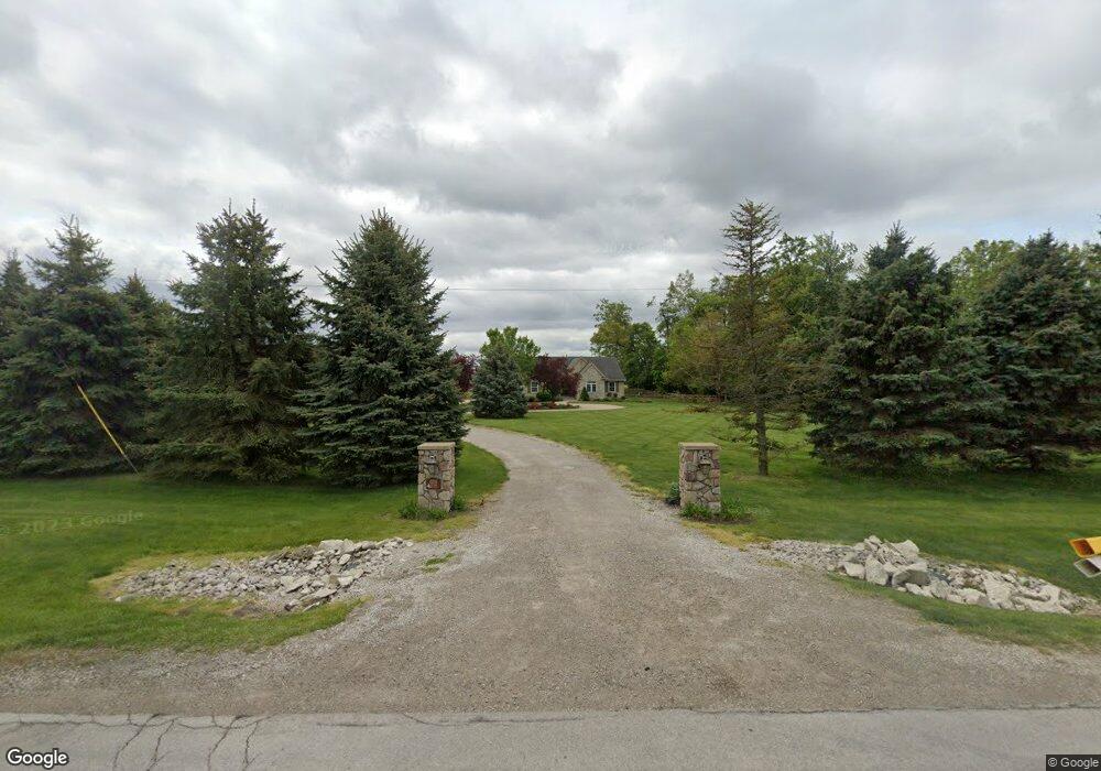
11295 S Custer Rd Monroe, MI 48161
Estimated Value: $363,000 - $599,000
Studio
--
Bath
--
Sq Ft
88,427
Sq Ft Lot
About This Home
This home is located at 11295 S Custer Rd, Monroe, MI 48161 and is currently estimated at $474,843. 11295 S Custer Rd is a home located in Monroe County with nearby schools including Dundee Middle School, Dundee Elementary School, and Dundee Community High School.
Ownership History
Date
Name
Owned For
Owner Type
Purchase Details
Closed on
May 20, 2019
Sold by
Lipford and Janice
Bought by
Swick Douglas R and Swick Lori A
Current Estimated Value
Home Financials for this Owner
Home Financials are based on the most recent Mortgage that was taken out on this home.
Original Mortgage
$192,000
Outstanding Balance
$167,761
Interest Rate
4%
Mortgage Type
New Conventional
Estimated Equity
$307,082
Create a Home Valuation Report for This Property
The Home Valuation Report is an in-depth analysis detailing your home's value as well as a comparison with similar homes in the area
Home Values in the Area
Average Home Value in this Area
Purchase History
| Date | Buyer | Sale Price | Title Company |
|---|---|---|---|
| Swick Douglas R | $400,000 | Hassett Title |
Source: Public Records
Mortgage History
| Date | Status | Borrower | Loan Amount |
|---|---|---|---|
| Open | Swick Douglas R | $192,000 |
Source: Public Records
Tax History
| Year | Tax Paid | Tax Assessment Tax Assessment Total Assessment is a certain percentage of the fair market value that is determined by local assessors to be the total taxable value of land and additions on the property. | Land | Improvement |
|---|---|---|---|---|
| 2025 | $1,826 | $213,300 | $213,300 | $0 |
| 2024 | $1,772 | $204,100 | $0 | $0 |
| 2023 | $1,687 | $161,300 | $0 | $0 |
| 2022 | $4,034 | $161,300 | $0 | $0 |
| 2021 | $3,902 | $149,400 | $0 | $0 |
| 2020 | $3,829 | $137,600 | $0 | $0 |
| 2019 | $2,819 | $137,600 | $0 | $0 |
| 2018 | $2,740 | $122,400 | $0 | $0 |
| 2017 | $2,590 | $122,400 | $0 | $0 |
| 2016 | $3,105 | $111,100 | $0 | $0 |
| 2015 | $3,106 | $98,057 | $0 | $0 |
| 2014 | $3,102 | $98,057 | $0 | $0 |
| 2013 | -- | $94,268 | $0 | $0 |
Source: Public Records
Map
Nearby Homes
- 11135 S Custer (Lot H)
- 10960 S Custer (Lot O)
- 11020 S Custer Rd
- 11075 S Custer Rd
- 11080 S Custer Rd
- 11140 S Custer Rd
- 000 Dixon Rd
- 13493 Dixon Rd
- 7600 Dixon Rd
- 8257 Ida West Rd
- 835 Golf Ridge Cir
- 850 Henning St
- 8344 Westwood St
- 835 Henning St
- 742 Forest Ln
- 671 Elk Ridge Dr
- 301 White Owl Ln Unit 236
- 535 Falcon Dr
- 190 Sidney St
- 2 Covell
- 11235 S Custer Rd
- 11215 S Custer Rd
- 9999 S Custer Rd
- 11300 S Custer Rd
- 11195 S Custer (Lot G)
- 11195 S Custer (G)
- 11330 S Custer Rd
- 11200 S Custer Rd
- 11135 S Custer (H)
- 11075 S Custer (Lot I)
- 11140 S Custer ( L )
- 11075 S Custer ( I )
- 11140 S Custer Rd (Lot L)
- 11140 S Custer (Lot L)
- 11080 S Custer (Lot M)
- 11080 S Custer ( M )
- 11015 S Custer (Lot J)
- 11015 S Custer (J)
- 11020 S Custer (Lot N)
- 11020 S Custer ( N )
Your Personal Tour Guide
Ask me questions while you tour the home.