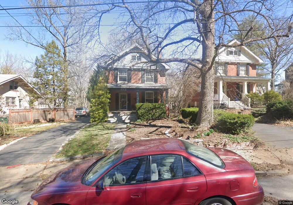
113 E Cedar Ave Saint Louis, MO 63119
Estimated Value: $696,000 - $754,000
4
Beds
2
Baths
2,488
Sq Ft
$294/Sq Ft
Est. Value
About This Home
This home is located at 113 E Cedar Ave, Saint Louis, MO 63119 and is currently estimated at $731,918, approximately $294 per square foot. 113 E Cedar Ave is a home located in St. Louis County with nearby schools including Bristol Elementary School, Hixson Middle School, and Webster Groves High School.
Ownership History
Date
Name
Owned For
Owner Type
Purchase Details
Closed on
Apr 9, 2010
Sold by
Brookfield Global Relocation Services Ll
Bought by
Holian Jeffrey A and Holian Jennifer A
Current Estimated Value
Purchase Details
Closed on
Jul 31, 2009
Sold by
Sloan John H and Marshall Nancy E
Bought by
Brookfield Global Relocation Services Ll
Create a Home Valuation Report for This Property
The Home Valuation Report is an in-depth analysis detailing your home's value as well as a comparison with similar homes in the area
Home Values in the Area
Average Home Value in this Area
Purchase History
| Date | Buyer | Sale Price | Title Company |
|---|---|---|---|
| Holian Jeffrey A | $299,000 | First American Title Ins Co | |
| Brookfield Global Relocation Services Ll | $383,250 | First American Title Ins Co |
Source: Public Records
Tax History
| Year | Tax Paid | Tax Assessment Tax Assessment Total Assessment is a certain percentage of the fair market value that is determined by local assessors to be the total taxable value of land and additions on the property. | Land | Improvement |
|---|---|---|---|---|
| 2025 | $7,666 | $130,400 | $78,340 | $52,060 |
| 2024 | $7,666 | $110,490 | $53,870 | $56,620 |
| 2023 | $7,629 | $110,490 | $53,870 | $56,620 |
| 2022 | $7,198 | $96,790 | $53,870 | $42,920 |
| 2021 | $7,173 | $96,790 | $53,870 | $42,920 |
| 2020 | $7,013 | $88,140 | $60,720 | $27,420 |
| 2019 | $6,963 | $88,140 | $60,720 | $27,420 |
| 2018 | $6,889 | $77,450 | $47,920 | $29,530 |
| 2017 | $6,842 | $77,450 | $47,920 | $29,530 |
| 2016 | $6,383 | $69,100 | $38,400 | $30,700 |
Source: Public Records
Map
Nearby Homes
- 8369 Big Bend Blvd
- 8349 Big Bend Blvd
- 207 Oakwood Ave
- 324 Stark Ct
- 426 Pasadena Ave
- 475 Catalina Ave
- 112 Oakwood Ave
- 539 Colebrook Dr Unit B
- 7 Barbre Ct
- 404 W Kirkham Ave
- 334 Marion Ave
- 638 Fairview Ave
- 439 Landscape Ct
- 614 Tuxedo Blvd
- 643 Elmwood Ave
- 457 Yorkshire Place
- 725 Cornell Ave
- 112 W Thornton Ave
- 815 Cornell Ave
- 618 S Rock Hill Rd
- 117 E Cedar Ave
- 111 E Cedar Ave
- 107 E Cedar Ave
- 40 S Maple Ave
- 34 S Maple Ave
- 125 E Cedar Ave
- 32 S Maple Ave
- 103 E Cedar Ave
- 108 E Cedar Ave
- 116 Valley Rd
- 35 Plant Ave
- 28 S Maple Ave
- 104 E Cedar Ave
- 41 Plant Ave
- 109 Plant Ave
- 29 Plant Ave
- 103 S Maple Ave
- 24 S Maple Ave
- 33 S Maple Ave
- 107 S Maple Ave
Your Personal Tour Guide
Ask me questions while you tour the home.