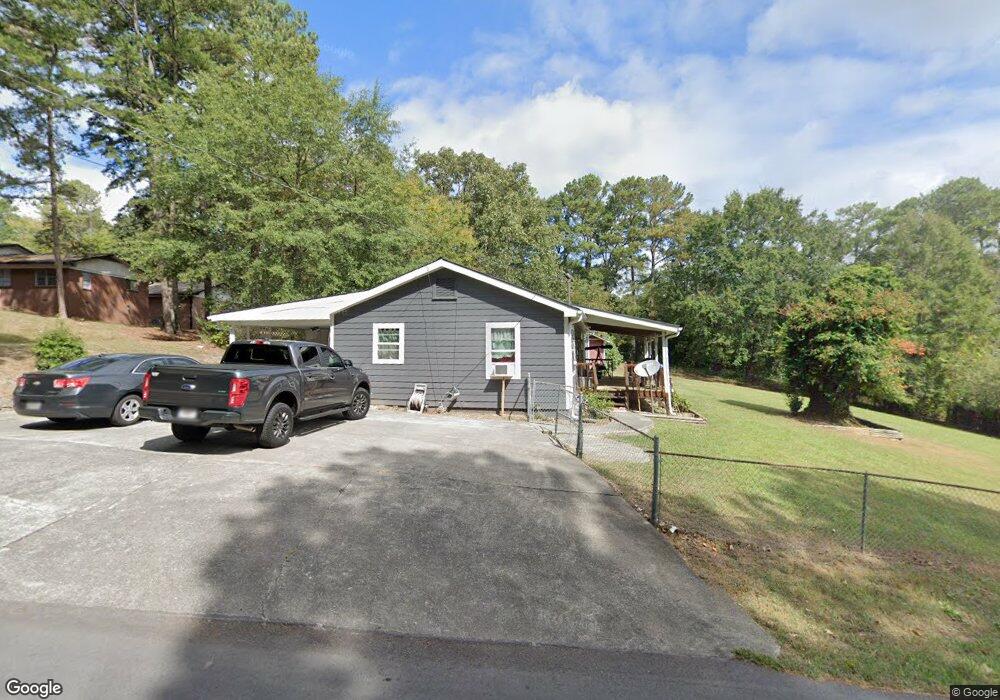
113 Hunt Dr Calhoun, GA 30701
Estimated Value: $206,495 - $262,000
3
Beds
1
Bath
1,380
Sq Ft
$165/Sq Ft
Est. Value
About This Home
This home is located at 113 Hunt Dr, Calhoun, GA 30701 and is currently estimated at $227,374, approximately $164 per square foot. 113 Hunt Dr is a home located in Gordon County with nearby schools including Calhoun Elementary School, Calhoun Middle School, and Calhoun High School.
Ownership History
Date
Name
Owned For
Owner Type
Purchase Details
Closed on
Mar 29, 2006
Sold by
Daniel Doris
Bought by
Curtis Crystal
Current Estimated Value
Home Financials for this Owner
Home Financials are based on the most recent Mortgage that was taken out on this home.
Original Mortgage
$97,850
Outstanding Balance
$54,137
Interest Rate
6.2%
Mortgage Type
New Conventional
Estimated Equity
$173,237
Purchase Details
Closed on
Feb 18, 2004
Sold by
Woodall Larry and Tammy Shea
Bought by
Daniel Doris
Purchase Details
Closed on
Mar 2, 1995
Bought by
Woodall Larry and Tammy Shea
Purchase Details
Closed on
Jun 1, 1984
Bought by
Morehead Ricky David
Create a Home Valuation Report for This Property
The Home Valuation Report is an in-depth analysis detailing your home's value as well as a comparison with similar homes in the area
Purchase History
We collect this data history from publicly available records. To have your information removed, we recommend requesting removal directly through your county’s website.
| Date | Buyer | Sale Price | Title Company |
|---|---|---|---|
| Curtis Crystal | $97,850 | -- | |
| Daniel Doris | $85,000 | -- | |
| Woodall Larry | $59,900 | -- | |
| Morehead Ricky David | $20,000 | -- |
Source: Public Records
Mortgage History
We collect this data history from publicly available records. To have your information removed, we recommend requesting removal directly through your county’s website.
| Date | Status | Borrower | Loan Amount |
|---|---|---|---|
| Open | Curtis Crystal | $97,850 |
Source: Public Records
Tax History
| Year | Tax Paid | Tax Assessment Tax Assessment Total Assessment is a certain percentage of the fair market value that is determined by local assessors to be the total taxable value of land and additions on the property. | Land | Improvement |
|---|---|---|---|---|
| 2025 | $1,328 | $53,572 | $13,960 | $39,612 |
| 2023 | $1,230 | $44,384 | $13,280 | $31,104 |
| 2022 | $382 | $42,192 | $12,880 | $29,312 |
| 2021 | $1,129 | $38,564 | $14,880 | $23,684 |
| 2020 | $1,135 | $38,456 | $14,880 | $23,576 |
| 2019 | $1,133 | $38,456 | $14,880 | $23,576 |
| 2018 | $309 | $34,116 | $14,120 | $19,996 |
| 2017 | $303 | $32,876 | $14,120 | $18,756 |
| 2016 | $304 | $32,876 | $14,120 | $18,756 |
| 2015 | $295 | $31,516 | $14,120 | $17,396 |
| 2014 | $249 | $27,285 | $12,656 | $14,629 |
Source: Public Records
Map
Nearby Homes
- 119 Hunt Dr
- 105 Garden Hill Dr
- 121 Stone Haven Dr
- 421 Boulevard Heights
- 606 Pisgah Way
- 121 Oakhurst Terrace NE
- 515 Woodlawn Ave
- 130 Oakhurst Terrace NE
- 315 E Line St
- 316 Waterford Dr
- 102 Lindsey Ct NE
- 709 College St
- 120 Waterford Dr
- 59 Old Water Works Rd
- 55 Old Water Works Rd
- 114 Lindsey Ct NE
- 224 Hillcrest Dr
- 120 Valley Cir
- 115 Devonwood Dr
- 78 Echota 2nd St
Your Personal Tour Guide
Ask me questions while you tour the home.