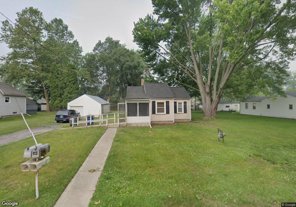
113 Leander Dr Toledo, OH 43615
Reynolds Corners NeighborhoodEstimated Value: $69,000 - $90,732
About This Home
This home is located at 113 Leander Dr, Toledo, OH 43615 and is currently estimated at $81,683, approximately $134 per square foot. 113 Leander Dr is a home located in Lucas County with nearby schools including McTigue Elementary School, Rogers High School, and Horizon Science Academy-Springfield.
Ownership History
We collect this data history from publicly available records. To have your information removed, we recommend requesting removal directly through your county’s website.
Purchase Details
Purchase Details
Purchase Details
Purchase Details
Purchase Details
Home Values in the Area
Average Home Value in this Area
Purchase History
We collect this data history from publicly available records. To have your information removed, we recommend requesting removal directly through your county’s website.
| Date | Buyer | Sale Price | Title Company |
|---|---|---|---|
| $62,000 | None Listed On Document | ||
| -- | None Available | ||
| -- | None Available | ||
| $6,250 | None Available | ||
| -- | None Available |
Mortgage History
We collect this data history from publicly available records. To have your information removed, we recommend requesting removal directly through your county’s website.
| Date | Status | Borrower | Loan Amount |
|---|---|---|---|
| Closed | $40,000 |
Tax History
We collect this data history from publicly available records. To have your information removed, we recommend requesting removal directly through your county’s website.
| Year | Tax Paid | Tax Assessment Tax Assessment Total Assessment is a certain percentage of the fair market value that is determined by local assessors to be the total taxable value of land and additions on the property. | Land | Improvement |
|---|---|---|---|---|
| 2025 | $1,857 | $23,555 | $4,830 | $18,725 |
| 2024 | $1,623 | $23,555 | $4,830 | $18,725 |
| 2023 | $1,417 | $21,420 | $5,740 | $15,680 |
| 2022 | $1,407 | $21,420 | $5,740 | $15,680 |
| 2021 | $1,455 | $21,420 | $5,740 | $15,680 |
| 2020 | $1,373 | $17,605 | $4,725 | $12,880 |
| 2019 | $1,357 | $17,605 | $4,725 | $12,880 |
| 2018 | $1,376 | $17,605 | $4,725 | $12,880 |
| 2017 | $3,593 | $17,220 | $4,620 | $12,600 |
| 2016 | $2,180 | $49,200 | $13,200 | $36,000 |
| 2015 | $1,391 | $49,200 | $13,200 | $36,000 |
| 2014 | $1,669 | $17,220 | $4,620 | $12,600 |
| 2013 | $1,113 | $17,220 | $4,620 | $12,600 |
Map
- 101 Abbotswood Dr
- 237 Shrewsbury St
- 6528 Lincoln Green Rd
- 102 Friars Ln
- 127 N Dorcas Rd
- 630 Saturn Dr
- 419 N Holland Sylvania Rd
- 6701 Burnham Green Rd
- 335 S Harefoote St
- 333 Danesmoor Rd
- 6154 Judge Dr
- 410 Danesmoor Rd
- 6032 Willowvale Dr
- 544 Clarion Ave
- 527 Favony Ave
- 6956 Wharton Rd
- 608 Diana Dr
- 5805 Fryer Ave
- 148 Curwood Rd
- 119 Sandbury Ct
Ask me questions while you tour the home.