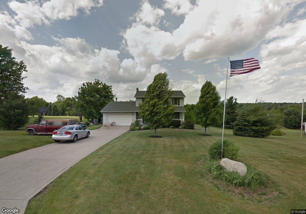
1133 Hoover Rd Mansfield, OH 44903
Estimated Value: $232,000 - $324,000
3
Beds
3
Baths
2,129
Sq Ft
$130/Sq Ft
Est. Value
About This Home
This home is located at 1133 Hoover Rd, Mansfield, OH 44903 and is currently estimated at $277,008, approximately $130 per square foot. 1133 Hoover Rd is a home located in Richland County with nearby schools including Madison High School, Temple-Christian School, and St. Mary Catholic School.
Ownership History
Date
Name
Owned For
Owner Type
Purchase Details
Closed on
Oct 28, 2022
Sold by
Alexander Kathy L
Bought by
Costello John D and Hipp Kandy L
Current Estimated Value
Home Financials for this Owner
Home Financials are based on the most recent Mortgage that was taken out on this home.
Original Mortgage
$166,250
Outstanding Balance
$158,766
Interest Rate
6.02%
Mortgage Type
New Conventional
Estimated Equity
$118,242
Purchase Details
Closed on
Dec 20, 2016
Sold by
Hassmann Joni
Bought by
Alexander Jeffrey S
Purchase Details
Closed on
Aug 16, 1996
Sold by
Seaton David J
Bought by
Alexander Jeffrey S and Alexander Kathy L
Home Financials for this Owner
Home Financials are based on the most recent Mortgage that was taken out on this home.
Original Mortgage
$93,450
Interest Rate
7.38%
Mortgage Type
New Conventional
Purchase Details
Closed on
Oct 1, 1993
Sold by
Sandor Albert
Bought by
Seaton David J
Create a Home Valuation Report for This Property
The Home Valuation Report is an in-depth analysis detailing your home's value as well as a comparison with similar homes in the area
Home Values in the Area
Average Home Value in this Area
Purchase History
We collect this data history from publicly available records. To have your information removed, we recommend requesting removal directly through your county’s website.
| Date | Buyer | Sale Price | Title Company |
|---|---|---|---|
| Costello John D | $175,000 | Southern Title | |
| Alexander Jeffrey S | -- | Attorney | |
| Alexander Jeffrey S | $128,450 | -- | |
| Seaton David J | $114,100 | -- |
Source: Public Records
Mortgage History
We collect this data history from publicly available records. To have your information removed, we recommend requesting removal directly through your county’s website.
| Date | Status | Borrower | Loan Amount |
|---|---|---|---|
| Open | Costello John D | $166,250 | |
| Previous Owner | Alexander Jeffrey S | $93,450 |
Source: Public Records
Tax History
| Year | Tax Paid | Tax Assessment Tax Assessment Total Assessment is a certain percentage of the fair market value that is determined by local assessors to be the total taxable value of land and additions on the property. | Land | Improvement |
|---|---|---|---|---|
| 2025 | $2,719 | $57,270 | $12,750 | $44,520 |
| 2024 | $2,719 | $57,270 | $12,750 | $44,520 |
| 2023 | $2,779 | $57,270 | $12,750 | $44,520 |
| 2022 | $3,065 | $56,110 | $11,390 | $44,720 |
| 2021 | $3,064 | $56,110 | $11,390 | $44,720 |
| 2020 | $3,088 | $56,110 | $11,390 | $44,720 |
| 2019 | $2,946 | $47,590 | $9,660 | $37,930 |
| 2018 | $2,754 | $47,590 | $9,660 | $37,930 |
| 2017 | $2,829 | $47,590 | $9,660 | $37,930 |
| 2016 | $2,961 | $50,510 | $9,170 | $41,340 |
| 2015 | $2,825 | $50,510 | $9,170 | $41,340 |
| 2014 | $2,814 | $50,510 | $9,170 | $41,340 |
| 2012 | $2,797 | $53,170 | $9,660 | $43,510 |
Source: Public Records
Map
Nearby Homes
- 1636 N Stewart Rd
- 1886 Beal Rd
- 1508 Beal Rd
- 725 Hoover Rd
- 961 Neil Cir N
- 1245 N Stewart Rd
- 1123 Fleming Falls Rd
- 1860 Hulit Rd
- 1106 Oakdale Dr
- 951 Dresden Dr
- 690 Ashland Rd
- 1779 Ashland Rd
- 888 Beal Rd
- 0 Wesley
- 1978 Outer Dr
- 2037 Windsor Rd
- 1168 ConcheMcO St
- 906 Duke Ave
- 0 Willow Dr
- 1217 Evergreen Ave W
- 1145 Hoover Rd
- 1121 Hoover Rd
- 1126 Hoover Rd
- 1105 Hoover Rd
- 1144 Hoover Rd
- 1087 Hoover Rd
- 1858 N Stewart Rd
- 1804 N Stewart Rd
- 1844 N Stewart Rd
- 1192 Hoover Rd
- 1227 Hoover Rd
- 1761 Beal Rd
- 1692 N Stewart Rd
- 1745 Beal Rd
- 1735 Beal Rd
- 1725 Beal Rd
- 1703 Beal Rd Unit 1705
- 1703 1705 Beal Rd
- 1885 N Stewart Rd
- 0 Hoover Rd
Your Personal Tour Guide
Ask me questions while you tour the home.