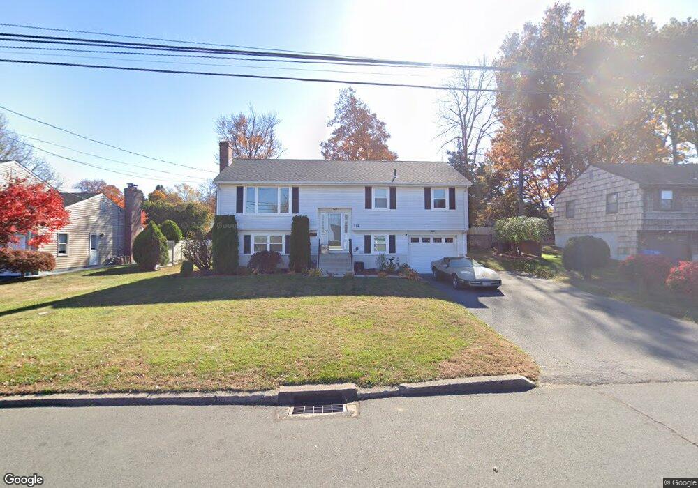
114 Batterson Dr New Britain, CT 06053
Estimated Value: $267,000 - $335,000
2
Beds
1
Bath
1,094
Sq Ft
$283/Sq Ft
Est. Value
About This Home
This home is located at 114 Batterson Dr, New Britain, CT 06053 and is currently estimated at $309,463, approximately $282 per square foot. 114 Batterson Dr is a home located in Hartford County with nearby schools including Holmes School, Pulaski Middle School, and St. Francis of Assisi Middle School.
Ownership History
Date
Name
Owned For
Owner Type
Purchase Details
Closed on
Sep 17, 2021
Sold by
Mele Paula B
Bought by
Mele Anthony R
Current Estimated Value
Home Financials for this Owner
Home Financials are based on the most recent Mortgage that was taken out on this home.
Original Mortgage
$107,000
Outstanding Balance
$78,911
Interest Rate
2.1%
Mortgage Type
New Conventional
Estimated Equity
$230,552
Purchase Details
Closed on
Sep 19, 2014
Sold by
Mele Anthony R and Koser Donna L
Bought by
Mele Patricia C
Purchase Details
Closed on
Sep 27, 2005
Sold by
Havel Mark J and Havel Gerald J
Bought by
Mele Anthony R and Mele Paula B
Home Financials for this Owner
Home Financials are based on the most recent Mortgage that was taken out on this home.
Original Mortgage
$149,520
Interest Rate
5.92%
Mortgage Type
Purchase Money Mortgage
Create a Home Valuation Report for This Property
The Home Valuation Report is an in-depth analysis detailing your home's value as well as a comparison with similar homes in the area
Home Values in the Area
Average Home Value in this Area
Purchase History
We collect this data history from publicly available records. To have your information removed, we recommend requesting removal directly through your county’s website.
| Date | Buyer | Sale Price | Title Company |
|---|---|---|---|
| Mele Anthony R | -- | None Available | |
| Mele Patricia C | -- | -- | |
| Mele Anthony R | $186,900 | -- |
Source: Public Records
Mortgage History
We collect this data history from publicly available records. To have your information removed, we recommend requesting removal directly through your county’s website.
| Date | Status | Borrower | Loan Amount |
|---|---|---|---|
| Open | Mele Anthony R | $107,000 | |
| Previous Owner | Mele Anthony R | $149,520 | |
| Previous Owner | Mele Anthony R | $37,380 | |
| Previous Owner | Mele Anthony R | $6,000 |
Source: Public Records
Tax History
| Year | Tax Paid | Tax Assessment Tax Assessment Total Assessment is a certain percentage of the fair market value that is determined by local assessors to be the total taxable value of land and additions on the property. | Land | Improvement |
|---|---|---|---|---|
| 2025 | $6,212 | $158,550 | $61,950 | $96,600 |
| 2024 | $6,277 | $158,550 | $61,950 | $96,600 |
| 2023 | $6,069 | $158,550 | $61,950 | $96,600 |
| 2022 | $5,821 | $117,600 | $43,330 | $74,270 |
| 2021 | $5,821 | $117,600 | $43,330 | $74,270 |
| 2020 | $5,939 | $117,600 | $43,330 | $74,270 |
| 2019 | $5,939 | $117,600 | $43,330 | $74,270 |
| 2018 | $5,939 | $117,600 | $43,330 | $74,270 |
| 2017 | $5,002 | $99,050 | $28,840 | $70,210 |
| 2016 | $5,002 | $99,050 | $28,840 | $70,210 |
| 2015 | $4,853 | $99,050 | $28,840 | $70,210 |
| 2014 | $4,377 | $89,320 | $28,840 | $60,480 |
Source: Public Records
Map
Nearby Homes
- 169 Country Club Rd
- 244 Alexander Rd
- 178 Alexander Rd
- 146 Alexander Rd
- 55 Blodgett Roy Dr
- 346 Lewis Rd
- 190 Brittany Farms Rd Unit F
- 160 Brittany Farms Rd Unit F
- 211 Brittany Farms Rd Unit C
- 200 Brittany Farms Rd Unit D
- 2180 Stanley St
- 260 Brittany Farms Rd Unit C
- 280 Brittany Farms Rd Unit A
- 117 Lewis Rd
- 24 Berkshire Dr
- 466 Blake Rd
- 678 Farmington Ave
- 131 Pendleton Rd
- 42 Helen Dr
- 14 Yorkshire Ct Unit 14
- 106 Batterson Dr
- 199 Belridge Rd
- 205 Belridge Rd
- 191 Belridge Rd
- 130 Batterson Dr
- 98 Batterson Dr
- 211 Belridge Rd
- 185 Belridge Rd
- 115 Batterson Dr
- 105 Batterson Dr
- 138 Batterson Dr
- 90 Batterson Dr
- 125 Batterson Dr
- 219 Belridge Rd
- 135 Batterson Dr
- 179 Belridge Rd
- 95 Batterson Dr
- 192 Belridge Rd
- 208 Belridge Rd
- 146 Batterson Dr
Your Personal Tour Guide
Ask me questions while you tour the home.