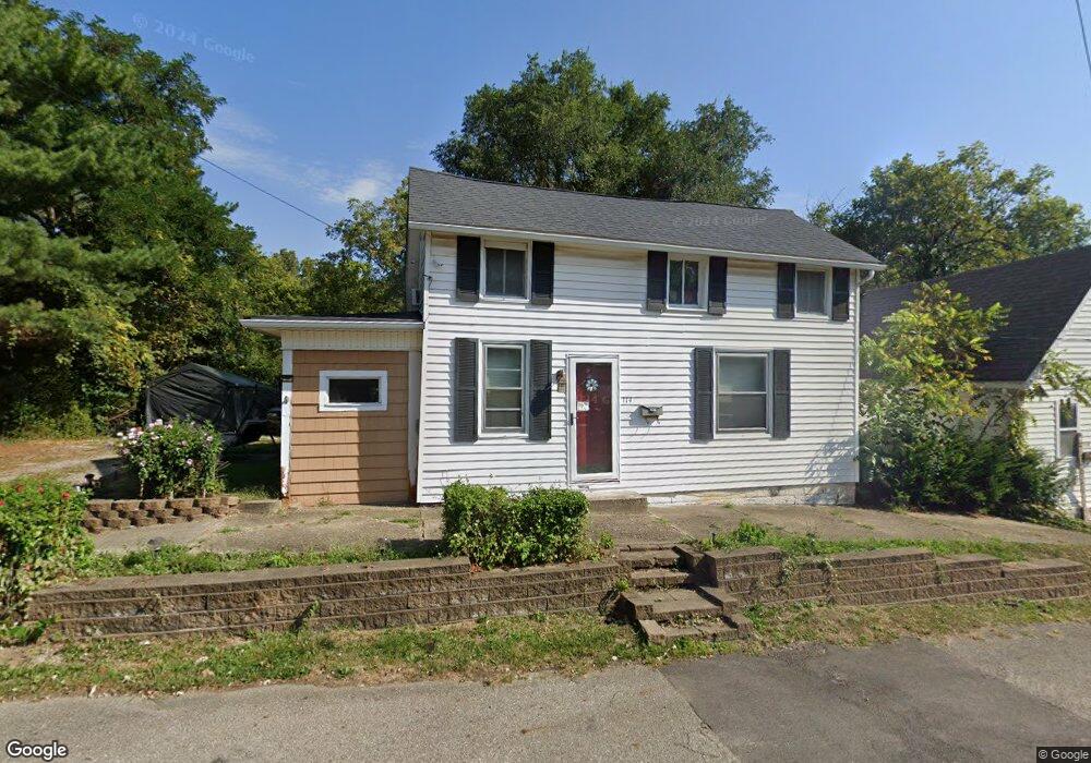
114 E Cliff St Baltimore, OH 43105
Estimated Value: $203,219 - $224,000
About This Home
This home is located at 114 E Cliff St, Baltimore, OH 43105 and is currently estimated at $214,305, approximately $163 per square foot. 114 E Cliff St is a home located in Fairfield County with nearby schools including Liberty Union Elementary School, Liberty Union Middle School, and Liberty Union High School.
Ownership History
We collect this data history from publicly available records. To have your information removed, we recommend requesting removal directly through your county’s website.
Purchase Details
Home Financials for this Owner
Home Financials are based on the most recent Mortgage that was taken out on this home.Purchase Details
Home Financials for this Owner
Home Financials are based on the most recent Mortgage that was taken out on this home.Purchase Details
Home Financials for this Owner
Home Financials are based on the most recent Mortgage that was taken out on this home.Home Values in the Area
Average Home Value in this Area
Purchase History
We collect this data history from publicly available records. To have your information removed, we recommend requesting removal directly through your county’s website.
| Date | Buyer | Sale Price | Title Company |
|---|---|---|---|
| $98,500 | -- | ||
| $985,000 | First Ohio Title Insurance B | ||
| $64,500 | -- |
Mortgage History
We collect this data history from publicly available records. To have your information removed, we recommend requesting removal directly through your county’s website.
| Date | Status | Borrower | Loan Amount |
|---|---|---|---|
| Closed | -- | ||
| Open | $99,494 | ||
| Previous Owner | $65,790 |
Tax History
We collect this data history from publicly available records. To have your information removed, we recommend requesting removal directly through your county’s website.
| Year | Tax Paid | Tax Assessment Tax Assessment Total Assessment is a certain percentage of the fair market value that is determined by local assessors to be the total taxable value of land and additions on the property. | Land | Improvement |
|---|---|---|---|---|
| 2025 | $3,377 | $55,910 | $8,850 | $47,060 |
| 2024 | $3,377 | $44,980 | $6,430 | $38,550 |
| 2023 | $1,726 | $44,980 | $6,430 | $38,550 |
| 2022 | $1,711 | $44,980 | $6,430 | $38,550 |
| 2021 | $1,384 | $32,980 | $5,820 | $27,160 |
| 2020 | $1,416 | $32,980 | $5,820 | $27,160 |
| 2019 | $1,439 | $32,980 | $5,820 | $27,160 |
| 2018 | $1,159 | $24,560 | $5,820 | $18,740 |
| 2017 | $1,155 | $24,150 | $5,820 | $18,330 |
| 2016 | $1,139 | $24,150 | $5,820 | $18,330 |
| 2015 | $1,048 | $23,280 | $5,820 | $17,460 |
| 2014 | $1,005 | $23,280 | $5,820 | $17,460 |
| 2013 | $1,005 | $23,280 | $5,820 | $17,460 |
Map
- 311 N Park Dr
- 313 W Market St
- 201 E Dorchester Dr
- 601 S Main St
- 208 N Fremont St
- 0 Basil Rd NW Unit 226003110
- Lot 18A S Creekview Ct
- 141 N Creekview Ct
- 7836 Basil Rd NW
- 0 Cherry Ln Unit 226008720
- 445 Baltimore Somerset Rd NE
- 570 Baltimore Somerset Rd NE Unit Lot 1
- 1333 Leonard Rd NW
- 2200 Leonard Rd NW
- 9915 Lancaster-Newark Rd NE
- 1575 Pleasantville Rd NW
- 5565 Stringtown Rd NW
- 8078 High St
- 8280 Bader Rd NW
- 5870 Brook Rd NW
- 200 E Cliff St
- 220 E Cliff St
- 221 E Cliff St
- 118 E Cliff St
- 214 N Park Dr
- 317 N Granville St
- 121 E Cliff St
- 300 N Granville St
- 304 N Granville St
- 206 N Park Dr
- 318 N Granville St
- 318 N Granville St
- 115 E Cliff St
- 214 E Mulberry St
- 106 E Cliff St
- 220 N Granville St
- 200 N Park Dr
- 209 N Park Dr
- 300 Short St
- 120 E Mulberry St
Ask me questions while you tour the home.