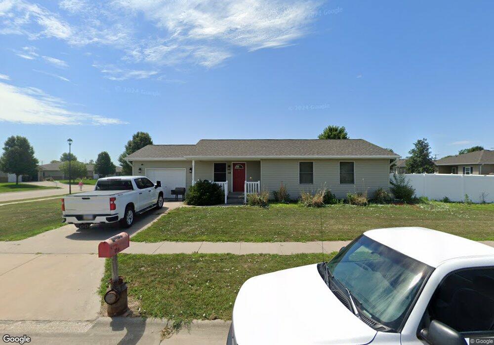
114 E Kent St Hastings, NE 68901
Estimated Value: $204,248 - $227,000
3
Beds
3
Baths
1,036
Sq Ft
$210/Sq Ft
Est. Value
About This Home
This home is located at 114 E Kent St, Hastings, NE 68901 and is currently estimated at $217,062, approximately $209 per square foot. 114 E Kent St is a home located in Adams County with nearby schools including Hastings Senior High School, Zion Lutheran School, and St. Cecilia High School.
Ownership History
Date
Name
Owned For
Owner Type
Purchase Details
Closed on
Sep 14, 2018
Sold by
Tonya L Tibke
Bought by
Timmerman Randy
Current Estimated Value
Home Financials for this Owner
Home Financials are based on the most recent Mortgage that was taken out on this home.
Original Mortgage
$119,790
Outstanding Balance
$104,045
Interest Rate
4.6%
Estimated Equity
$113,017
Purchase Details
Closed on
Dec 28, 2007
Sold by
Hastings Area Habitat For Humanity Inc
Bought by
Tibke Tonya L
Home Financials for this Owner
Home Financials are based on the most recent Mortgage that was taken out on this home.
Original Mortgage
$75,743
Interest Rate
6.23%
Mortgage Type
Purchase Money Mortgage
Create a Home Valuation Report for This Property
The Home Valuation Report is an in-depth analysis detailing your home's value as well as a comparison with similar homes in the area
Home Values in the Area
Average Home Value in this Area
Purchase History
| Date | Buyer | Sale Price | Title Company |
|---|---|---|---|
| Timmerman Randy | -- | -- | |
| Tibke Tonya L | $106,000 | None Available |
Source: Public Records
Mortgage History
| Date | Status | Borrower | Loan Amount |
|---|---|---|---|
| Open | Timmerman Randy | $119,790 | |
| Closed | Timmerman Randy | -- | |
| Previous Owner | Tibke Tonya L | $75,743 |
Source: Public Records
Tax History
| Year | Tax Paid | Tax Assessment Tax Assessment Total Assessment is a certain percentage of the fair market value that is determined by local assessors to be the total taxable value of land and additions on the property. | Land | Improvement |
|---|---|---|---|---|
| 2025 | $2,815 | $180,045 | $18,265 | $161,780 |
| 2024 | $2,884 | $176,964 | $18,265 | $158,699 |
| 2023 | $3,057 | $148,134 | $18,265 | $129,869 |
| 2022 | $3,337 | $148,134 | $18,265 | $129,869 |
| 2021 | $2,952 | $134,625 | $13,916 | $120,709 |
| 2020 | $2,779 | $128,877 | $13,916 | $114,961 |
| 2019 | $2,589 | $121,356 | $13,916 | $107,440 |
| 2018 | $2,478 | $115,565 | $8,125 | $107,440 |
| 2017 | $2,476 | $115,565 | $0 | $0 |
| 2016 | $2,288 | $106,695 | $8,125 | $98,570 |
| 2011 | -- | $0 | $0 | $0 |
Source: Public Records
Map
Nearby Homes
- 820 S Pine Ave
- Lot S California
- 823 S Colorado Ave
- 734 S Saint Joseph Ave
- 927 S Lincoln Ave
- 1612 S Wabash Ave
- 901 S Lincoln Ave
- 913 W J St
- 720 W D St
- 611 S Burlington Ave
- 211 S California Ave
- 1142 W H St
- 414 S Bellevue Ave
- 410 S Chicago Ave
- 620 W 2nd St
- 312 N Colorado Ave
- 747 E 2nd St
- 527 S Boston Ave
- 724 E 5th St
- 117 E 6th St
- 111 E Kent St
- 110 E Kent St
- 107 E Kent St
- 1025 Ross Ave
- 1016 S Pine Ave
- 1035 S Pine Ave
- 1017 Ross Ave
- 1017 Ross Ave
- 1012 S Pine Ave
- 1019 S Pine Ave Unit 1023
- 1013 Ross Ave
- 1013 Ross Ave
- 1015 S Pine Ave
- 1008 S Pine Ave
- 1020 Ross Ave
- 1009 Ross Ave
- 1009 Ross Ave
- 1009 S Pine Ave
- 1016 Ross Ave
- 1004 S Pine Ave
Your Personal Tour Guide
Ask me questions while you tour the home.