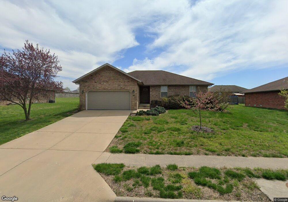
1140 W Broad St Republic, MO 65738
Estimated Value: $240,780 - $247,000
3
Beds
2
Baths
1,350
Sq Ft
$181/Sq Ft
Est. Value
About This Home
This home is located at 1140 W Broad St, Republic, MO 65738 and is currently estimated at $244,195, approximately $180 per square foot. 1140 W Broad St is a home located in Greene County with nearby schools including Lyon Elementary School, Republic Middle School, and Republic High School.
Ownership History
Date
Name
Owned For
Owner Type
Purchase Details
Closed on
Nov 26, 2019
Sold by
Bad Bob Investments Llc
Bought by
R Carlson Properties Llc
Current Estimated Value
Purchase Details
Closed on
Aug 17, 2007
Sold by
Urquilla Mario A and Urquilla Angela L
Bought by
Morelock Ross Properties Inc
Home Financials for this Owner
Home Financials are based on the most recent Mortgage that was taken out on this home.
Original Mortgage
$128,900
Interest Rate
6.69%
Mortgage Type
Purchase Money Mortgage
Create a Home Valuation Report for This Property
The Home Valuation Report is an in-depth analysis detailing your home's value as well as a comparison with similar homes in the area
Home Values in the Area
Average Home Value in this Area
Purchase History
We collect this data history from publicly available records. To have your information removed, we recommend requesting removal directly through your county’s website.
| Date | Buyer | Sale Price | Title Company |
|---|---|---|---|
| R Carlson Properties Llc | -- | None Available | |
| Morelock Ross Properties Inc | -- | None Available | |
| Urquilla Mario A | -- | None Available |
Source: Public Records
Mortgage History
We collect this data history from publicly available records. To have your information removed, we recommend requesting removal directly through your county’s website.
| Date | Status | Borrower | Loan Amount |
|---|---|---|---|
| Previous Owner | Urquilla Mario A | $128,900 |
Source: Public Records
Tax History
| Year | Tax Paid | Tax Assessment Tax Assessment Total Assessment is a certain percentage of the fair market value that is determined by local assessors to be the total taxable value of land and additions on the property. | Land | Improvement |
|---|---|---|---|---|
| 2025 | $1,884 | $35,470 | $5,700 | $29,770 |
| 2024 | $1,814 | $32,470 | $5,700 | $26,770 |
| 2023 | $1,779 | $32,470 | $5,700 | $26,770 |
| 2022 | $1,283 | $23,310 | $3,800 | $19,510 |
| 2021 | $1,276 | $23,310 | $3,800 | $19,510 |
| 2020 | $1,296 | $23,310 | $3,800 | $19,510 |
| 2019 | $1,291 | $23,310 | $3,800 | $19,510 |
| 2018 | $1,295 | $22,590 | $3,800 | $18,790 |
| 2017 | $1,284 | $22,590 | $3,800 | $18,790 |
| 2016 | $1,299 | $22,590 | $3,800 | $18,790 |
| 2015 | $1,294 | $22,590 | $3,800 | $18,790 |
| 2014 | $1,305 | $22,590 | $3,800 | $18,790 |
Source: Public Records
Map
Nearby Homes
- 1135 W Broad St
- 1001 W Broad St
- 000 W Crestview Ln
- 1255 W Penny Ln
- 1011 W Crestview Ln
- 571 S Caroline Ave
- 569 S Abigail Ave
- 586 S Caroline
- 916 W Charlotte Ct
- 874 W Charlotte Ct
- 833 W Charlotte St
- 500 Ethan Ave
- 202 S Jackson St
- 0 Highway 60 Unit 60319554
- 0 Highway 60 Unit 60319555
- 549 W Melody Ln
- 525 W Melody Ln
- 435 W Logan St
- 521 N Forest Ln
- 130 S Walnut Ave
- 1117 W Broad St
- 1159 W Broad St
- 1101 W Broad St
- 1118 W Broad St
- 1183 W Broad St
- 1162 W Broad St
- 1048 W Ridgecrest Ave
- 405 S Sarah Ave
- 1184 W Broad St
- 1009 W Broad St
- ? W Ridgecrest
- 1157 W Lois Ln
- 407 S Sarah Ave
- 1151 W Lois Ln
- 1169 W Lois Ln
- 1007 W Broad St
- 1187 W Lois Ln
- 409 S Sarah Ave
- 1032 W Ridgecrest Ave
- 406 S Sarah Ave
Your Personal Tour Guide
Ask me questions while you tour the home.