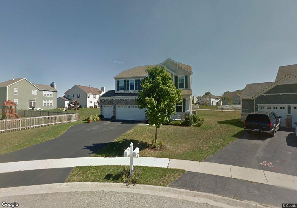
1141 Moore Ct Antioch, IL 60002
Estimated Value: $404,000 - $435,000
4
Beds
3
Baths
2,510
Sq Ft
$169/Sq Ft
Est. Value
About This Home
This home is located at 1141 Moore Ct, Antioch, IL 60002 and is currently estimated at $423,002, approximately $168 per square foot. 1141 Moore Ct is a home located in Lake County with nearby schools including Antioch Community High School.
Ownership History
Date
Name
Owned For
Owner Type
Purchase Details
Closed on
Sep 10, 2009
Sold by
Gale Roger F and Gale Heidi L
Bought by
Gale Roger F and Gale Heidi L
Current Estimated Value
Home Financials for this Owner
Home Financials are based on the most recent Mortgage that was taken out on this home.
Original Mortgage
$279,500
Outstanding Balance
$182,792
Interest Rate
5.19%
Mortgage Type
New Conventional
Estimated Equity
$240,210
Purchase Details
Closed on
Jun 29, 2007
Sold by
Neumann Homes Inc
Bought by
Gale Roger F and Ferris Heidi L
Home Financials for this Owner
Home Financials are based on the most recent Mortgage that was taken out on this home.
Original Mortgage
$272,510
Interest Rate
6.54%
Mortgage Type
Purchase Money Mortgage
Create a Home Valuation Report for This Property
The Home Valuation Report is an in-depth analysis detailing your home's value as well as a comparison with similar homes in the area
Home Values in the Area
Average Home Value in this Area
Purchase History
| Date | Buyer | Sale Price | Title Company |
|---|---|---|---|
| Gale Roger F | -- | None Available | |
| Gale Roger F | $341,000 | Chicago Title Insurance Co |
Source: Public Records
Mortgage History
| Date | Status | Borrower | Loan Amount |
|---|---|---|---|
| Open | Gale Roger F | $279,500 | |
| Closed | Gale Roger F | $272,510 |
Source: Public Records
Tax History
| Year | Tax Paid | Tax Assessment Tax Assessment Total Assessment is a certain percentage of the fair market value that is determined by local assessors to be the total taxable value of land and additions on the property. | Land | Improvement |
|---|---|---|---|---|
| 2024 | $12,138 | $120,612 | $12,340 | $108,272 |
| 2023 | $11,591 | $107,997 | $11,049 | $96,948 |
| 2022 | $11,591 | $96,416 | $12,629 | $83,787 |
| 2021 | $10,908 | $89,965 | $11,784 | $78,181 |
| 2020 | $10,711 | $87,481 | $11,459 | $76,022 |
| 2019 | $10,814 | $83,658 | $10,958 | $72,700 |
| 2018 | $10,123 | $74,429 | $12,078 | $62,351 |
| 2017 | $10,031 | $70,844 | $11,496 | $59,348 |
| 2016 | $9,799 | $68,369 | $11,094 | $57,275 |
| 2015 | $7,625 | $66,630 | $10,812 | $55,818 |
| 2014 | $6,877 | $65,826 | $13,128 | $52,698 |
| 2012 | $6,363 | $65,826 | $13,128 | $52,698 |
Source: Public Records
Map
Nearby Homes
- 1226 Bradford Ln
- 1195 Mark Ct
- 1214 Jerome Ct
- 1210 Parkview Dr
- 1055 Christine Ln
- 1013 Kimberly Ln
- 1056 Deertrail Ct
- 1110 Walker Ct
- 1297 Holly Ct
- 1053 Walker Ct
- 966 Forest View Way
- 614 Birch Hollow Dr
- 1692 Serenity Dr
- 1873 White Lake Dr
- 1749 Serenity Ct
- 1261 Prairie Ridge Trail
- 1253 Prairie Ridge Trail
- 1288 Prairie Ridge Trail
- 1249 Prairie Ridge Trail
- 1245 Prairie Ridge Trail
- 1153 Moore Ct
- 1252 Bradford Ln
- 1246 Bradford Ln
- 1157 Moore Ct
- 1158 Moore Ct
- 1144 Mackenzie Dr
- 1138 Mackenzie Dr
- 1150 Mackenzie Dr
- 1288 Sandy Dr
- 1236 Bradford Ln
- 1130 Mackenzie Dr
- 1154 Moore Ct
- 1142 Moore Ct
- 1122 Mackenzie Dr
- 1284 Sandy Dr
- 1253 Bradford Ln
- 1230 Bradford Ln
- 1247 Bradford Ln
- 1163 Mackenzie Dr
- 1259 Bradford Ln
Your Personal Tour Guide
Ask me questions while you tour the home.