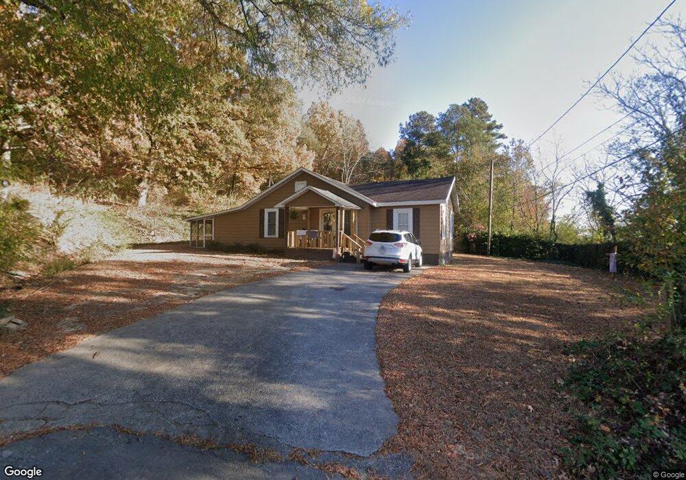
115 Mac Ave Calhoun, GA 30701
Estimated Value: $146,000 - $205,000
2
Beds
1
Bath
1,080
Sq Ft
$171/Sq Ft
Est. Value
About This Home
This home is located at 115 Mac Ave, Calhoun, GA 30701 and is currently estimated at $184,591, approximately $170 per square foot. 115 Mac Ave is a home located in Gordon County with nearby schools including Calhoun Elementary School, Calhoun Middle School, and Calhoun High School.
Ownership History
Date
Name
Owned For
Owner Type
Purchase Details
Closed on
Nov 3, 2023
Sold by
Hollingsworth Susie B
Bought by
Hollingsworth Jerry E and Hollingsworth Susie B
Current Estimated Value
Purchase Details
Closed on
Nov 3, 2014
Sold by
Bartenfield Linda Y
Bought by
Hollingsworth Susie B
Home Financials for this Owner
Home Financials are based on the most recent Mortgage that was taken out on this home.
Original Mortgage
$56,122
Interest Rate
4.26%
Mortgage Type
FHA
Purchase Details
Closed on
Aug 19, 1994
Bought by
Bartenfield Linda Y
Create a Home Valuation Report for This Property
The Home Valuation Report is an in-depth analysis detailing your home's value as well as a comparison with similar homes in the area
Purchase History
| Date | Buyer | Sale Price | Title Company |
|---|---|---|---|
| Hollingsworth Jerry E | -- | -- | |
| Hollingsworth Susie B | $55,000 | -- | |
| Bartenfield Linda Y | -- | -- |
Source: Public Records
Mortgage History
| Date | Status | Borrower | Loan Amount |
|---|---|---|---|
| Previous Owner | Hollingsworth Susie B | $56,122 |
Source: Public Records
Tax History
| Year | Tax Paid | Tax Assessment Tax Assessment Total Assessment is a certain percentage of the fair market value that is determined by local assessors to be the total taxable value of land and additions on the property. | Land | Improvement |
|---|---|---|---|---|
| 2025 | $725 | $66,136 | $13,440 | $52,696 |
| 2023 | $444 | $37,736 | $13,440 | $24,296 |
| 2022 | $327 | $36,336 | $13,440 | $22,896 |
| 2021 | $361 | $31,136 | $13,440 | $17,696 |
| 2020 | $368 | $31,456 | $13,440 | $18,016 |
| 2019 | $365 | $31,456 | $13,440 | $18,016 |
| 2018 | $272 | $30,216 | $13,440 | $16,776 |
| 2017 | $267 | $29,176 | $13,440 | $15,736 |
| 2016 | $268 | $29,176 | $13,440 | $15,736 |
| 2015 | $220 | $28,816 | $13,440 | $15,376 |
| 2014 | $276 | $27,990 | $13,440 | $14,550 |
Source: Public Records
Map
Nearby Homes
- 106 Mac Ave
- 0 Resaca Lafayette Rd Unit 10706558
- 0 Resaca Lafayette Rd Unit 10706565
- 156 Saddle Ridge Trail
- 138 Saddle Ridge Trail
- 00 Resaca Lafayette Rd
- 0 Resaca Lafayette Rd Unit 7731810
- 1401 Ga-53
- 200 Ridgeview Trail
- 101 Victory Ct
- 200 Cherry Hill Cir
- 198 Hillcrest Dr
- 300 Woodland Dr
- 202 Woodland Cir
- 119 Peters St
- 102 Rory Dr
- 111 Rory Dr
- 105 Rory Dr
- 107 Rory Dr
- 120 Dan Cheri Dr
- 113 Mac Ave
- 422 S Wall St
- 420 S Wall St
- 111 Mac Ave
- 112 Mac Ave
- 200 S Dale Ave
- 109 Mac Ave
- 110 Mac Ave
- S Wall Station Unit 414 & 418
- 107 Mac Ave
- 105 Mac Ave
- 518 (47) McGinnis Circles
- 00 Benstone Dr
- 125 Victory Dr
- 123 Victory Dr
- 102 S Dale Ave
- 102 S Dale Ave
- 121 Victory Dr
- 300 S Dale Ave
- 107 Hughey St
Your Personal Tour Guide
Ask me questions while you tour the home.