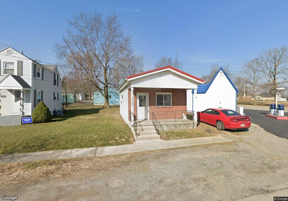
115 N High St Lafayette, OH 45854
Estimated Value: $47,297
About This Home
This home is located at 115 N High St, Lafayette, OH 45854 and is currently estimated at $47,297, approximately $105 per square foot. 115 N High St is a home located in Allen County with nearby schools including Allen East Elementary School, Allen East Middle School, and Allen East High School.
Ownership History
We collect this data history from publicly available records. To have your information removed, we recommend requesting removal directly through your county’s website.
Purchase Details
Home Financials for this Owner
Home Financials are based on the most recent Mortgage that was taken out on this home.Purchase Details
Purchase Details
Home Financials for this Owner
Home Financials are based on the most recent Mortgage that was taken out on this home.Purchase History
We collect this data history from publicly available records. To have your information removed, we recommend requesting removal directly through your county’s website.
| Date | Buyer | Sale Price | Title Company |
|---|---|---|---|
| $25,000 | Attorney | ||
| -- | Attorney | ||
| $27,500 | None Available |
Mortgage History
We collect this data history from publicly available records. To have your information removed, we recommend requesting removal directly through your county’s website.
| Date | Status | Borrower | Loan Amount |
|---|---|---|---|
| Open | $17,500 | ||
| Previous Owner | $13,750 |
Tax History
We collect this data history from publicly available records. To have your information removed, we recommend requesting removal directly through your county’s website.
| Year | Tax Paid | Tax Assessment Tax Assessment Total Assessment is a certain percentage of the fair market value that is determined by local assessors to be the total taxable value of land and additions on the property. | Land | Improvement |
|---|---|---|---|---|
| 2025 | $511 | $9,980 | $420 | $9,560 |
| 2024 | $510 | $9,980 | $420 | $9,560 |
| 2023 | $510 | $9,070 | $390 | $8,680 |
| 2022 | $512 | $9,070 | $390 | $8,680 |
| 2021 | $511 | $9,070 | $390 | $8,680 |
| 2020 | $489 | $8,580 | $600 | $7,980 |
| 2019 | $489 | $8,580 | $600 | $7,980 |
| 2018 | $488 | $8,580 | $600 | $7,980 |
| 2017 | $494 | $8,580 | $600 | $7,980 |
| 2016 | $496 | $8,580 | $600 | $7,980 |
| 2015 | $367 | $8,580 | $600 | $7,980 |
| 2014 | $367 | $6,520 | $600 | $5,920 |
| 2013 | $359 | $6,520 | $600 | $5,920 |
Map
- 212 N Washington St
- 2327 N Phillips Rd
- 119 N Mcclure Rd
- 6170 Reservoir Rd
- 1701 Bentley Rd
- 1700 N Thayer Rd
- 0 Brentlinger Rd
- 2200 Johnston Rd
- 0 N Thayer Rd
- 4545 Ada Rd
- 4444 Sandusky Rd
- 109 S Main St
- 0000 S Hardin Rd
- 6476 Mickelson Ln
- 6349 Sorenstam Ln
- 4801 Township Road 25
- 0 Stewart Rd Unit 1044859
- 0 Stewart Rd Unit 309909
- 4786 Harding Hwy
- 6065 E State Rd
Ask me questions while you tour the home.