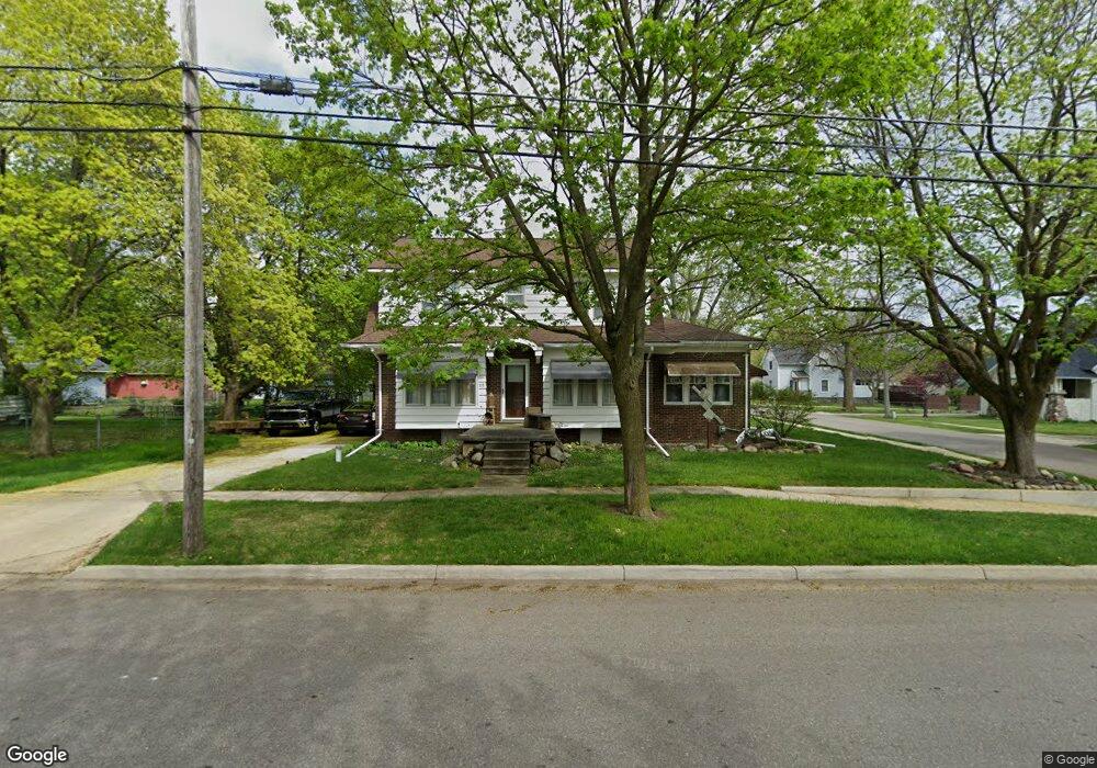
115 S Maple St Vernon, MI 48476
Estimated Value: $160,000 - $219,000
About This Home
This home is located at 115 S Maple St, Vernon, MI 48476 and is currently estimated at $183,750. 115 S Maple St is a home located in Shiawassee County with nearby schools including Corunna High School and Grace Lutheran School.
Ownership History
We collect this data history from publicly available records. To have your information removed, we recommend requesting removal directly through your county’s website.
Purchase Details
Home Financials for this Owner
Home Financials are based on the most recent Mortgage that was taken out on this home.Purchase Details
Home Financials for this Owner
Home Financials are based on the most recent Mortgage that was taken out on this home.Purchase History
We collect this data history from publicly available records. To have your information removed, we recommend requesting removal directly through your county’s website.
| Date | Buyer | Sale Price | Title Company |
|---|---|---|---|
| -- | Metropolitan Title Company | ||
| -- | Metropolitan Title Company |
Mortgage History
We collect this data history from publicly available records. To have your information removed, we recommend requesting removal directly through your county’s website.
| Date | Status | Borrower | Loan Amount |
|---|---|---|---|
| Open | $104,000 |
Tax History
We collect this data history from publicly available records. To have your information removed, we recommend requesting removal directly through your county’s website.
| Year | Tax Paid | Tax Assessment Tax Assessment Total Assessment is a certain percentage of the fair market value that is determined by local assessors to be the total taxable value of land and additions on the property. | Land | Improvement |
|---|---|---|---|---|
| 2025 | $1,822 | $88,100 | $0 | $0 |
| 2024 | $1,804 | $82,400 | $0 | $0 |
| 2023 | $705 | $75,600 | $0 | $0 |
| 2022 | $1,489 | $68,800 | $0 | $0 |
| 2021 | $2,376 | $64,700 | $0 | $0 |
| 2020 | $2,344 | $60,000 | $0 | $0 |
| 2019 | $2,292 | $55,700 | $0 | $0 |
| 2018 | $2,225 | $56,200 | $0 | $0 |
| 2017 | $2,121 | $53,600 | $0 | $0 |
| 2016 | -- | $53,600 | $0 | $0 |
| 2015 | -- | $52,800 | $0 | $0 |
| 2014 | $5 | $50,700 | $0 | $0 |
Map
- 310 E Main St
- 218 E Main St
- 160 Ash St
- VL Michigan 71
- 7690 Michigan 71
- 0 E Lansing Rd Unit 50159391
- 8612 Monroe Rd
- 1128 N Saginaw St
- 300 N Lenawee St
- 506 W Brand St
- 507 W Fitzgerald St
- 111 S Oak St
- 9252 E Brooks Rd
- 402 W Perry St
- 202 N Mackinaw St
- 103 N Mackinaw St
- 0 S New Lothrop Rd Unit 20251050266
- 8453 S Durand Rd
- 117 E Fauble St
- 10001 E Goodall Rd Unit 298
Ask me questions while you tour the home.