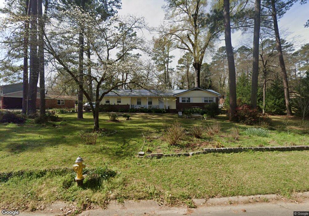
1152 Normandy Rd Macon, GA 31210
Estimated Value: $180,935 - $219,000
3
Beds
2
Baths
1,608
Sq Ft
$122/Sq Ft
Est. Value
About This Home
This home is located at 1152 Normandy Rd, Macon, GA 31210 and is currently estimated at $195,984, approximately $121 per square foot. 1152 Normandy Rd is a home located in Bibb County with nearby schools including Lane Elementary School, Howard Middle School, and Howard High School.
Ownership History
Date
Name
Owned For
Owner Type
Purchase Details
Closed on
May 30, 2006
Sold by
Crawford J Quincy
Bought by
Bettencourtt Janice M
Current Estimated Value
Home Financials for this Owner
Home Financials are based on the most recent Mortgage that was taken out on this home.
Original Mortgage
$118,500
Outstanding Balance
$68,686
Interest Rate
6.51%
Mortgage Type
New Conventional
Estimated Equity
$127,298
Purchase Details
Closed on
Feb 15, 2005
Create a Home Valuation Report for This Property
The Home Valuation Report is an in-depth analysis detailing your home's value as well as a comparison with similar homes in the area
Purchase History
| Date | Buyer | Sale Price | Title Company |
|---|---|---|---|
| Bettencourtt Janice M | $118,500 | None Available | |
| -- | -- | -- |
Source: Public Records
Mortgage History
| Date | Status | Borrower | Loan Amount |
|---|---|---|---|
| Open | Bettencourtt Janice M | $118,500 |
Source: Public Records
Tax History
| Year | Tax Paid | Tax Assessment Tax Assessment Total Assessment is a certain percentage of the fair market value that is determined by local assessors to be the total taxable value of land and additions on the property. | Land | Improvement |
|---|---|---|---|---|
| 2025 | $1,404 | $64,142 | $13,188 | $50,954 |
| 2024 | $1,451 | $64,142 | $13,188 | $50,954 |
| 2023 | $592 | $48,294 | $10,550 | $37,744 |
| 2022 | $1,651 | $54,693 | $9,087 | $45,606 |
| 2021 | $1,540 | $47,538 | $7,633 | $39,905 |
| 2020 | $1,527 | $46,338 | $7,633 | $38,705 |
| 2019 | $1,352 | $41,537 | $7,633 | $33,904 |
| 2018 | $2,027 | $37,810 | $6,906 | $30,904 |
| 2017 | $1,079 | $35,811 | $7,307 | $28,504 |
| 2016 | $945 | $34,310 | $7,307 | $27,003 |
| 2015 | $1,335 | $34,310 | $7,307 | $27,003 |
| 2014 | $1,700 | $36,622 | $8,119 | $28,504 |
Source: Public Records
Map
Nearby Homes
- 1161 Ousley Place
- 1209 Normandy Rd
- 1024 Normandy Rd
- 3678 Northside Dr
- 3640 Northside Dr
- 3622 Northside Dr
- 3602 Northside Dr
- 3500 Northside Dr
- 122 Lundy Ct
- 870 Glen Hill Ct
- 840 Balim Ct
- 843 Green Oak Terrace
- 4070 Carrie Ct
- 1422 Forest Hill Rd
- 835 Old Lundy Rd
- 636 Lokchapee Ridge
- 4015 Elnora Dr
- 166 Brookstone Way
- 177 Brookstone Way
- 681 Forest Lake Dr N
- 1168 Normandy Rd
- 1136 Normandy Rd
- 1176 Normandy Rd
- 1149 Normandy Rd
- 1124 Normandy Rd
- 1165 Normandy Rd
- 1141 Normandy Rd
- 1186 Normandy Rd
- 1133 Normandy Rd
- 1116 Normandy Rd
- 1125 Normandy Rd
- 1181 Normandy Rd
- 1219 Newport Place
- 1227 Newport Place
- 1052 Newport Rd
- 1117 Normandy Rd
- 1235 Newport Place
- 1211 Newport Place
- 1060 Newport Rd
- 1139 Ousley Place
Your Personal Tour Guide
Ask me questions while you tour the home.