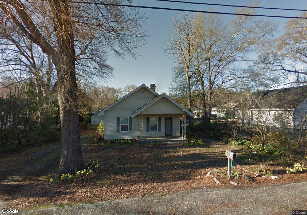
116 Beattie St Simpsonville, SC 29681
Estimated Value: $189,000 - $208,000
2
Beds
1
Bath
974
Sq Ft
$203/Sq Ft
Est. Value
About This Home
This home is located at 116 Beattie St, Simpsonville, SC 29681 and is currently estimated at $197,439, approximately $202 per square foot. 116 Beattie St is a home located in Greenville County with nearby schools including Simpsonville Elementary, Hillcrest Middle School, and Hillcrest High School.
Ownership History
Date
Name
Owned For
Owner Type
Purchase Details
Closed on
Jun 20, 2016
Sold by
Federal National Mortgage Association
Bought by
Hansson John
Current Estimated Value
Home Financials for this Owner
Home Financials are based on the most recent Mortgage that was taken out on this home.
Original Mortgage
$67,500
Outstanding Balance
$53,298
Interest Rate
3.66%
Mortgage Type
New Conventional
Estimated Equity
$144,141
Purchase Details
Closed on
Oct 7, 2015
Sold by
Murray Jerald and Murray James
Bought by
Federal National Mortgage Association
Create a Home Valuation Report for This Property
The Home Valuation Report is an in-depth analysis detailing your home's value as well as a comparison with similar homes in the area
Home Values in the Area
Average Home Value in this Area
Purchase History
| Date | Buyer | Sale Price | Title Company |
|---|---|---|---|
| Hansson John | $75,000 | None Available | |
| Federal National Mortgage Association | $60,000 | Masters Title |
Source: Public Records
Mortgage History
| Date | Status | Borrower | Loan Amount |
|---|---|---|---|
| Open | Hansson John | $67,500 |
Source: Public Records
Tax History
| Year | Tax Paid | Tax Assessment Tax Assessment Total Assessment is a certain percentage of the fair market value that is determined by local assessors to be the total taxable value of land and additions on the property. | Land | Improvement |
|---|---|---|---|---|
| 2025 | $477 | $3,750 | $1,120 | $2,630 |
| 2024 | $415 | $3,260 | $600 | $2,660 |
| 2023 | $415 | $3,260 | $600 | $2,660 |
| 2022 | $410 | $3,260 | $600 | $2,660 |
| 2021 | $410 | $3,260 | $600 | $2,660 |
| 2020 | $359 | $2,840 | $320 | $2,520 |
| 2019 | $359 | $2,840 | $320 | $2,520 |
| 2018 | $592 | $2,840 | $320 | $2,520 |
| 2017 | $592 | $2,840 | $320 | $2,520 |
| 2016 | $348 | $42,190 | $8,000 | $34,190 |
| 2015 | $47 | $42,190 | $8,000 | $34,190 |
| 2014 | $47 | $43,960 | $9,656 | $34,304 |
Source: Public Records
Map
Nearby Homes
- 55 Heritage Oak Way
- 300 South St Unit 119
- 300 South St Unit 122
- 300 South St
- 300 South St Unit 221
- 117 Sylvan Oak Way
- 115 Sylvan Oak Way
- 101 Iselin St
- 305 N Maple St
- 112 Edwards St
- 19 Sidney Wilson Ct
- 130 Market Bay Ct
- 113 Market Bay Ct
- 103 Perry Ave
- 303 Boyd Ave
- 106 Stonegate Ct
- 208 S Pliney Cir
- 209 Boyd Ave
- 3989 Grandview Dr
- 3990 Grandview Dr
- 114 Beattie St
- 118 Beattie St
- 317 W College St
- 315 W College St
- 319 W College St
- 120 Beattie St
- 112 Beattie St
- 313 W College St
- 310 W Curtis St
- 306 E Curtis St
- 202 Beattie St
- 311 W College St
- 316 W College St
- 320 W College St
- 108 Beattie St
- 201 Beattie St
- 318 W College St
- 309 W College St
- 314 W College St
- 322 W College St
Your Personal Tour Guide
Ask me questions while you tour the home.