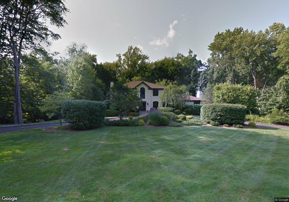
116 Lynam Rd Stamford, CT 06903
North Stamford NeighborhoodEstimated Value: $1,420,634 - $2,286,000
4
Beds
4
Baths
4,572
Sq Ft
$372/Sq Ft
Est. Value
About This Home
This home is located at 116 Lynam Rd, Stamford, CT 06903 and is currently estimated at $1,702,909, approximately $372 per square foot. 116 Lynam Rd is a home located in Fairfield County with nearby schools including Roxbury School, Cloonan School, and Westhill High School.
Ownership History
Date
Name
Owned For
Owner Type
Purchase Details
Closed on
Jul 14, 1999
Sold by
Wald Adrienne
Bought by
Sverchek Joseph P and Schaefer Ann C
Current Estimated Value
Home Financials for this Owner
Home Financials are based on the most recent Mortgage that was taken out on this home.
Original Mortgage
$650,000
Interest Rate
7.13%
Purchase Details
Closed on
Jun 1, 1989
Sold by
Absher Margo
Bought by
Wald Adrienne
Create a Home Valuation Report for This Property
The Home Valuation Report is an in-depth analysis detailing your home's value as well as a comparison with similar homes in the area
Home Values in the Area
Average Home Value in this Area
Purchase History
| Date | Buyer | Sale Price | Title Company |
|---|---|---|---|
| Sverchek Joseph P | $821,000 | -- | |
| Wald Adrienne | $710,000 | -- |
Source: Public Records
Mortgage History
| Date | Status | Borrower | Loan Amount |
|---|---|---|---|
| Open | Wald Adrienne | $500,000 | |
| Closed | Wald Adrienne | $560,000 | |
| Closed | Wald Adrienne | $590,000 | |
| Closed | Wald Adrienne | $650,000 |
Source: Public Records
Tax History
| Year | Tax Paid | Tax Assessment Tax Assessment Total Assessment is a certain percentage of the fair market value that is determined by local assessors to be the total taxable value of land and additions on the property. | Land | Improvement |
|---|---|---|---|---|
| 2025 | $18,064 | $776,290 | $267,060 | $509,230 |
| 2024 | $17,668 | $776,290 | $267,060 | $509,230 |
| 2023 | $18,988 | $776,290 | $267,060 | $509,230 |
| 2022 | $15,851 | $602,000 | $201,940 | $400,060 |
| 2021 | $15,634 | $602,000 | $201,940 | $400,060 |
| 2020 | $15,249 | $602,000 | $201,940 | $400,060 |
| 2019 | $15,249 | $602,000 | $201,940 | $400,060 |
| 2018 | $14,719 | $602,000 | $201,940 | $400,060 |
| 2017 | $15,026 | $587,190 | $185,110 | $402,080 |
| 2016 | $14,574 | $587,190 | $185,110 | $402,080 |
| 2015 | $14,175 | $587,190 | $185,110 | $402,080 |
| 2014 | $13,687 | $587,190 | $185,110 | $402,080 |
Source: Public Records
Map
Nearby Homes
- 27 Nob Hill Ln
- 42 Dogwood Ln
- 67 Briarwood Ln
- 320 Chestnut Hill Rd
- 511 Den Rd
- 459 Den Rd
- 64 Alpine St
- 1016 Long Ridge Rd
- 422 Scofieldtown Rd
- 57 Jay Rd
- 192 Barclay Dr
- 37 Blue Ridge Dr
- 72 Barclay Dr
- 112 Willard Terrace
- 180 Turn of River Rd Unit 13A
- 30 Archer Ln
- 79 Loughran Ave
- 37 Haviland Ct
- 36 Somerset Ln
- 95 Intervale Rd Unit 40
Your Personal Tour Guide
Ask me questions while you tour the home.