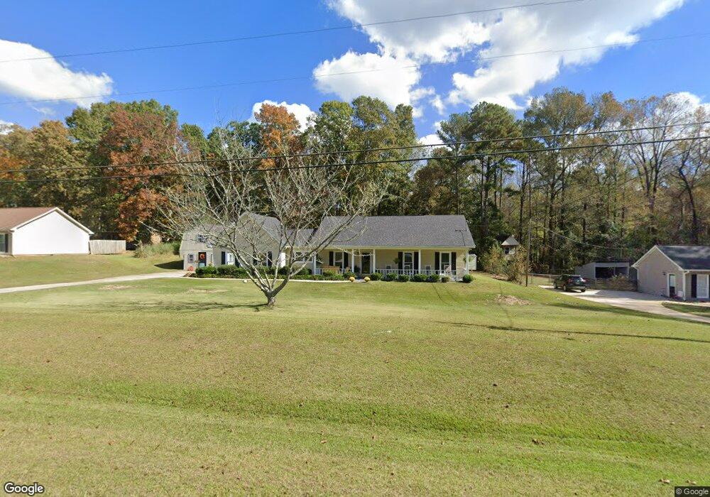
116 Rockwell Dr Lagrange, GA 30240
Estimated Value: $218,076 - $263,000
3
Beds
2
Baths
1,460
Sq Ft
$167/Sq Ft
Est. Value
About This Home
This home is located at 116 Rockwell Dr, Lagrange, GA 30240 and is currently estimated at $244,019, approximately $167 per square foot. 116 Rockwell Dr is a home located in Troup County with nearby schools including Long Cane Elementary School, Berta Weathersbee Elementary School, and Whitesville Road Elementary School.
Ownership History
Date
Name
Owned For
Owner Type
Purchase Details
Closed on
Jan 7, 1997
Sold by
Felix Snider Int
Bought by
Snider Felix Lamar and Snider Connie M
Current Estimated Value
Purchase Details
Closed on
Dec 27, 1996
Sold by
Sheryl Dennis and Sheryl Montgomery
Bought by
Felix Snider Int
Purchase Details
Closed on
Sep 23, 1993
Sold by
Montgomery Dennis Tyrone
Bought by
Sheryl Dennis and Sheryl Montgomery
Purchase Details
Closed on
Dec 8, 1989
Sold by
Shirley James W and Shirley Jennifer R
Bought by
Montgomery Dennis Tyrone
Purchase Details
Closed on
Aug 25, 1987
Sold by
Dan-Ric Inc
Bought by
Shirley James W and Shirley Jennifer R
Purchase Details
Closed on
Sep 1, 1986
Sold by
Dan-Ric Inc
Bought by
Dan-Ric Inc
Create a Home Valuation Report for This Property
The Home Valuation Report is an in-depth analysis detailing your home's value as well as a comparison with similar homes in the area
Purchase History
| Date | Buyer | Sale Price | Title Company |
|---|---|---|---|
| Snider Felix Lamar | -- | -- | |
| Felix Snider Int | $83,000 | -- | |
| Sheryl Dennis | -- | -- | |
| Montgomery Dennis Tyrone | $8,400 | -- | |
| Shirley James W | $74,800 | -- | |
| Dan-Ric Inc | $87,400 | -- |
Source: Public Records
Tax History
| Year | Tax Paid | Tax Assessment Tax Assessment Total Assessment is a certain percentage of the fair market value that is determined by local assessors to be the total taxable value of land and additions on the property. | Land | Improvement |
|---|---|---|---|---|
| 2025 | -- | $77,640 | $14,000 | $63,640 |
| 2024 | -- | $69,880 | $14,000 | $55,880 |
| 2023 | $0 | $2,132 | $0 | $2,132 |
| 2022 | $1,696 | $60,760 | $8,000 | $52,760 |
| 2021 | $1,584 | $52,520 | $6,000 | $46,520 |
| 2020 | $1,584 | $52,520 | $6,000 | $46,520 |
| 2019 | $1,495 | $49,560 | $6,000 | $43,560 |
| 2018 | $1,495 | $49,560 | $6,000 | $43,560 |
| 2017 | $1,495 | $49,560 | $6,000 | $43,560 |
Source: Public Records
Map
Nearby Homes
- 0 Glass Bridge Rd Unit 10679358
- 245 Teaver Rd
- 640 Hudson Rd
- 112 Foxdale Dr
- 808 S Fling Rd
- 105 Redwood Dr
- 427 Fling Rd
- 288 Bradfield Dr
- 104 Independence Ct
- 402 Ginger Cir
- 53 Horace Carter Rd
- 8 Horace Carter Rd
- 0 Bradfield Dr Unit 10568803
- 113 Colonial Ct
- 3009 Old West Point Rd
- 311 Cumberland Dr
- 2239 Pegasus Pkwy
- 22 Freeman Rd
- 98 Hearn Rd
- 101 Ivy Springs Dr
- 118 Rockwell Dr
- 115 Rockwell Dr
- 112 Rockwell Dr
- 120 Rockwell Dr
- 101 Hawthorne Cir
- 138 Glass Bridge Rd
- 110 Rockwell Dr
- 157 Hawthorne Cir
- 155 Hawthorne Cir
- 108 Rockwell Dr
- 153 Hawthorne Cir
- 130 Hawthorne Cir
- 151 Hawthorne Cir
- 106 Rockwell Dr
- 106 Rockwell Dr
- 102 Hawthorne Cir
- 107 Hawthorne Cir
- 310 Glass Bridge Rd
- 149 Hawthorne Cir
- 104 Hawthorne Cir
Your Personal Tour Guide
Ask me questions while you tour the home.