Estimated Value: $253,000 - $265,000
About This Home
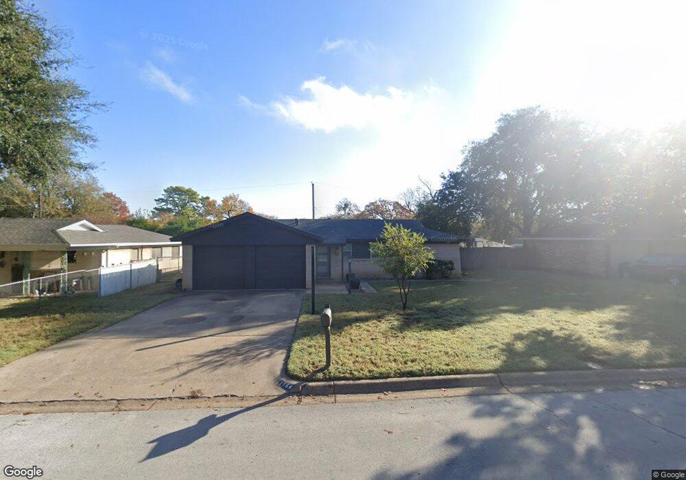
This home is located at 1164 Simpson Dr, Hurst, TX 76053 and is currently estimated at $259,578, approximately $225 per square foot. 1164 Simpson Dr is a home located in Tarrant County with nearby schools including Harrison Lane Elementary School, Hurst J High School, and L.D. Bell High School.
Ownership History
We collect this data history from publicly available records. To have your information removed, we recommend requesting removal directly through your county’s website.
Purchase Details
Purchase Details
Purchase Details
Purchase Details
Home Financials for this Owner
Home Financials are based on the most recent Mortgage that was taken out on this home.Purchase Details
Home Financials for this Owner
Home Financials are based on the most recent Mortgage that was taken out on this home.Purchase Details
Purchase Details
Purchase Details
Home Financials for this Owner
Home Financials are based on the most recent Mortgage that was taken out on this home.Home Values in the Area
Average Home Value in this Area
Purchase History
We collect this data history from publicly available records. To have your information removed, we recommend requesting removal directly through your county’s website.
| Date | Buyer | Sale Price | Title Company |
|---|---|---|---|
| -- | First American Title | ||
| -- | None Available | ||
| $95,500 | None Available | ||
| -- | Alamo Title Company | ||
| -- | First American Title | ||
| $65,000 | -- | ||
| -- | -- | ||
| -- | -- |
Mortgage History
We collect this data history from publicly available records. To have your information removed, we recommend requesting removal directly through your county’s website.
| Date | Status | Borrower | Loan Amount |
|---|---|---|---|
| Previous Owner | $90,741 | ||
| Previous Owner | $75,000 | ||
| Previous Owner | $19,978 |
Tax History
We collect this data history from publicly available records. To have your information removed, we recommend requesting removal directly through your county’s website.
| Year | Tax Paid | Tax Assessment Tax Assessment Total Assessment is a certain percentage of the fair market value that is determined by local assessors to be the total taxable value of land and additions on the property. | Land | Improvement |
|---|---|---|---|---|
| 2025 | $5,025 | $238,790 | $55,000 | $183,790 |
| 2024 | $4,877 | $238,790 | $55,000 | $183,790 |
| 2023 | $4,516 | $225,431 | $40,000 | $185,431 |
| 2022 | $4,603 | $199,902 | $40,000 | $159,902 |
| 2021 | $3,719 | $154,186 | $40,000 | $114,186 |
| 2020 | $3,710 | $154,186 | $40,000 | $114,186 |
| 2019 | $3,695 | $150,955 | $40,000 | $110,955 |
| 2018 | $3,532 | $144,301 | $19,000 | $125,301 |
| 2017 | $3,448 | $136,264 | $19,000 | $117,264 |
| 2016 | $3,198 | $126,384 | $19,000 | $107,384 |
| 2015 | $2,017 | $76,900 | $15,000 | $61,900 |
| 2014 | $2,017 | $76,900 | $15,000 | $61,900 |
Map
- 1140 Simpson Dr
- 1144 Norwood Dr
- 1113 Norwood Dr
- 1140 Cavender Dr
- 1352 Simpson Dr
- 201 W Cheryl Ave
- 905 Brown Trail
- 1213 Glenda Dr
- 509 Patricia Rd
- 1112 Karla Dr
- 341 Hurst Dr
- 828 Glenda Dr
- 802 Brown Trail
- 743 Norwood Dr
- 60 Somerset Terrace
- 727 Norwood Dr
- 100 W Pleasantview Dr
- 33 Somerset Terrace
- 1441 Hurstview Dr
- 889 Jerry Ln
- 1205 Simpson Dr
- 1209 Simpson Dr
- 1201 Simpson Dr
- 1204 Harrison Ln
- 1208 Harrison Ln
- 1213 Simpson Dr
- 1200 Harrison Ln
- 1173 Simpson Dr
- 1204 Simpson Dr
- 1212 Harrison Ln
- 1208 Simpson Dr
- 1200 Simpson Dr
- 1172 Harrison Ln
- 1217 Simpson Dr
- 1212 Simpson Dr
- 1168 Simpson Dr
- 1169 Simpson Dr
- 1216 Harrison Ln
- 1168 Harrison Ln
- 1216 Simpson Dr
Ask me questions while you tour the home.