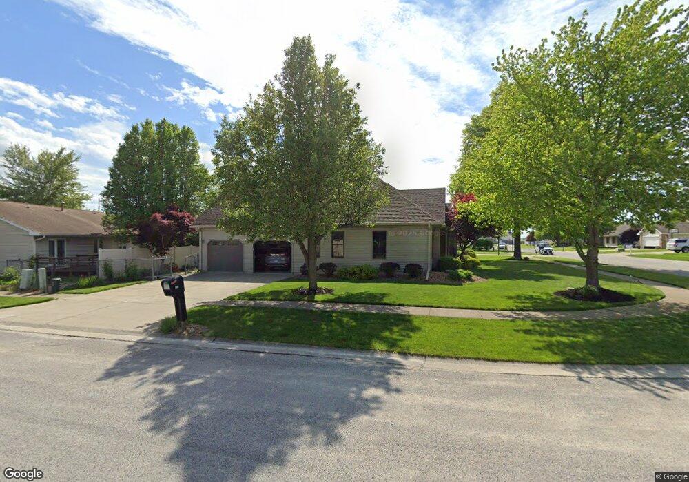
117 Arborgate Dr Mattoon, IL 61938
Estimated Value: $228,345 - $255,000
3
Beds
2
Baths
1,537
Sq Ft
$160/Sq Ft
Est. Value
About This Home
This home is located at 117 Arborgate Dr, Mattoon, IL 61938 and is currently estimated at $245,336, approximately $159 per square foot. 117 Arborgate Dr is a home located in Coles County with nearby schools including Mattoon High School and St Mary School.
Ownership History
Date
Name
Owned For
Owner Type
Purchase Details
Closed on
Feb 19, 2007
Sold by
Reese Joe and Reese Nancy Elizabeth
Bought by
Willingham Mark L and Willingham Cathy A
Current Estimated Value
Home Financials for this Owner
Home Financials are based on the most recent Mortgage that was taken out on this home.
Original Mortgage
$60,000
Outstanding Balance
$36,077
Interest Rate
6.23%
Mortgage Type
New Conventional
Estimated Equity
$209,259
Create a Home Valuation Report for This Property
The Home Valuation Report is an in-depth analysis detailing your home's value as well as a comparison with similar homes in the area
Home Values in the Area
Average Home Value in this Area
Purchase History
| Date | Buyer | Sale Price | Title Company |
|---|---|---|---|
| Willingham Mark L | $164,000 | None Available |
Source: Public Records
Mortgage History
| Date | Status | Borrower | Loan Amount |
|---|---|---|---|
| Open | Willingham Mark L | $60,000 |
Source: Public Records
Tax History
| Year | Tax Paid | Tax Assessment Tax Assessment Total Assessment is a certain percentage of the fair market value that is determined by local assessors to be the total taxable value of land and additions on the property. | Land | Improvement |
|---|---|---|---|---|
| 2024 | $5,440 | $69,932 | $7,573 | $62,359 |
| 2023 | $4,851 | $62,440 | $6,762 | $55,678 |
| 2022 | $4,851 | $61,408 | $6,650 | $54,758 |
| 2021 | $4,844 | $56,405 | $6,108 | $50,297 |
| 2020 | $4,785 | $58,441 | $6,328 | $52,113 |
| 2019 | $4,693 | $56,405 | $5,885 | $50,520 |
| 2018 | $4,609 | $56,405 | $5,885 | $50,520 |
| 2017 | $4,594 | $56,405 | $5,885 | $50,520 |
| 2016 | $4,497 | $56,405 | $5,885 | $50,520 |
| 2015 | $4,352 | $55,438 | $5,885 | $49,553 |
| 2014 | $4,352 | $55,438 | $5,885 | $49,553 |
| 2013 | $4,352 | $55,438 | $5,885 | $49,553 |
Source: Public Records
Map
Nearby Homes
- 308 Melody Ln
- 3905 Western Ave
- 916 S 36th St
- 7 Noyes Ct
- 1 Western Avenue Heights
- 32 Westwood
- 2820 Walnut Ave
- 2812 Pine Ave
- 3020 Champaign Ave
- 2800 Pine Ave
- 2720 Champaign Ave
- 109 N 26th St
- 2617 Richmond Ave
- 2800 Shelby Ave
- 2516 Pine Ave
- 2505 Pine Ave
- 113 S 25th St
- 1117 N 32nd St
- 2301 Charleston Ave
- 2413 Moultrie Ave
Your Personal Tour Guide
Ask me questions while you tour the home.