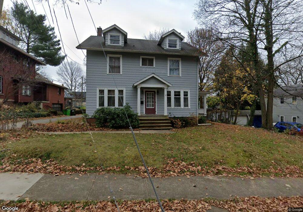
117 E University St Wooster, OH 44691
Estimated Value: $181,000 - $231,000
About This Home
This home is located at 117 E University St, Wooster, OH 44691 and is currently estimated at $207,388, approximately $108 per square foot. 117 E University St is a home located in Wayne County with nearby schools including Cornerstone Elementary School, Edgewood Middle School, and Wooster High School.
Ownership History
We collect this data history from publicly available records. To have your information removed, we recommend requesting removal directly through your county’s website.
Purchase Details
Purchase Details
Purchase Details
Home Values in the Area
Average Home Value in this Area
Purchase History
We collect this data history from publicly available records. To have your information removed, we recommend requesting removal directly through your county’s website.
| Date | Buyer | Sale Price | Title Company |
|---|---|---|---|
| -- | Attorney | ||
| -- | Attorney | ||
| -- | -- |
Tax History
We collect this data history from publicly available records. To have your information removed, we recommend requesting removal directly through your county’s website.
| Year | Tax Paid | Tax Assessment Tax Assessment Total Assessment is a certain percentage of the fair market value that is determined by local assessors to be the total taxable value of land and additions on the property. | Land | Improvement |
|---|---|---|---|---|
| 2025 | $2,005 | $47,380 | $9,080 | $38,300 |
| 2024 | $2,005 | $47,380 | $9,080 | $38,300 |
| 2023 | $2,013 | $47,380 | $9,080 | $38,300 |
| 2022 | $2,041 | $38,220 | $7,330 | $30,890 |
| 2021 | $2,104 | $38,220 | $7,330 | $30,890 |
| 2020 | $1,997 | $38,220 | $7,330 | $30,890 |
| 2019 | $1,818 | $33,360 | $7,070 | $26,290 |
| 2018 | $1,823 | $33,360 | $7,070 | $26,290 |
| 2017 | $1,838 | $33,360 | $7,070 | $26,290 |
| 2016 | $1,896 | $32,070 | $6,800 | $25,270 |
| 2015 | $1,863 | $32,070 | $6,800 | $25,270 |
| 2014 | $1,864 | $32,070 | $6,800 | $25,270 |
| 2013 | $1,834 | $31,170 | $6,910 | $24,260 |
Map
- 900 Quinby Ave
- 708 N Bever St
- 637 Quinby Ave
- 254 W Wayne Ave
- 851 Park Blvd
- 329 E Bowman St
- 523 College Ave
- 430 Bloomington Ave
- 431 College Ave
- 423 N Market St
- 944 Northwestern Ave
- 708 E Bowman St
- 412 Spink St
- 487 Woodland Ave
- 972 Washington St
- 935 Washington St
- 1031 Washington St
- 535 E North St
- 1033 Washington St Unit 201
- 369 W North St
- 125 E University St
- 939 Quinby Ave
- 947 Quinby Ave
- 135 E University St
- 927 Quinby Ave
- 118 E University St
- 932 Scovel Ave
- 924 Scovel Ave
- 923 Quinby Ave
- 1001 Quinby Ave
- 920 Scovel Ave
- 205 E University St
- 911 Quinby Ave
- 948 Quinby Ave
- 929 Scovel Ave
- 136 E University St
- 1004 Quinby Ave
- 124 E Pine St
- 925 Scovel Ave
- 213 E University St
Ask me questions while you tour the home.