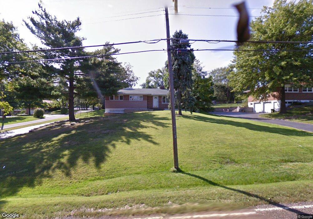
11726 Sappington Barracks Rd Saint Louis, MO 63127
Estimated Value: $371,625 - $601,000
3
Beds
2
Baths
1,696
Sq Ft
$273/Sq Ft
Est. Value
About This Home
This home is located at 11726 Sappington Barracks Rd, Saint Louis, MO 63127 and is currently estimated at $463,656, approximately $273 per square foot. 11726 Sappington Barracks Rd is a home located in St. Louis County with nearby schools including Concord Elementary School, Sperreng Middle School, and Lindbergh High School.
Ownership History
Date
Name
Owned For
Owner Type
Purchase Details
Closed on
Aug 30, 2002
Sold by
Guardado Lesley S and Guardado Jeremy
Bought by
Banes Hal R and Banes Mary E
Current Estimated Value
Home Financials for this Owner
Home Financials are based on the most recent Mortgage that was taken out on this home.
Original Mortgage
$227,050
Interest Rate
6.33%
Purchase Details
Closed on
Aug 11, 1998
Sold by
Shekelton Marie A
Bought by
Shekelton Lesley Elaine
Create a Home Valuation Report for This Property
The Home Valuation Report is an in-depth analysis detailing your home's value as well as a comparison with similar homes in the area
Home Values in the Area
Average Home Value in this Area
Purchase History
We collect this data history from publicly available records. To have your information removed, we recommend requesting removal directly through your county’s website.
| Date | Buyer | Sale Price | Title Company |
|---|---|---|---|
| Banes Hal R | $239,000 | -- | |
| Shekelton Lesley Elaine | -- | -- |
Source: Public Records
Mortgage History
We collect this data history from publicly available records. To have your information removed, we recommend requesting removal directly through your county’s website.
| Date | Status | Borrower | Loan Amount |
|---|---|---|---|
| Previous Owner | Banes Hal R | $227,050 |
Source: Public Records
Tax History
| Year | Tax Paid | Tax Assessment Tax Assessment Total Assessment is a certain percentage of the fair market value that is determined by local assessors to be the total taxable value of land and additions on the property. | Land | Improvement |
|---|---|---|---|---|
| 2025 | $3,840 | $59,390 | $25,590 | $33,800 |
| 2024 | $3,840 | $59,050 | $25,590 | $33,460 |
| 2023 | $3,830 | $59,050 | $25,590 | $33,460 |
| 2022 | $3,416 | $50,560 | $25,590 | $24,970 |
| 2021 | $3,296 | $50,560 | $25,590 | $24,970 |
| 2020 | $3,105 | $45,960 | $17,840 | $28,120 |
| 2019 | $3,097 | $45,960 | $17,840 | $28,120 |
| 2018 | $3,009 | $40,620 | $11,040 | $29,580 |
| 2017 | $2,976 | $40,620 | $11,040 | $29,580 |
| 2016 | $2,878 | $37,300 | $11,040 | $26,260 |
Source: Public Records
Map
Nearby Homes
- 11922 Gravois Rd Unit 15
- 9801 Hilltop Dr
- 9803 Hilltop Dr
- 9443 Oakwood Manor Ln
- 9404 Gates Manor Ct
- 9513 Sappington Rd
- 10001 Kalinda Ln
- 9422 Parklind Dr
- 1 Chandler @ Gates Manor Court
- 1 Sedona @ Gates Manor Court
- 11624 Denny Rd
- 10755 Kennerly Rd
- 9341 Werkdale Dr
- 10620 Leebur Dr
- 9316 Sappington Rd
- 10636 Roanna Ln
- 9418 Sunset Reserve Dr
- 12259 Sunset Reserve Ct
- 9810 Grandview Lake Ct
- 10448 Gregory Ct
- 11801 Crestwick Ct
- 11805 Crestwick Ct
- 9 Meppen Ct
- 11800 Crestwick Ct
- 9722 Southgate Ln
- 9722 Crestwick Dr
- 11 Meppen Ct
- 11806 Crestwick Ct
- 9710 Crestwick Dr
- 11734 Sappington Barracks Rd
- 7 Meppen Ct
- 11720 Sappington Barracks Rd
- 11742 Sappington Barracks Rd
- 15 Meppen Ct
- 3 Meppen Continue To Show Dr
- 3 Meppen Dr
- 9812 Barrington Dr
- 5 Meppen Ct
- 9806 Barrington Dr
- 1 Meppen Dr
Your Personal Tour Guide
Ask me questions while you tour the home.