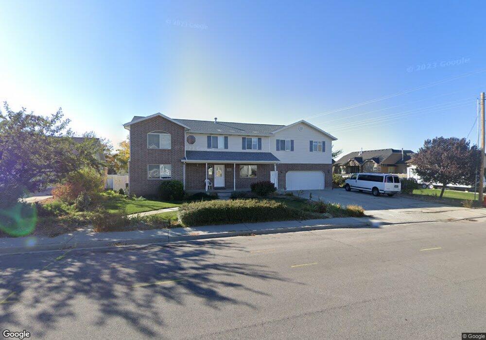
1175 W 2000 N Mapleton, UT 84664
Estimated Value: $758,000 - $858,082
6
Beds
4
Baths
4,624
Sq Ft
$178/Sq Ft
Est. Value
About This Home
This home is located at 1175 W 2000 N, Mapleton, UT 84664 and is currently estimated at $822,021, approximately $177 per square foot. 1175 W 2000 N is a home located in Utah County with nearby schools including Mapleton School, Mapleton Junior High School, and Maple Mountain High School.
Ownership History
Date
Name
Owned For
Owner Type
Purchase Details
Closed on
May 23, 2024
Sold by
Dittli Albin L and Dittli Ada L
Bought by
Albin L Dittli And Ada L Dittli Revocable Tru and Dittli
Current Estimated Value
Purchase Details
Closed on
Jun 15, 2001
Sold by
Dittli Albin and Dittli Ada L
Bought by
Kay Angela
Purchase Details
Closed on
Aug 8, 2000
Sold by
S & G Development Lc
Bought by
Dittli Albin L and Dittli Ada L
Create a Home Valuation Report for This Property
The Home Valuation Report is an in-depth analysis detailing your home's value as well as a comparison with similar homes in the area
Home Values in the Area
Average Home Value in this Area
Purchase History
| Date | Buyer | Sale Price | Title Company |
|---|---|---|---|
| Albin L Dittli And Ada L Dittli Revocable Tru | -- | None Listed On Document | |
| Kay Angela | -- | Title West Title Co | |
| Dittli Albin L | -- | Security Title & Abstract |
Source: Public Records
Tax History
| Year | Tax Paid | Tax Assessment Tax Assessment Total Assessment is a certain percentage of the fair market value that is determined by local assessors to be the total taxable value of land and additions on the property. | Land | Improvement |
|---|---|---|---|---|
| 2025 | $4,122 | $417,835 | -- | -- |
| 2024 | $4,122 | $403,755 | $0 | $0 |
| 2023 | $4,442 | $437,855 | $0 | $0 |
| 2022 | $4,271 | $416,295 | $0 | $0 |
| 2021 | $3,614 | $540,900 | $179,000 | $361,900 |
| 2020 | $3,594 | $520,300 | $158,400 | $361,900 |
| 2019 | $3,159 | $466,700 | $152,000 | $314,700 |
| 2018 | $2,899 | $407,800 | $128,000 | $279,800 |
| 2017 | $2,907 | $217,030 | $0 | $0 |
| 2016 | $2,865 | $212,630 | $0 | $0 |
| 2015 | $2,696 | $198,880 | $0 | $0 |
| 2014 | $2,456 | $177,925 | $0 | $0 |
Source: Public Records
Map
Nearby Homes
- 1121 W 1800 N
- 1403 S 625 E
- 1264 E 1150 S
- 949 S 1060 E
- 1518 S 600 E
- 598 W 1600 N
- 1697 N 500 W
- 899 E 800 S
- 1410 W 1200 N
- 1525 S 400 E Unit 36
- 405 W 1200 N Unit 4
- 487 W 1200 N Unit 1
- 677 E 800 South St
- 883 E 700 S
- 1518 E Pheasant Run Dr
- 145 W Carnesecca Ct
- 1853 S 375 E
- 1618 E 970 S
- 579 E 800 St S
- 629 E 800 St S
- 1143 W 2000 N
- 1950 N 1250 W Unit 19
- 1950 N 1250 W
- 1235 W 2000 N
- 1920 N 1250 W Unit 18
- 1920 N 1250 W
- 1889 N 1100 W
- 1084 W 1900 N
- 1248 W 2000 N
- 1115 W 2000 N
- 1129 W 2000 N
- 1890 N 1250 W
- 1072 W 1900 N
- 1095 W 2000 N
- 1095 W 2000 N Unit 2nd Story Apartment
- 1091 W 2000 N
- 1255 W 2000 N
- 1857 N 1100 W
- 1085 W 2000 N
- 1092 W 2000 N
Your Personal Tour Guide
Ask me questions while you tour the home.