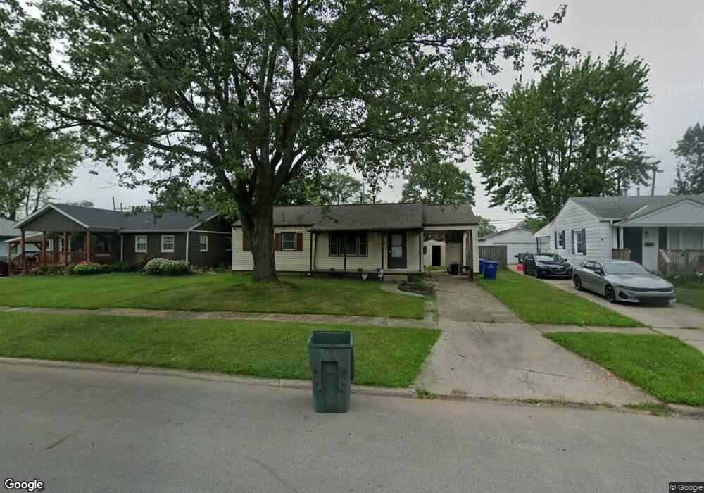
1177 Maetzel Dr Columbus, OH 43227
Shady Lane NeighborhoodEstimated Value: $170,123 - $200,000
4
Beds
1
Bath
912
Sq Ft
$207/Sq Ft
Est. Value
About This Home
This home is located at 1177 Maetzel Dr, Columbus, OH 43227 and is currently estimated at $188,531, approximately $206 per square foot. 1177 Maetzel Dr is a home located in Franklin County with nearby schools including Shady Lane Elementary School, Sherwood Middle School, and Walnut Ridge High School.
Ownership History
Date
Name
Owned For
Owner Type
Purchase Details
Closed on
Aug 31, 2010
Sold by
Federal Home Loan Mortgage Corporation
Bought by
Phillips Carol
Current Estimated Value
Purchase Details
Closed on
Jun 23, 2010
Sold by
Oneal Steven Robert
Bought by
Federal Home Loan Mortgage Corp
Purchase Details
Closed on
Sep 8, 1986
Bought by
Oneal Steven R
Purchase Details
Closed on
Nov 1, 1984
Create a Home Valuation Report for This Property
The Home Valuation Report is an in-depth analysis detailing your home's value as well as a comparison with similar homes in the area
Home Values in the Area
Average Home Value in this Area
Purchase History
| Date | Buyer | Sale Price | Title Company |
|---|---|---|---|
| Phillips Carol | $26,000 | None Available | |
| Federal Home Loan Mortgage Corp | $48,000 | None Available | |
| Oneal Steven R | -- | -- | |
| -- | $40,000 | -- |
Source: Public Records
Tax History
| Year | Tax Paid | Tax Assessment Tax Assessment Total Assessment is a certain percentage of the fair market value that is determined by local assessors to be the total taxable value of land and additions on the property. | Land | Improvement |
|---|---|---|---|---|
| 2025 | $2,597 | $56,670 | $16,980 | $39,690 |
| 2024 | $2,597 | $56,670 | $16,980 | $39,690 |
| 2023 | $2,565 | $56,665 | $16,975 | $39,690 |
| 2022 | $1,512 | $28,460 | $6,370 | $22,090 |
| 2021 | $1,515 | $28,460 | $6,370 | $22,090 |
| 2020 | $1,517 | $28,460 | $6,370 | $22,090 |
| 2019 | $1,428 | $22,970 | $5,080 | $17,890 |
| 2018 | $713 | $22,970 | $5,080 | $17,890 |
| 2017 | $1,428 | $22,970 | $5,080 | $17,890 |
| 2016 | $618 | $9,100 | $5,880 | $3,220 |
| 2015 | $281 | $9,100 | $5,880 | $3,220 |
| 2014 | $564 | $9,100 | $5,880 | $3,220 |
| 2013 | $278 | $9,100 | $5,880 | $3,220 |
Source: Public Records
Map
Nearby Homes
- 1281 Maetzel Dr
- 4382 E Fulton St
- 1243 Simpson Dr
- 4366 E Mound St
- 1253 Dutton Place
- 4530 Amesbury Rd
- 1085 S Hamilton Rd
- 1193 Marble Dr
- 1211 Shady Lane Rd
- 4289 Astor Ave
- 4467 Grimsby Rd
- 4562 Grimsby Rd
- 1301 Bernhard Rd
- 4236 E Mound St
- 1241 Erickson Rd
- 4472 Aragon Ave
- 4308 E Main St Unit 1
- 1321 Country Club Rd
- 844 Westphal Ave
- 1370 Erickson Rd
- 1171 Maetzel Dr
- 1185 Maetzel Dr
- 1193 Maetzel Dr
- 1153 Simpson Dr
- 1190 Huntly Dr
- 1174 Maetzel Dr
- 1201 Maetzel Dr
- 1164 Maetzel Dr
- 1209 Maetzel Dr
- 1192 Huntly Dr
- 1161 Simpson Dr
- 1210 Maetzel Dr
- 1217 Maetzel Dr
- 1201 Huntly Dr
- 1144 Simpson Dr
- 1146 Simpson Dr
- 1165 Simpson Dr
- 1148 Simpson Dr
- 1196 Huntly Dr
- 1218 Maetzel Dr
Your Personal Tour Guide
Ask me questions while you tour the home.