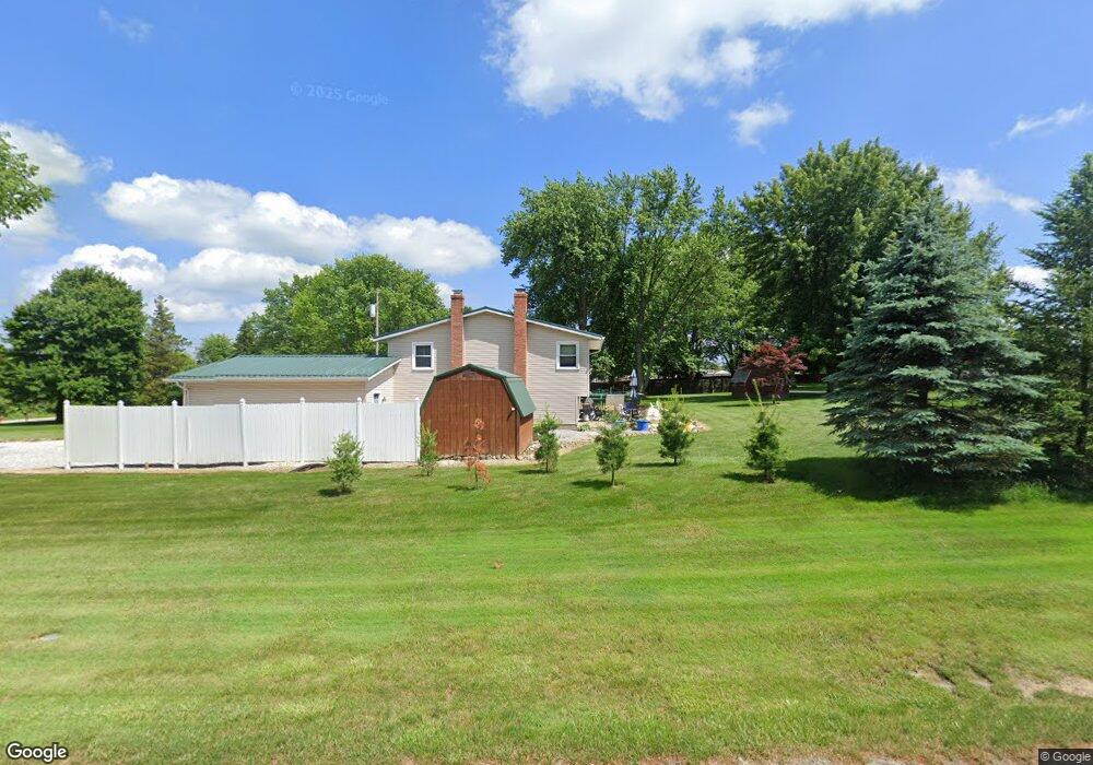
11788 Sharp Dr Doylestown, OH 44230
Estimated Value: $263,000 - $297,000
About This Home
This home is located at 11788 Sharp Dr, Doylestown, OH 44230 and is currently estimated at $281,766, approximately $228 per square foot. 11788 Sharp Dr is a home located in Wayne County with nearby schools including Hazel Harvey Elementary School, Chippewa Intermediate School, and Chippewa Jr./Sr. High School.
Ownership History
We collect this data history from publicly available records. To have your information removed, we recommend requesting removal directly through your county’s website.
Purchase Details
Purchase Details
Home Financials for this Owner
Home Financials are based on the most recent Mortgage that was taken out on this home.Purchase Details
Home Values in the Area
Average Home Value in this Area
Purchase History
We collect this data history from publicly available records. To have your information removed, we recommend requesting removal directly through your county’s website.
| Date | Buyer | Sale Price | Title Company |
|---|---|---|---|
| -- | -- | ||
| $85,000 | -- | ||
| -- | -- |
Mortgage History
We collect this data history from publicly available records. To have your information removed, we recommend requesting removal directly through your county’s website.
| Date | Status | Borrower | Loan Amount |
|---|---|---|---|
| Previous Owner | $80,500 |
Tax History
We collect this data history from publicly available records. To have your information removed, we recommend requesting removal directly through your county’s website.
| Year | Tax Paid | Tax Assessment Tax Assessment Total Assessment is a certain percentage of the fair market value that is determined by local assessors to be the total taxable value of land and additions on the property. | Land | Improvement |
|---|---|---|---|---|
| 2025 | $2,913 | $84,120 | $24,890 | $59,230 |
| 2024 | $2,913 | $84,120 | $24,890 | $59,230 |
| 2023 | $2,927 | $84,120 | $24,890 | $59,230 |
| 2022 | $2,180 | $57,620 | $17,050 | $40,570 |
| 2021 | $2,196 | $57,620 | $17,050 | $40,570 |
| 2020 | $2,211 | $57,620 | $17,050 | $40,570 |
| 2019 | $2,057 | $50,710 | $16,250 | $34,460 |
| 2018 | $2,077 | $50,710 | $16,250 | $34,460 |
| 2017 | $2,061 | $50,710 | $16,250 | $34,460 |
| 2016 | $2,010 | $48,770 | $15,630 | $33,140 |
| 2015 | $2,003 | $48,770 | $15,630 | $33,140 |
| 2014 | $1,764 | $48,770 | $15,630 | $33,140 |
| 2013 | $1,721 | $46,110 | $15,860 | $30,250 |
Map
- 13069 Hametown Rd
- 13129 Shank Rd
- 18592 Edwards Rd Unit 211
- 18592 Edwards Rd Unit 223
- 0 Cleveland Massillon St Unit 5221430
- 0 V L Black Diamond Rd
- 16441 Bieri Rd
- 0 V L Warwick Rd
- 485 Vineyard Way
- 0 V L Bieri Rd
- 410 Juniper Path
- 3110 Bronco Dr
- 1255 Thorn Way
- 385 Thorn Way
- 144 Church St
- 120 Thorn Way
- 680 Thorn Way
- 620 Thorn Way
- 125 Frederick St
- 5983 Kungle Rd
- 11804 Clinton Rd
- 11766 Sharp Dr
- 11814 Clinton Rd
- 11756 Sharp Dr
- 11824 Clinton Rd
- 11742 Sharp Dr
- 11787 Clinton Rd
- 11834 Clinton Rd
- 11767 Clinton Rd
- 11642 Rogues Dr
- 11813 Clinton Rd
- 11730 Sharp Dr
- 11844 Clinton Rd
- 11637 Rogues Dr
- 11761 Clinton Rd
- 11827 Clinton Rd
- 11867 Breezewood Dr
- 18220 William Dr
- 18390 William Dr
- 11854 Clinton Rd
Ask me questions while you tour the home.