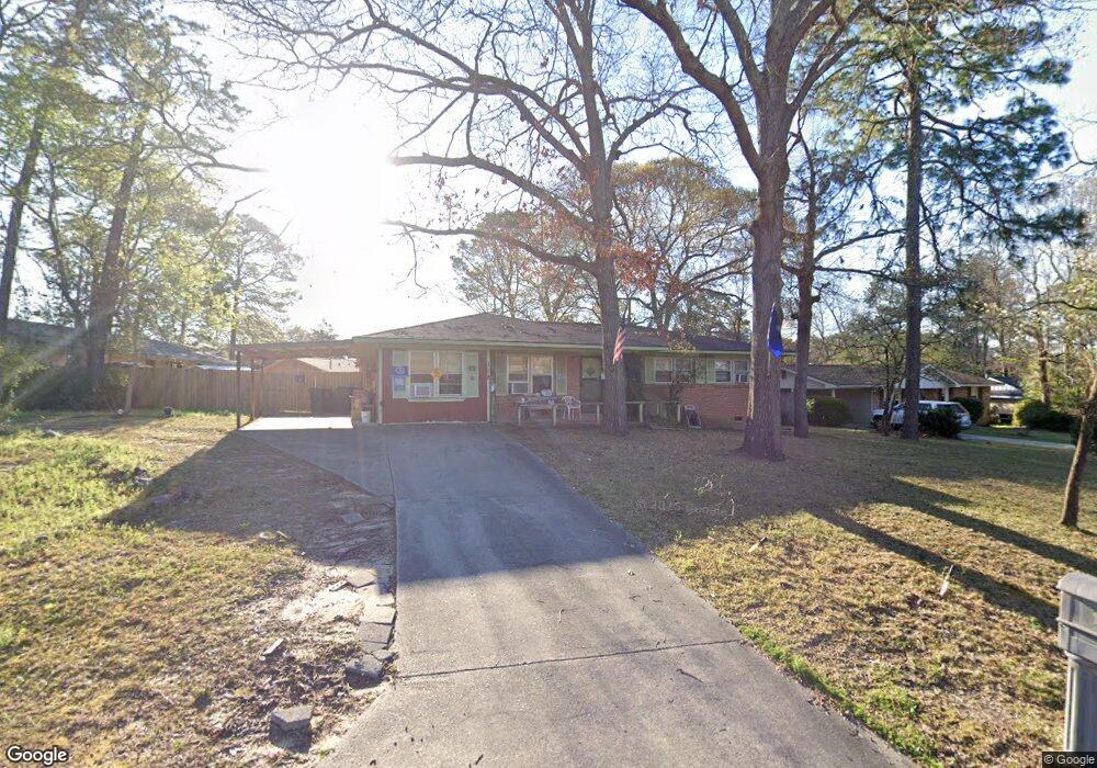
118 Amber Dr Warner Robins, GA 31088
Estimated Value: $140,000 - $180,000
About This Home
This home is located at 118 Amber Dr, Warner Robins, GA 31088 and is currently estimated at $165,187, approximately $120 per square foot. 118 Amber Dr is a home located in Houston County with nearby schools including Russell Elementary School, Warner Robins Middle School, and Warner Robins High School.
Ownership History
We collect this data history from publicly available records. To have your information removed, we recommend requesting removal directly through your county’s website.
Purchase Details
Home Financials for this Owner
Home Financials are based on the most recent Mortgage that was taken out on this home.Purchase Details
Home Financials for this Owner
Home Financials are based on the most recent Mortgage that was taken out on this home.Purchase Details
Purchase Details
Purchase Details
Home Values in the Area
Average Home Value in this Area
Purchase History
We collect this data history from publicly available records. To have your information removed, we recommend requesting removal directly through your county’s website.
| Date | Buyer | Sale Price | Title Company |
|---|---|---|---|
| -- | None Available | ||
| $67,000 | None Available | ||
| -- | -- | ||
| -- | -- | ||
| -- | -- |
Mortgage History
We collect this data history from publicly available records. To have your information removed, we recommend requesting removal directly through your county’s website.
| Date | Status | Borrower | Loan Amount |
|---|---|---|---|
| Previous Owner | $67,000 |
Tax History
We collect this data history from publicly available records. To have your information removed, we recommend requesting removal directly through your county’s website.
| Year | Tax Paid | Tax Assessment Tax Assessment Total Assessment is a certain percentage of the fair market value that is determined by local assessors to be the total taxable value of land and additions on the property. | Land | Improvement |
|---|---|---|---|---|
| 2025 | $1,191 | $56,720 | $8,000 | $48,720 |
| 2024 | $1,293 | $53,200 | $8,000 | $45,200 |
| 2023 | $840 | $39,120 | $8,000 | $31,120 |
| 2022 | $552 | $33,160 | $5,200 | $27,960 |
| 2021 | $423 | $27,440 | $5,200 | $22,240 |
| 2020 | $425 | $27,440 | $5,200 | $22,240 |
| 2019 | $637 | $27,440 | $5,200 | $22,240 |
| 2018 | $637 | $27,440 | $5,200 | $22,240 |
| 2017 | $638 | $27,440 | $5,200 | $22,240 |
| 2016 | $639 | $27,440 | $5,200 | $22,240 |
| 2015 | -- | $29,680 | $5,200 | $24,480 |
| 2014 | -- | $29,680 | $5,200 | $24,480 |
| 2013 | -- | $29,680 | $5,200 | $24,480 |
Map
- 250 Randy Cir
- 114 Tommy Terrace
- 117 Cheryl Blvd
- 103 Cheryl Blvd
- 408 Angus Blvd
- 205 Debra Dr
- 305 Bonnie Dr
- 212 Palomino Ln
- 114 Karen Dr
- 107 Woodfield Dr
- 101 Sunnybrook Ct
- 0 Russell Pkwy Unit 10656199
- 108 Tina Dr
- 327 Bonnie Dr
- 101 Ranch Rd Unit 29
- 118 Fox Glove Ct
- 315 Donna Dr
- 510 Arrowhead Trail
- 104 Ridgedale Dr
- 103 Royal Tern Way
Ask me questions while you tour the home.