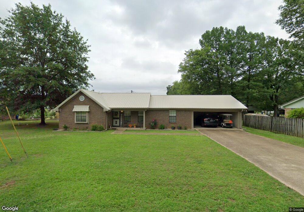
118 Burns St Pontotoc, MI 38863
Estimated Value: $138,541 - $228,000
3
Beds
2
Baths
1,738
Sq Ft
$111/Sq Ft
Est. Value
About This Home
This home is located at 118 Burns St, Pontotoc, MI 38863 and is currently estimated at $193,385, approximately $111 per square foot. 118 Burns St is a home located in Pontotoc County with nearby schools including Pontotoc Elementary School, D.T. Cox Elementary School, and Pontotoc Middle School.
Ownership History
Date
Name
Owned For
Owner Type
Purchase Details
Closed on
Nov 7, 2019
Sold by
Bridgman Donna and Bridgman Ricky
Bought by
Bryant Lisa
Current Estimated Value
Home Financials for this Owner
Home Financials are based on the most recent Mortgage that was taken out on this home.
Original Mortgage
$123,473
Outstanding Balance
$108,169
Interest Rate
3.5%
Mortgage Type
Credit Line Revolving
Estimated Equity
$85,216
Purchase Details
Closed on
Jan 18, 2019
Sold by
Sumner Pamela Kay
Bought by
Bridgman Donna
Create a Home Valuation Report for This Property
The Home Valuation Report is an in-depth analysis detailing your home's value as well as a comparison with similar homes in the area
Home Values in the Area
Average Home Value in this Area
Purchase History
| Date | Buyer | Sale Price | Title Company |
|---|---|---|---|
| Bryant Lisa | -- | None Available | |
| Bridgman Donna | -- | None Available |
Source: Public Records
Mortgage History
| Date | Status | Borrower | Loan Amount |
|---|---|---|---|
| Open | Bryant Lisa | $123,473 |
Source: Public Records
Tax History
| Year | Tax Paid | Tax Assessment Tax Assessment Total Assessment is a certain percentage of the fair market value that is determined by local assessors to be the total taxable value of land and additions on the property. | Land | Improvement |
|---|---|---|---|---|
| 2025 | $1,175 | $8,849 | $0 | $0 |
| 2024 | $1,131 | $8,849 | $0 | $0 |
| 2023 | $1,129 | $8,849 | $0 | $0 |
| 2022 | $672 | $7,605 | $0 | $0 |
| 2021 | $696 | $7,605 | $0 | $0 |
| 2020 | $944 | $7,605 | $0 | $0 |
| 2019 | $957 | $7,576 | $0 | $0 |
| 2018 | $894 | $7,077 | $0 | $0 |
| 2017 | $0 | $7,077 | $0 | $0 |
| 2016 | $0 | $7,077 | $0 | $0 |
| 2015 | -- | $7,158 | $0 | $0 |
| 2014 | -- | $7,158 | $0 | $0 |
Source: Public Records
Map
Nearby Homes
- 0 W Reynolds St
- 122 N Columbia St
- 605 County Road 442
- 168 Highland Dr
- 455 W Reynolds St
- 231 Lake Dr
- 17 N Main St
- 259 Shady Ln
- 0 Mississippi 336
- 188 N Main St
- 191 Wilson St
- 4 Oak Dr
- 0 N Main St
- 159 Fawn Cir
- 0 Fawn Cir
- 328 Old Airport Rd S
- 145 Forest Dr
- 0 0 Tallant Lane (16 6 Ac)
- 12 Forest Dr
- 10 Forest Dr
Your Personal Tour Guide
Ask me questions while you tour the home.