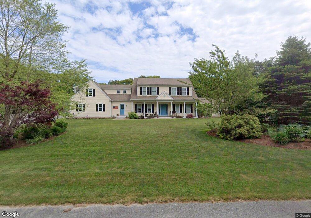
118 Flintrock Rd Barnstable, MA 02630
Barnstable Village NeighborhoodEstimated Value: $1,073,000 - $1,593,000
3
Beds
2
Baths
1,501
Sq Ft
$838/Sq Ft
Est. Value
About This Home
This home is located at 118 Flintrock Rd, Barnstable, MA 02630 and is currently estimated at $1,258,351, approximately $838 per square foot. 118 Flintrock Rd is a home located in Barnstable County with nearby schools including West Barnstable Elementary School, Barnstable United Elementary School, and Barnstable Intermediate School.
Ownership History
Date
Name
Owned For
Owner Type
Purchase Details
Closed on
Feb 21, 2008
Sold by
Frederickson Frank G
Bought by
Frederickson Frank G
Current Estimated Value
Home Financials for this Owner
Home Financials are based on the most recent Mortgage that was taken out on this home.
Original Mortgage
$580,000
Interest Rate
5.9%
Mortgage Type
Purchase Money Mortgage
Purchase Details
Closed on
Oct 30, 1996
Sold by
Tahmoush Frank G and Tahmoush Karen J
Bought by
Frederickson Frank G
Create a Home Valuation Report for This Property
The Home Valuation Report is an in-depth analysis detailing your home's value as well as a comparison with similar homes in the area
Home Values in the Area
Average Home Value in this Area
Purchase History
We collect this data history from publicly available records. To have your information removed, we recommend requesting removal directly through your county’s website.
| Date | Buyer | Sale Price | Title Company |
|---|---|---|---|
| Frederickson Frank G | -- | -- | |
| Frederickson Frank G | $153,000 | -- |
Source: Public Records
Mortgage History
We collect this data history from publicly available records. To have your information removed, we recommend requesting removal directly through your county’s website.
| Date | Status | Borrower | Loan Amount |
|---|---|---|---|
| Open | Frederickson Frank G | $560,000 | |
| Closed | Frederickson Frank G | $565,000 | |
| Closed | Frederickson Frank G | $580,000 | |
| Previous Owner | Frederickson Frank G | $138,000 |
Source: Public Records
Tax History
| Year | Tax Paid | Tax Assessment Tax Assessment Total Assessment is a certain percentage of the fair market value that is determined by local assessors to be the total taxable value of land and additions on the property. | Land | Improvement |
|---|---|---|---|---|
| 2025 | $10,338 | $1,118,800 | $202,800 | $916,000 |
| 2024 | $9,289 | $1,060,400 | $202,800 | $857,600 |
| 2023 | $8,588 | $956,300 | $200,400 | $755,900 |
| 2022 | $8,765 | $785,400 | $142,500 | $642,900 |
| 2021 | $8,175 | $698,100 | $142,500 | $555,600 |
| 2020 | $8,635 | $704,300 | $142,500 | $561,800 |
| 2019 | $7,855 | $642,800 | $142,500 | $500,300 |
| 2018 | $7,459 | $592,900 | $156,300 | $436,600 |
| 2017 | $7,161 | $572,900 | $156,300 | $416,600 |
| 2016 | $7,064 | $572,900 | $156,300 | $416,600 |
| 2015 | $6,315 | $521,500 | $124,000 | $397,500 |
Source: Public Records
Map
Nearby Homes
- 122 Salt Rock Rd
- 284 Braggs Ln
- 320 Braggs Ln
- 0 Indian Trail
- 79 Bayberry Ln
- 30 Indian Trail
- 61 Old Phinneys Ln
- 170 Althea Dr
- 45 Old Phinney's Ln
- 44 Iris Ln
- 55 Tonela Ln
- 218 Oakmont Rd
- 79 Sturgis Ln
- 124 Old Jail Ln
- 153 Oakmont Dr
- 153 Oakmont Dr
- 93 Oakmont Dr Unit Lot 2
- 22 Kent Rd
- 64 Wingfoot Dr
- 65 Oakmont Rd
- 246 Flintrock Rd
- 205 Salt Rock Rd
- 211 Flintrock Rd
- 146 Flintrock Rd
- 98 Flintrock Rd
- 26 Palomino Dr
- 183 Salt Rock Rd
- 2 Palomino Dr
- 227 Salt Rock Rd
- 78 Flintrock Rd
- 194 Salt Rock Rd
- 212 Salt Rock Rd
- 155 Flintrock Rd
- 157 Salt Rock Rd
- 26 Hanson Ln
- 54 Palomino Dr
- 33 Palomino Dr
- 174 Salt Rock Rd
- 228 Salt Rock Rd
- 159 Flintrock Rd
Your Personal Tour Guide
Ask me questions while you tour the home.