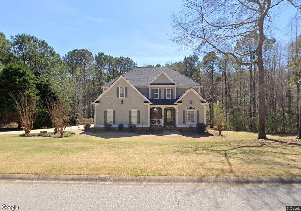
118 St Anthony Dr Lagrange, GA 30240
LaGrange AreaEstimated Value: $574,000 - $728,909
About This Home
This home is located at 118 St Anthony Dr, Lagrange, GA 30240 and is currently estimated at $640,977, approximately $132 per square foot. 118 St Anthony Dr is a home located in Troup County with nearby schools including Franklin Forest Elementary School, Hollis Hand Elementary School, and Ethel W. Kight Elementary School.
Ownership History
We collect this data history from publicly available records. To have your information removed, we recommend requesting removal directly through your county’s website.
Purchase Details
Purchase Details
Purchase Details
Purchase Details
Purchase History
We collect this data history from publicly available records. To have your information removed, we recommend requesting removal directly through your county’s website.
| Date | Buyer | Sale Price | Title Company |
|---|---|---|---|
| $362,500 | -- | ||
| $398,500 | -- | ||
| $43,500 | -- | ||
| -- | -- |
Mortgage History
We collect this data history from publicly available records. To have your information removed, we recommend requesting removal directly through your county’s website.
| Date | Status | Borrower | Loan Amount |
|---|---|---|---|
| Previous Owner | $50,000 |
Tax History
We collect this data history from publicly available records. To have your information removed, we recommend requesting removal directly through your county’s website.
| Year | Tax Paid | Tax Assessment Tax Assessment Total Assessment is a certain percentage of the fair market value that is determined by local assessors to be the total taxable value of land and additions on the property. | Land | Improvement |
|---|---|---|---|---|
| 2025 | $6,114 | $224,160 | $20,000 | $204,160 |
| 2024 | $5,545 | $203,320 | $20,000 | $183,320 |
| 2023 | $5,470 | $200,560 | $20,000 | $180,560 |
| 2022 | $5,313 | $190,360 | $20,000 | $170,360 |
| 2021 | $5,175 | $171,600 | $20,000 | $151,600 |
| 2020 | $5,175 | $171,600 | $20,000 | $151,600 |
| 2019 | $5,087 | $168,680 | $20,000 | $148,680 |
| 2018 | $4,365 | $144,720 | $20,000 | $124,720 |
| 2017 | $4,486 | $150,720 | $20,000 | $130,720 |
| 2016 | $4,369 | $146,835 | $20,000 | $126,835 |
| 2015 | $4,376 | $146,835 | $20,000 | $126,835 |
| 2014 | $4,181 | $140,160 | $20,000 | $120,160 |
| 2013 | -- | $140,442 | $20,000 | $120,442 |
Map
- 108 Saint Anthony Dr
- 127 Ashling Dr
- 1784 Mooty Bridge Rd
- 129 Lismore Dr
- 101 Ridgeview Dr
- 312 Ashford Cir
- 105 Creekside Dr
- 100 Deer Creek Dr
- 1351 New Franklin Rd
- 406 Ashford Cir
- 413 Ashford Cir
- 216 Ashford Cir
- 501 Ashford Cir
- 1333 Mooty Bridge Rd Unit 2
- 1341 Mooty Bridge Rd
- 110 N Chilton Crescent
- 105 Yellow Jacket Ct
- 121 N Chilton Crescent
- 204 S Chilton Crescent
- 135 S Chilton Crescent
- 118 Saint Anthony Dr
- 116 Saint Anthony Dr
- 122 Saint Anthony Dr
- 121 Saint Anthony Dr
- 117 St Anthony Dr
- 119 Saint Anthony Dr
- 109 Saint Anthony Dr
- 117 Saint Anthony Dr
- 114 St Anthony Dr
- 114 Saint Anthony Dr
- 123 St Anthony Dr
- 115 St Anthony Dr
- 107 Sweetgum Dr
- 126 St Anthony Dr
- 113 Saint Anthony Dr
- 125 St Anthony Dr
- 122 Ashling Dr
- 124 Ashling Dr
- 120 Ashling Dr
- 112 St Anthony Dr
Ask me questions while you tour the home.