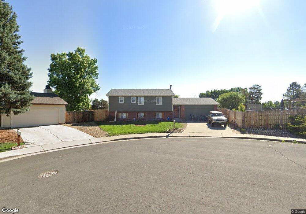
1185 Maple Dr Broomfield, CO 80020
Lac Amora NeighborhoodEstimated Value: $521,000 - $580,000
4
Beds
2
Baths
1,875
Sq Ft
$301/Sq Ft
Est. Value
About This Home
This home is located at 1185 Maple Dr, Broomfield, CO 80020 and is currently estimated at $564,450, approximately $301 per square foot. 1185 Maple Dr is a home located in Broomfield County with nearby schools including Aspen Creek K-8 School, Broomfield High School, and Nativity: Faith and Reason.
Ownership History
Date
Name
Owned For
Owner Type
Purchase Details
Closed on
Aug 17, 2022
Sold by
Westlake Mortgage Group 401K Psp
Bought by
Lewis Kristen
Current Estimated Value
Home Financials for this Owner
Home Financials are based on the most recent Mortgage that was taken out on this home.
Original Mortgage
$412,000
Outstanding Balance
$392,122
Interest Rate
5.3%
Mortgage Type
New Conventional
Estimated Equity
$172,329
Purchase Details
Closed on
Jul 1, 2022
Sold by
Roney Hazel E
Bought by
Westlake Mortgage Group 401K Psp
Home Financials for this Owner
Home Financials are based on the most recent Mortgage that was taken out on this home.
Original Mortgage
$412,000
Outstanding Balance
$392,122
Interest Rate
5.3%
Mortgage Type
New Conventional
Estimated Equity
$172,329
Purchase Details
Closed on
Jul 1, 1992
Purchase Details
Closed on
Apr 17, 1990
Purchase Details
Closed on
Sep 8, 1989
Create a Home Valuation Report for This Property
The Home Valuation Report is an in-depth analysis detailing your home's value as well as a comparison with similar homes in the area
Home Values in the Area
Average Home Value in this Area
Purchase History
| Date | Buyer | Sale Price | Title Company |
|---|---|---|---|
| Lewis Kristen | $515,000 | First American Title | |
| Westlake Mortgage Group 401K Psp | $465,000 | First American Title | |
| -- | $90,000 | -- | |
| -- | $77,600 | -- | |
| -- | $72,500 | -- |
Source: Public Records
Mortgage History
| Date | Status | Borrower | Loan Amount |
|---|---|---|---|
| Open | Lewis Kristen | $412,000 |
Source: Public Records
Tax History
| Year | Tax Paid | Tax Assessment Tax Assessment Total Assessment is a certain percentage of the fair market value that is determined by local assessors to be the total taxable value of land and additions on the property. | Land | Improvement |
|---|---|---|---|---|
| 2025 | $3,330 | $36,160 | $12,660 | $23,500 |
| 2024 | $3,330 | $35,540 | $11,470 | $24,070 |
| 2023 | $3,324 | $40,700 | $13,140 | $27,560 |
| 2022 | $2,170 | $29,400 | $8,910 | $20,490 |
| 2021 | $2,160 | $30,250 | $9,170 | $21,080 |
| 2020 | $2,032 | $28,750 | $8,690 | $20,060 |
| 2019 | $2,028 | $28,950 | $8,750 | $20,200 |
| 2018 | $1,611 | $24,270 | $6,000 | $18,270 |
| 2017 | $1,587 | $26,830 | $6,630 | $20,200 |
| 2016 | $1,235 | $21,060 | $6,630 | $14,430 |
| 2015 | $1,193 | $18,160 | $6,630 | $11,530 |
| 2014 | $949 | $18,160 | $6,630 | $11,530 |
Source: Public Records
Map
Nearby Homes
- 1109 Lilac St
- 1151 Goldenrod Cir
- 3174 W 11th Avenue Dr
- 2150 Ridge Dr
- 2054 Sunridge Cir Unit 8
- 2181 Sunridge Cir Unit 22
- 1018 Depot Hill Rd
- 1425 W 12th Ave
- 1130 Opal St Unit 104
- 1010 Opal St Unit 204
- 1190 Opal St Unit 101
- 1190 Opal St Unit 104
- 1156 Opal St Unit 102
- 1166 Opal St Unit 104
- 1370 Foxtail Dr
- 865 Nickel St
- 1310 Laurel St
- 925 Kohl St
- 1149 Larch Ct
- 740 Lotus Way
- 1187 Maple Dr
- 1177 Maple Dr
- 1175 Maple Dr
- 1167 Maple Dr
- 1184 Maple Dr
- 1157 Maple Cir
- 1174 Maple Dr
- 1155 Maple Cir
- 1165 Maple Cir
- 2882 Ridge Dr
- 2882 Ridge Dr Unit A
- 2882 Ridge Dr
- 2892 Ridge Dr
- 1164 Maple Dr
- 1154 Maple Dr
- 1147 Maple Cir
- 2909 W 11th Avenue Cir
- 2893 Ridge Dr
- 2919 W 11th Avenue Cir
- 2872 Ridge Dr
Your Personal Tour Guide
Ask me questions while you tour the home.