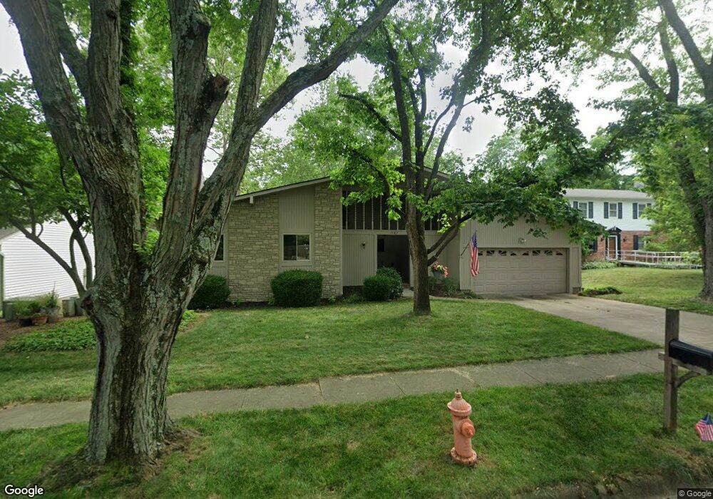
1187 Middleport Dr Columbus, OH 43235
The Gables NeighborhoodEstimated Value: $418,000 - $453,000
3
Beds
2
Baths
1,725
Sq Ft
$251/Sq Ft
Est. Value
About This Home
This home is located at 1187 Middleport Dr, Columbus, OH 43235 and is currently estimated at $432,315, approximately $250 per square foot. 1187 Middleport Dr is a home located in Franklin County with nearby schools including Gables Elementary School, Ridgeview Middle School, and Centennial High School.
Ownership History
Date
Name
Owned For
Owner Type
Purchase Details
Closed on
Mar 18, 2022
Sold by
Barrow Robert and Edlefson Carla J
Bought by
Barrow Robert and Edlefson Carla J
Current Estimated Value
Purchase Details
Closed on
Jan 28, 2005
Sold by
Barrow Robert and Edlefson Carla J
Bought by
Barrow Robert and Edlefson Carla J
Purchase Details
Closed on
May 23, 1995
Sold by
Yorde Robert J
Bought by
Edlefson Robert Barrow and Edlefson Carla J
Home Financials for this Owner
Home Financials are based on the most recent Mortgage that was taken out on this home.
Original Mortgage
$125,000
Interest Rate
8.42%
Mortgage Type
New Conventional
Purchase Details
Closed on
Aug 2, 1994
Sold by
Trewyn Ronald W
Bought by
Yorde Robert J and Yorde Helen C
Purchase Details
Closed on
Oct 1, 1985
Create a Home Valuation Report for This Property
The Home Valuation Report is an in-depth analysis detailing your home's value as well as a comparison with similar homes in the area
Home Values in the Area
Average Home Value in this Area
Purchase History
| Date | Buyer | Sale Price | Title Company |
|---|---|---|---|
| Barrow Robert | -- | None Listed On Document | |
| Barrow Robert | -- | -- | |
| Edlefson Robert Barrow | $175,000 | -- | |
| Yorde Robert J | $163,400 | -- | |
| -- | $103,500 | -- |
Source: Public Records
Mortgage History
| Date | Status | Borrower | Loan Amount |
|---|---|---|---|
| Previous Owner | Edlefson Robert Barrow | $125,000 |
Source: Public Records
Tax History
| Year | Tax Paid | Tax Assessment Tax Assessment Total Assessment is a certain percentage of the fair market value that is determined by local assessors to be the total taxable value of land and additions on the property. | Land | Improvement |
|---|---|---|---|---|
| 2025 | $5,086 | $123,130 | $51,450 | $71,680 |
| 2024 | $5,086 | $123,130 | $51,450 | $71,680 |
| 2023 | $5,049 | $123,130 | $51,450 | $71,680 |
| 2022 | $4,718 | $99,720 | $29,680 | $70,040 |
| 2021 | $4,727 | $99,720 | $29,680 | $70,040 |
| 2020 | $4,733 | $99,720 | $29,680 | $70,040 |
| 2019 | $4,287 | $79,420 | $23,770 | $55,650 |
| 2018 | $4,243 | $79,420 | $23,770 | $55,650 |
| 2017 | $4,284 | $79,420 | $23,770 | $55,650 |
| 2016 | $4,635 | $78,720 | $18,240 | $60,480 |
| 2015 | $4,208 | $78,720 | $18,240 | $60,480 |
| 2014 | $4,218 | $78,720 | $18,240 | $60,480 |
| 2013 | $1,969 | $74,970 | $17,360 | $57,610 |
Source: Public Records
Map
Nearby Homes
- 985 Linworth Village Dr
- 1440 Slade Ave Unit 301
- 962 Augusta Glen Dr
- 1221 Bethel Rd
- 1521 Ramblewood Ave
- 5376 Amy Ln
- 1242 Bradshire Dr
- 1234 Bradshire Dr
- 5285 Portland St Unit 104
- 5874 Aqua Bay Dr
- 1239 Bradshire Dr
- 824 Katherines Ridge Ln
- 5936 Aqua Bay Dr
- 5931 Shadow Lake Cir Unit 5852
- 5938 Aqua Bay Dr
- 788 Katherines Ridge Ln
- 1256 Francisco Rd
- 5273 Berrywood Dr Unit 5273
- 5084 Olentangy River Rd
- 5644 Linworth Rd
- 1179 Middleport Dr
- 1203 Middleport Dr
- 1173 Middleport Dr
- 1218 Southport Dr
- 1222 Southport Dr
- 5417 Millington Rd
- 5434 Millington Rd
- 1180 Middleport Dr
- 1168 Rockport Ln
- 1165 Middleport Dr
- 5425 Millington Rd
- 1174 Middleport Dr
- 1234 Southport Dr
- 5431 Millington Rd
- 1215 Southport Dr
- 1174 Rockport Ln
- 5440 Millington Rd
- 1157 Middleport Dr
- 5437 Heathmoor St
- 5441 Millington Rd
Your Personal Tour Guide
Ask me questions while you tour the home.